Download
1 / 14
140 likes | 237 Vues
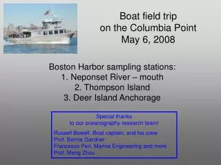
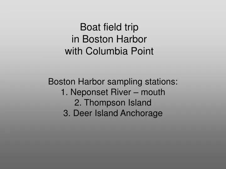
Boat field trip in Boston Harbor with Columbia Point. Boston Harbor sampling stations: 1. Neponset River – mouth 2. Thompson Island 3. Deer Island Anchorage. http://www.nps.gov/boha/pphtml/subnaturalfeatures14.html. Plankton net Copepods.

E N D
Boat field tripin Boston Harbor with Columbia Point Boston Harbor sampling stations: 1. Neponset River – mouth 2. Thompson Island 3. Deer Island Anchorage
Plankton net Copepods Niskin bottle – collecting water from specific depths for e.g. concentrations of chlorophyll-a, nitrogen, phosphorous, and fecal coliform bacteria; Secchi disk – for measuring transparency/clarity of the water
Review of zooplankton communities in Mass Bay/Boston Harbor http://www.mwra.state.ma.us/harbor/enquad/pdf/2003-06.pdf Acartia spp. Organism-sediment-contaminant interactions: http://alpha.es.umb.edu/faculty/edg/files/bhms/bhms.pdf
CTD Instrument recorder: Conductivity Temperature Depth
Photosynthetically Active Radiation (PAR) – light attenuation coefficient Kd; Calculating euphotic depth in the oceans;
http://www.nps.gov/boha/parkmgmt/sciencesymposia.htm • Seagrasses: The nurseries of the Harbor Dense meadows of seagrass are characteristic of pristine, shallow depositional environments in New England. A century ago, seagrass meadows covered hundreds of acres of subtidal flats of Boston Harbor. Important nursery areas for young fish and shellfish, these meadows had all but vanished by the late 1980s, victims of turbid water, viral diseases, and excessive nutrients which promote the growth of algae on seagrass leaves.Boston Harbor supports small areas of seagrasses. With the reduction in nutrients in the water and the increase in clarity, especially in the South Harbor, we might expect to see recolonization of the harbor floor by these important habitats in the years to come.
http://www.mwra.state.ma.us/harbor/graphic/soh_2-9.gif DITP = Deer Island Treatment Plant Microscopic diatoms
http://www.mwra.state.ma.us/harbor/html/bhreport.htm ALGAE In the harbor and rivers, photosynthesis is carried out by algae (or phytoplankton), microscopic plants suspended in the water column. To determine the amount of algae in the water, we measure chlorophyll. High chlorophyll concentrations indicate an overabundance of nutrients in the water, which can result in elevated algae levels, or algal blooms. Algal blooms can deplete bottom-water dissolved oxygen, reduce water clarity, and impair recreational uses. Chlorophyll concentrations greater than 12 micrograms per liter in the Harbor and 25 micrograms per liter in the rivers indicate an overgrowth of algae.
Benthic amphipods • Ampelisca ssp. (abdita)
Long-term Trends of Benthic Habitats Related to Reduction in Wastewater Discharge to Boston Harbor • Robert J. Diaz1 , Donald C. Rhoads2, James A. Blake2, Roy K. Kropp3 and Kenneth E. Keay4 • (1) Virginia Institute of Marine Science, College of William and Mary, Gloucester Pt., VA 23062, USA(2) ENSR Marine and Coastal Center, 89 Water Street, Woods Hole, MA 02543, USA(3) Battelle, Pacific Northwest National Laboratory, Richland, WA 99352, USA(4) ENQUAD/Operations, Massachusetts Water Resources Authority, 100 First Avenue, Charlestown Navy Yard, Boston, MA 02129, USA • Received: 24 February 2008 Revised: 22 August 2008 Accepted: 29 August 2008 Published online: 16 September 2008 • Abstract A combination of methods (infaunal grabs and sediment profile cameras) were used to monitor the response of Boston Harbor benthic habitats to reductions in wastewater associated with movement of the outfalls to the mouth of the harbor and then offshore. From 1992 to 2006, there was strong evidence that benthic habitats within Boston Harbor have shifted from a more anaerobic state to a more aerobic state and that these changes are directly related to changes in carbon loading associated with outfall placement and improvements in wastewater treatment. Over the period of 1992 to 2000, when the ocean outfall started to operate, there was >90% reduction in organic loadings to Boston Harbor from 11,400 to 1,200 t C per year. There were also corresponding decreases in primary production due to reduced nutrient loadings. The most apparent change in harbor benthos was the widespread increase in 1992 and subsequent decline by 2005 in Ampelisca spp. tube mats. The long-term increase in thickness of the apparent color redox potential discontinuity layer was consistent with reductions in organic loading and increases in bioturbation. The optimal organic loading for maintaining large areas of amphipod tube mats and high bioturbation rates was around 500 g C per square meter per year. Above and below this level, the area of tube mats in Boston Harbor declined.