Download
1 / 15
160 likes | 378 Vues
JULES: Joint UK Land Environment Simulator A community land surface scheme. MOSES + TRIFFID. Evaporation and CO2 exchange from bare soil, trees, grass, snow etc. Radiation. Rainfall. Snow. Surface runoff. Darcian flow of soil moisture. Roots extract soil moisture for

E N D
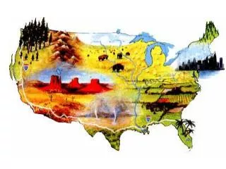
JULES:Joint UK Land Environment SimulatorA community land surface scheme
MOSES + TRIFFID Evaporation and CO2 exchange from bare soil, trees, grass, snow etc Radiation Rainfall Snow Surface runoff Darcian flow of soil moisture Roots extract soil moisture for transpiration Unified into MOSESII In 2002 Deep drainage
Relationship between JULES and MOSES Met Office Unified Model GSWP2 Tower fluxes IMOGEN CRU MOSESII JULES v1
Modular surface flux model DGVM Crop model Soil/root model Hydrology model
JULES modular structure Unified Model IMOGEN Other driving data phenology radiation Surface exchange Canopy conductance Ocean and sea ice snow soil Dynamic vegetation hydrology
Test Data: International Experiments FLUXNET/ Carbon-Europe GAME tundra and forest LAPP Tundra MAGS,northern rivers BOREAS boreal forest and snow HAPEX-MOBHILY agriculture and forest FIFE grassland HAPEX-SAHEL savannah ABRACOS/LBA rainforest and grassland SiberiaII
Phenology Radiation transfer through the canopy Soils – soil freezing, peaty soils DVGM Heterogeneity – topography / hydrology Snow Improved Processes
Improving processes in JULES • Big leaf – unrealistic representation • 10-layer improved ‘Light mod’ Far more realistic • Importance of canopy structure and leaf angle inclination
Nitrogen, Phosphorus, Ozone, Isotopes Wetlands and methane production Elevation tiles More hydrology: irrigation, crop models, Groundwater New Processes
Distributed Distributed ancillary files (soil, land cover etc) now available globally e.g. GLDAS soil porosity
Nimrod – real time hydrology Distributed applications Rainfall Soil Moisture Surface Runoff HIECroP - historic crop water use and carbon production
Calibration Methods • New methods needed to deal with: • Multiple data sets • Different levels of certainty of data • Time series at a point verses Snap-shots of spatial data • Integrated data (e.g. river flow, areal evaporation) • Uncertainty of parameters – Monte Carlo simulations
Field Observations Land Surface Modelling Distributed Applications • Global or local • Verification Evaporation CO2 flux Soil moisture • Land cover types calibrated example: predicted map of wetlands over N Europe Linking JULES with observations verification MODIS snow cover
Tools for climate research (IMOGEN) Base Climate Anomaly Patterns scale factor Atmospheric Greenhouse Gas Concentrations Meteorological forcing variables Fluxes: CO2, CH4 Anthropogenic emissions JULES Land Surface Scheme
DESCRIPTION OF THE CODE JULES JULES is the Joint UK Land Environment Simulator. It is based on MOSES (Met Office Surface Exchange System), the land surface model used in the Unified Model of the UK Met Office. MOSES was originally designed to use to represent the land surface in Meteorological and Climate models, but is increasingly used for other purposes: predicting river flows, identifying global wetlands, quantifying water resources. It was therefore decided to officially release the model from its original role in two ways. Firstly, the model should become a community model and secondly, the model should be used and developed independently of the meteorological and climate model. The CODE is available for any researcher, free of charge. A license can be downloaded from this website (see DOWNLOAD THE LICENSE). The development of the code is ongoing. The latest version is described in DESCRIPTION OF THE CODE and the next release versions, with dates, are outlined in MANAGEMENT OF JULES. For further information, please contact JULES@JCHMR.ORG.UK DOWNLOAD THE LICENSE Science in JULES Results Web access Version 1 of the code is available to researchers. From end of October, access will be via a web-site.