Download
1 / 32
320 likes | 520 Vues
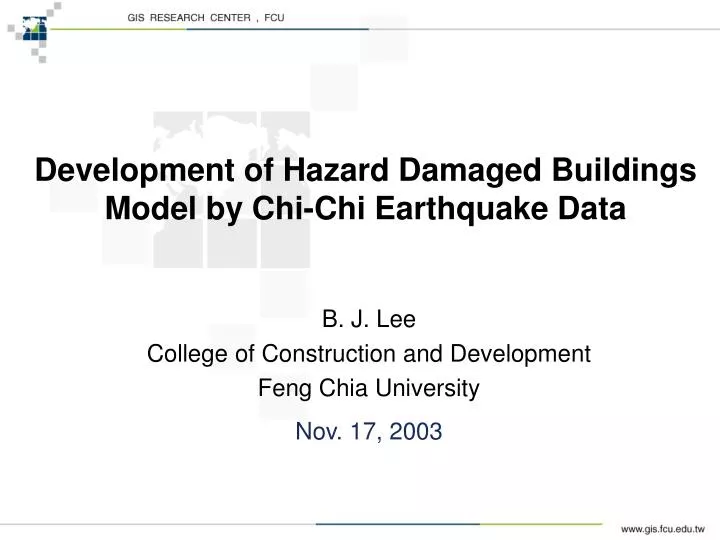
Development of Hazard Damaged Buildings Model by Chi-Chi Earthquake Data. B. J. Lee College of Construction and Development Feng Chia University Nov. 17, 2003. Contents. Introduction Overview of Building Damage Estimation of Strong Motion Fragility Curves for the Building Damage

E N D
Development of Hazard Damaged Buildings Model by Chi-Chi Earthquake Data B. J. Lee College of Construction and Development Feng Chia University Nov. 17, 2003
Contents • Introduction • Overview of Building Damage • Estimation of Strong Motion • Fragility Curves for the Building Damage • BuildingSeismic Risk Analysis • Conclusions
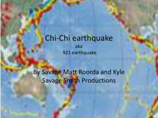
Introduction Chichi Earthquake & Chelungpu Fault The Chelungpu fault cross Guangfu elementary school, Wufeng , Taichung County
Introduction Building Damage Survey Report 8,773 buildings were surveyed in preliminary report
Introduction incomplete Building Damage Ratio = (Buildings) = (Buildings) No suitable database • Although the survey report is very useful, the inventory of buildings was not possible to associated with data. • To construct the fragility curve to be used for damage assessments, however, building damage data associated by inventory are necessary.
Introduction Building Damage Database List of earthquake building subsidy Partially & Totally Collapsed Building Database of Building Tax (inventory of buildings) Address Type of Structure Floor Area Name Construction Period …… Chichi Earthquake Building Damage Data Warehouse
Overview of Building Damage in the Chichi Earthquake Use Base Area to Measure Building Damage One Building Base area
Overview of Building Damage in the Chichi Earthquake Structural Type Distribution of Totally Collapsed Buildings
Overview of Building Damage in the Chichi Earthquake Collapsed Ratio for Each Structural Type
Overview of Building Damage in the Chichi Earthquake Collapsed Ratio of Reinforced Concrete Buildings in Different Construction Periods
Estimation of Strong Ground Motion Distribution of Accelerometer Sites • Recover region : (Miaoli、Taichung、 Nantou、Jiayi、Yunlin and Changhua) • Number of accelerometer sites : 103 • Min=21.05 gal Max=989.22 gal Avg.=214.62 gal St.Dev.=177.492 gal
Estimation of Strong Ground Motion Attenuation Model - Campbell Form Coefficients of different strong motion factors
Estimation of Strong Ground Motion =correction factor = number of observation (103sites) = data of Chichi earthquake = data of Campell form Correction Factor for Campbell Form (Tsai, 2001)
Estimation of Strong Ground Motion Campbell Form Including Correction Factor Chichi earthquake records (103 stations)
Estimation of Strong Ground Motion Geostatistic Theory Equation of horizontal attenuation relationship Trend Kriging Residual
Estimation of Strong Ground Motion Ordinary Kriging System (Semi-variogram) • Spherical Model Data interval : 2500 M h Distance (M)
Estimation of Strong Ground Motion Estimated PGA Distribution in Recover Region PGA(gal) Taichung County Taichung City Nantou County Che-long-pu fault
Fragility Curve for Building Damage Fragility Curves • A lot of seismologists hypothesize lognormal distribution between strong motion and building damage (Shinozuka, 1999; Yamaguchi & Yamazaki, 1999; Osamu Murao, 1999) • After Determining the mean and standard deviation, we can construct the fragility curve
Fragility Curve for Building Damage Study region – 15 Km buffer of Chelungpu fault line
Fragility Curve for Building Damage Fragility curves of the different structural types – totally collapsed
Fragility Curve for Building Damage Fragility curves of RC building for three different construction periods
Near-Fault Area Hanging Wall Foot Wall Puli Basin BuildingSeismic Risk Analysis Topographical Classification of Nantou County
BuildingSeismic Risk Analysis CDF of estimated PGA for different topographic conditions
Topographic Condition - - Hanging wall Foot wall Near-fault line Basin - - 5.99 5.88 6.11 6.07 - - 0.20 0.22 0.21 0.05 RC Before 1982 6.76 0.48 7.29% 4.85% 11.05% 7.84% 1983~1989 6.87 0.45 3.83% 2.37% 6.38% 3.87% After 1990 7.06 0.55 3.53% 2.33% 5.45% 3.72% Reinforced Masonry 6.72 0.44 6.79% 4.36% 10.73% 7.17% Mud-Brick 6.19 0.33 30.50% 21.23% 41.88% 35.72% Masonry 6.48 0.40 13.78% 9.13% 20.59% 15.19% BuildingSeismic Risk Analysis BuildingSeismic Risk Analysis
BuildingSeismic Risk Analysis Risk probability • The damage ratio of building= the degree of building resist the strong motion index (R) < PGA(S) Risk probability of building damage refers to the probability when resistance of the building against strong motion index ( ) is smaller than significance of strong motion ( )
The stands for the cumulative probability distribution and is also called reliability index. BuildingSeismic Risk Analysis Risk probability
Topographic Condition - - Hanging wall Foot wall Near-fault line Basin - - 5.99 5.88 6.11 6.07 - - 0.20 0.22 0.21 0.05 RC Before 1982 6.76 0.48 7.29% 4.85% 11.05% 7.84% 1983~1989 6.87 0.45 3.83% 2.37% 6.38% 3.87% After 1990 7.06 0.55 3.53% 2.33% 5.45% 3.72% Reinforced Masonry 6.72 0.44 6.79% 4.36% 10.73% 7.17% Mud-Brick 6.19 0.33 30.50% 21.23% 41.88% 35.72% Masonry 6.48 0.40 13.78% 9.13% 20.59% 15.19% BuildingSeismic Risk Analysis Risk probability
å m w N = Pi k kl k=1 k = building category l = indicates the subsurface soil condition Nk = ratio of buildings with category k w kl = risk probability of building category k on soil condition l BuildingSeismic Risk Analysis BuildingSeismic Risk Analysis • Murao et al. (1999)
BuildingSeismic Risk Analysis Actual Damage vs. Risk Analysis Risk level Actual damage level
BuildingSeismic Risk Analysis Error of Risk Analysis >
Conclusions Haz-Taiwan