Download
1 / 3
30 likes | 39 Vues
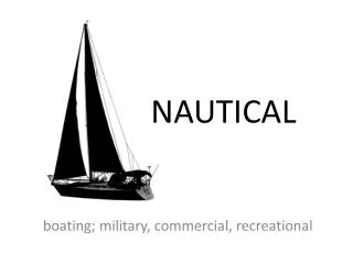
The assessment is done on a variety of methods of tracking and alerting the fishermen in maritime using GPS. Navigation in marine is the most important factor used by the fishermen. The tracking system uses the electronic scheme installed on the boat and with software design which allows the client or holder to track the boat location based on latitude and longitude data. Today global positioning system GPS technology is becoming the safe tool for navigation purpose. The position and location in sequence can be viewed in electronic map via GPS receiver. Ms. M. Florence Dayana | M. Vengadeswari | G. Keerthana | M. Vinothini "Fishermen Nautical Border Alert System" Published in International Journal of Trend in Scientific Research and Development (ijtsrd), ISSN: 2456-6470, Volume-2 | Issue-3 , April 2018, URL: https://www.ijtsrd.com/papers/ijtsrd11653.pdf Paper URL: http://www.ijtsrd.com/engineering/computer-engineering/11653/fishermen-nautical-border-alert-system/ms-m-florence-dayana<br>

E N D
International Research Research and Development (IJTSRD) International Open Access Journal Fishermen Nautical Border Alert System Florence Dayana, 2M. Vengadeswari, 3G. Keerthana, 4M. Vinothini , 2, 3, 4Department of Computer Applications, Bon Secours College for Women, Thanjavur, Tamil Nadu, India International Journal of Trend in Scientific Scientific (IJTSRD) International Open Access Journal ISSN No: 2456 ISSN No: 2456 - 6470 | www.ijtsrd.com | Volume www.ijtsrd.com | Volume - 2 | Issue – 3 Fishermen Nautical Border Alert System Fishermen Nautical Border Alert System 1Ms. M. Florence Dayana Vinothini 1Head,1, 2, 3, 4 Bon Secours College for Women India 1. ABSTRACT The assessment is done on a variety of methods of tracking and alerting the fishermen in maritime using GPS. Navigation in marine is the most important factor used by the fishermen. The tracking system uses the electronic scheme installed on the boat and with software design which allows the client or holder to track the boat location based on latitude and longitude data. Today global positioning system (GPS) technology is becoming the safe tool for navigation purpose. The position and location in sequence can be viewed in electronic map via GPS receiver. The assessment is done on a variety of methods of tracking and alerting the fishermen in maritime using GPS. Navigation in marine is the most important factor used by the fishermen. The tracking system uses the electronic scheme installed on the boat and ith software design which allows the client or holder to track the boat location based on latitude and longitude data. Today global positioning system (GPS) technology is becoming the safe tool for navigation purpose. The position and location in can be viewed in electronic map via GPS in the direction of is the International from the existing border previously imparted is that, the interlock of the GSM where minute by minute kilometres in the direction of borders. The additional lead from t alert systems that are previously interlock of the GSM where minute by minute location of the boat can be inward bound SMS to the family unit members from the control room through the use of GPS. But, employed infrared radiations which proved to be pretty disadvantageous and difficult to use. disadvantageous and difficult to use. inward bound through an members from the control room through the use of GPS. But, prior systems employed infrared radiations which proved to be 3. LITERATURE SURVEY 3.1 Alert System for Fishermen Crossing Border using Android The application can be widely used by people in the border to find the appropriate path to reach the destination. The application information of where the devices are being located and intimate them about the issues that occur due to opponent forces in ships to server. This can act as an incident management application to avoid conflicts at varying situations. 3.2 Location Based Services using Android From the available GIS processing tools in Android we can realize all three types of LBS services as a mobile can be configured as a server and for that we can also use the SQLite database to store information as android also supports this technology. We can configure the two mobiles to provide peer services through SMS or MMS with the use of appropriate intents. 3.3 Tagciti: A Practical Approach for Loc Aware and Socially-Relevant Creation and Discovery for Mobile Users Creation and Discovery for Mobile Users 3.1 Alert System for Fishermen Crossing Border Keywords: global positioning system (GPS), GPS receiver, maritime global positioning system (GPS), GPS The application can be widely used by people in the e appropriate path to reach the destination. The application information of where the devices are being located and intimate them about the issues that occur due to opponent forces in ships to server. This can act as an application to avoid conflicts at 2. INTRODUCTION will will notify notify the the Global Positioning system (GPS) provides a wide range of navigation and timing services. With the mutual interlocked usage of the GSM technology, it can be used for border safety measures boats and ships in the oceans and in the seas. The present issue of Indian fishermen being abducted by the Sri Lankan navy is of Solemn concern. It serves as a promote for these people where a GPS system is attached to the boat which in turn is associated alarm device. The GPS receives the topographic location of the boat in the sea and then triggers an alarm if the border of the country is crossed by the boat. Topographic location of a country’s border can be obtained with the in sequence of the latitude and longitude of the place and position of the boat. The borders of each country are distinct in two level first level extends till a certain distance in the sea and it is called as the nationwide border of the country. Following the countrywide borders and just a few Global Positioning system (GPS) provides a wide igation and timing services. With the interlocked usage of the GSM technology, it safety measures, tracking of and in the seas. The issue of Indian fishermen being abducted by 3.2 Location Based Services using Android From the available GIS processing tools in Android we can realize all three types of LBS services as a mobile can be configured as a server and for that we also use the SQLite database to store information as android also supports this technology. We can configure the two mobiles to provide peer-peer LBS services through SMS or MMS with the use of concern. It serves as for these people where a GPS system is associated to an alarm device. The GPS receives the topographic location of the boat in the sea and then triggers an if the border of the country is crossed by the boat. Topographic location of a country’s border can of the latitude and longitude of the place and position of the boat. The in two levels. The 3.3 Tagciti: A Practical Approach for Location- first level extends till a certain distance in the sea and Relevant Information Information border of the country. borders and just a few @ IJTSRD | Available Online @ www.ijtsrd.com @ IJTSRD | Available Online @ www.ijtsrd.com | Volume – 2 | Issue – 3 | Mar-Apr 2018 Apr 2018 Page: 1971
International Journal of Trend in Scientific Research and Development (IJTSRD) ISSN: 2456-6470 Tagciti is a novel location-aware and socially- relevant information creating and discovering service for mobile users. Instead of depending on commercially created location related information, Tagciti provides users the necessary means to become part of the information creation process. It enables the creation of dynamic, up to date, and socially-relevant shared information. Also, it provides an effective mechanism to discover created information in a socially-relevant and location-aware manner utilizing users’ social network and location information. 3.4 Remote Monitoring of Vehicle Diagnostics and Location Using a Smart Box with Global Positioning System and General Packet Radio Service Distributed system is achieved by using on-board microcomputer system, called On-Board Smart Box (OBSB), General Packet Radio Service (GPRS) and a remote server. The OBSB which is equipped with an integrated Global Positioning System (GPS) receiver is empowered by a software application that manages the processes of local data acquisition and transmission of the acquired data to the remote server via GPRS. 3.5 A Rule-Based Approach towards Context- Aware User Notification Services Pervasive Computing is the vision of technology that is invisibly embedded in our natural surroundings. Users are offered unobtrusive services that require minimal attention. In this paper the Awareness and Notification Service (ANS) is presented that enables to rapidly build applications that inform users about their environment. Additionally, the service offers notifications tailored to the user’s preferences and current context. 4. AIMS AND OBJECTIVES OF THE STUDY sense the border of the country from beginning to end the precise longitude and latitude of the position, not only between Sri Lanka and India but all over the world. The meticulous layer level i.e. border can be predefined and this can be stored in microcontroller memory. In progress value is compared with predefined values and if these values are identical, straight away the meticulous process will be done i.e., the microcontroller gives instruction to the alarm to buzzer. It also uses a memorandum transmitter to send message to the base station which monitors the boats in the sea. The structure provides an indication to both fisherman and to coastal guard. Thus it saves the lives of the fisherman and alerts the base station to provide help. RF Transmitter and Receiver An RF module (radio frequency module) is a (usually) small electronic device used to transmit and/or receive radio signals between two devices. In an embedded system it communicate with another device wirelessly. This wireless communication may be accomplished through optical through radio frequency (RF) communication. For many applications the medium of choice is RF since it does not require line of sight. RF communications incorporate a transmitter and a receiver. They are of various types and ranges. Some can transmit up to 500 feet. RF modules are widely used in electronic design owing to the difficulty of designing radio circuitry. Good electronic radio design is notoriously complex because of the sensitivity of radio circuits and the accuracy of components and layouts required to achieve operation on a specific frequency. In addition, reliable RF communication circuit requires careful monitoring of the manufacturing process to ensure that the RF performance is not adversely affected. Finally, radio circuits are usually subject to limits on radiated emissions, and testing and certification a standardization organization such as ETSI or the U.S. Federal Communications Commission (FCC). For these reasons, design engineers will often design a circuit for an application which requires radio communication and then "drop in" a pre-made radio module rather than attempt a discrete design, saving time and money on development. Controller Unit is often desirable to communication or require Conformance At the in attendance time there are few breathing systems which help to classify the in progress position of the boats/ships using System and observation them on an electronic map. For the purpose of classification the fisherman are using the GPS72h, apparatus used for the navigation in sea. It provides the greatest and most accurate method for mariners to navigate, compute speed, and determines location. 5. PROPOSED METHODOLOGY The projected system uses a GPS receiver which receives signal from the satellite and gives the present position of the boat. The proposed system is used to by The control unit (CU) is a component of a computer's central processing unit (CPU) that directs the operation of the processor. It tells the computer's @ IJTSRD | Available Online @ www.ijtsrd.com | Volume – 2 | Issue – 3 | Mar-Apr 2018 Page: 1972
International Journal of Trend in Scientific Research and Development (IJTSRD) ISSN: 2456-6470 memory, arithmetic/logic unit and input and output devices how to respond to a program's instructions. as land region. If they crossed certain limit on the sea. They have to pay the penalty or got arrested by the naval guards of the national country. The project generates alarm if they cross the border by mistake. With the simple circuitry and the use of sensors (low cost sensors) makes the project a low cost product, which can be purchased even by a poor fisherman. This project is best suited for places where the fishermen continuously monitor the boundary limit. This project also aims at solving relevant social problems with the appropriate use of satellite geographical location data for through wireless networking. Our goal is to confront wireless networking with a concrete problem of worldwide dimensions, the sustainability community are taken care by the simulation experiments. The simulation result shows the circuit level work is outperformed well that can be extended to circuit fabrication in future. This paper will be used for advancement of coastal border averment. It directs the operation of the other units by providing timing and control signals. Most computer resources are managed by the CU. It directs the flow of data between the CPU and the other devices. John von Neumann included the control unit as part of the von Neumann architecture.[2] In modern computer designs, the control unit is typically an internal part of the CPU with its overall role and operation unchanged since its introduction. Power supply A power supply is an electrical device that supplies electric power to an electrical load. The primary function of a power supply is to convert electric current from a source to the correct voltage, current, and frequency to power the load. As a result, power supplies are sometimes referred to as electric power converters. Some power supplies are separate standalone pieces of equipment, while others are built into the load appliances that they power. Examples of the latter include power supplies found in desktop computers and consumer electronics devices. Other functions that power supplies may perform include limiting the current drawn by the load to safe levels, shutting off the current in the event of an electrical fault, power conditioning to prevent electronic noise or voltage surges on the input from reaching the load, power- factor correction, and storing energy so it can continue to power the load in the event of a temporary interruption in the source power (uninterruptible power supply). 6. IMPLEMENTATION RESULTS of fishermen 8. REFERENCES 1)Arora.A , Kumar.S, and Lai. T, “Barrier Coverage with Wireless Sensors,” Proc. MobiCom, pp. 284- 298, 2005. 2)Akan,OB, and Arik, M “Collaborative Mobile Target Imaging in UWB Wireless Radar Sensor Networks,” IEEE J. Selected Areas in Comm., vol. 28, no. 6, pp. 950-961, Aug. 2010. 3)Bulut, E, and Szymanski,B,A “Distributed EnergyEfficient Target Tracking with Binary Sensor Networks,” ACM Trans. Sensor Networks (TOSN), vol. 6, no. 4, pp. 1-32, 2010. 4)Chand,N, Katiyar, V, Kumar,P, “An Intelligent TransportationSystems Wireless Sensor Networks,” Int’lJ. Computer Applications(CA), vol. 14, no. 2, pp. 22-26, 2011. 5)Challen, G.W, Waterman, J., and Welsh, M., “IDEA: Integrated Distributed Energy Awareness for Wireless Sensor Networks,” Proc. Eighth Int’l Conf. Mobile Systems, Applications, and Services (MobiSys ’10), 2010. 6)http://timesofindia.indiatimes.com/city/madurai/8 5-fishermenkilled-by-Sri-Lanka-in-10-years- Govt/articleshow/15540452.cms 7)K. Suresh Kumar et al., “Design of low cost maritime boundary identification device using GPS system”, International Journal of Engineering Science and Technology, Vol. 2(9), PP. 4665- 4672, 2010. , Wang,Z Architecture Using 7. CONCLUSION In the conventional, the fishermen have to keep watch the maritime border, which cannot be easily separated @ IJTSRD | Available Online @ www.ijtsrd.com | Volume – 2 | Issue – 3 | Mar-Apr 2018 Page: 1973