Download
1 / 18
180 likes | 313 Vues
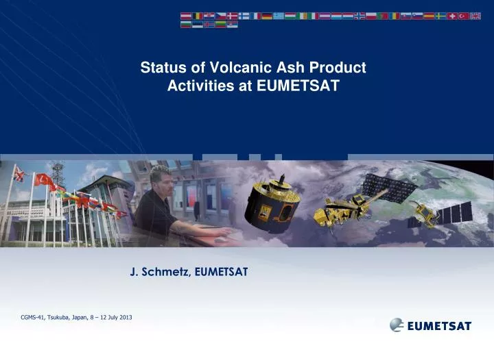
Status of Volcanic Ash Product Activities at EUMETSAT. J. Schmetz, EUMETSAT. Broader Perspective:. Major volcanic eruptions in recent years (e.g. Icelandic volcanoes) have re- inforced the interest in monitoring volcanic ash clouds

E N D
Status of Volcanic Ash Product Activities at EUMETSAT J. Schmetz, EUMETSAT
Broader Perspective: • Major volcanic eruptions in recent years (e.g. Icelandic volcanoes) have re-inforced the interest in monitoring volcanic ash clouds • Volcanic ash can be monitored from satellite. The most advanced products can currently be derived from the 12-channel imager (SEVIRI) on Meteosat 2nd Generation satellites (MSG) • EUMETSAT has procured through a study a simple ‘two-channel algorithm’ for quantitative applications (method by Dr F. Prata). This two-channel algorithm is currently operational. • It is clear that the current EUMETSAT operational product will be enhanced using the full capability of MSG • Future perspective is that most CGMS agencies will fly the common (or the same) multi-channel imagers on their near-future geostationary satellites
Idea discussed at CGMS-40 • All satellite operators of geostationary satellites should derive quantitative estimates/products of volcanic ash in a consistent way for distribution to users (e.g. VAACs) • The consistent products would benefit VAACs because interpretation, use of the product and the feedback to the product providers would be on a common ground • The existing ‘two-channel algorithm’ for quantitative applications (method by Dr F. Prata) could be used with all current geostationary satellites because they all have the necessary ‘split-window’ observations (Note: not true for recent GOES)
Recalling Actions from CGMS-40 Action 40.24: EUMETSAT, JMA and NOAA are invited to report on their development toward common and consistent volcanic ash products from Meteosat and MTSAT-2 and GOES, respectively. Due date CGMS-41 Action 40.25: EUMETSAT to invite Dr. Fred Prata to make a presentation on volcanic ash products science and applications at CGMS-41.
CGMS created a basis for sharing scientific prototype software • Since CGMS-40 EUMETSAT has shared (provided) existing science prototype for a two-channel Volcanic Ash product (Prata algorithm) with JMA and KMA. • This is done in accordance with Recommendation 37.25 from CGMS-37:On the basis of existing scientific prototype software for product retrievals, NOAA and EUMETSAT offer to other satellite operators existing prototype algorithm software for testing and further development. • General note: In order to make this an activity of mutual and reciprocal benefit it is expected that the receiving CGMS agency provides feedback to the providing agency . This will ultimately result in further improvements to the science behind the product and to the applications.
1=VIS0.6 2=VIS0.8 3=NIR1.6 4=IR3.8 5=WV6.2 6=WV7.3 7=IR8.7 8=IR9.7 9=IR10.8 10=IR12.0 11=IR13.4 MSG-SEVIRI Instrument Characteristics SEVIRI 15 min repeat cycle for full disk 5 min repeat cycle for RSS 3 km (1 km) spatial resolution 12=HRV Slide: 6
SEVIRI Ash Detection: Channels and absorption by ash, ice cloud and SO2
SEVIRI Ash Detection with split-window only • Simple test on brightness temperature difference: • BTD := T10.8 – T12.0 < 0. K • Many false alarms • over clear land at night • over cloud edges • i.e. "simple" detection is faced with many false alarms
Refinements • Use of other channels in this thresholding technique: • e.g. Combination of IR3.9 and VIS0.6 (daytime) … (TBC!) • Combination of IR3.9, IR8.7, IT10.8 and IR12.0 at all times, • together with predicted clear-sky brightness temperatures in • these channels (from forecast fields), • together with a spatial consistency check
SEVIRI Volcanic Ash Product • The ash product is available in the following formats: • netCDF format (with ash effective radius, mass loading, height (incl. quality) per pixel) – 96 times per day • and in case of an event (upon request from the London VAAC): • CAP (Common Alert Protocol) format • Text files • Image (PNG format)
Word of Caution • No full validation of the operational product done yet – satellite product should always be used in combination with other information! • “Visual” impression from the RGB composites, e.g. the RGB colour composites • IR12.0 – IR10.8 • IR10.8 - IR8.7 • IR10.8 • has proven to be useful for the delineation of the ash area
SEVIRI Ash Detection Future Plans • Reliable ash detection still a problem • Improvements and tests are ongoing • Collaboration with UK Met Office (Peter Francis) and Fred Prata • Plans to investigate all volcanic eruptions in the Meteosat FOV • Use of two Meteosats for stereo height assignment • Plans for including the detection of SO2 • Explore potential of an optimal estimation approach (promising especially in case of ash above lower clouds) – Science Study with RAL in 2013 ;OE approach: fitting radiances of all channels to find best solution for ash properties, notably also height
Volcanic Ash: Optimum Estimation Approach(P. Watts, EUMETSAT) One layer Two layers
EUMETSAT Polar System NOAA / NPP (NOAA) Metop (EUMETSAT) Suite of Instruments: Imager (AVHRR) Infrared Sounding (HIRS and IASI) UV-VIS (GOME-2) … Microwave sounding Scatterometer Radio-occultation
Metop Aerosol Product Example Volcanic ash event around Iceland: Global: Aerosol optical depth (GOME) preliminary 23 May 2011 • Orange: Strong ash test positive, cloud tests ignored • Blue: cloud fraction < 0.3, AOD retrieved • White: • no retrieval or • cloud fraction > 0.3 and negative ash test Aerosol optical depth (GOME)
Future Missions: Meteosat Third Generation MTG • The MTG satellite system will include a sounding satellite, carrying an Infrared Sounder. Volcanic ash products from the sounder will be similar to what is currently available for e.g. IASI • MTG time schedule: • Imager satellite to be launched in Dec 2018 (similar to MSG, improved spatial/temporal resolution, more shortwave channels) • Sounding satellite: To be launched 2 years later
H2O(p) CO T(p) Sfc O3 Sfc 700 – 1210 cm-1 1600 – 2175 cm-1 Temp (CO2) Surface, Clouds Surface, Clouds Surface, Clouds CO O3 N2O, Temp (CO2) H2O, CH4, N2O Temp (CO2) Meteosat Third Generation (MTG) hyperspectral IR Sounder (IRS) 1740 spectral samples at 4 km resolution, full disk coverage every 60 minutes, European area covered every 30 minutes
Towards a MTG IRS Volcanic Ash Product • Similar to current work using IASI (absorbing aerosol index): Université libre de Bruxelles, Belgium Laboratoire Atmosphères, Milieux, Observations Spatiales, France Cathy Clerbaux, Lieven Clarisse, P. Coheur, D. Hurtmans