Download
1 / 9

E N D
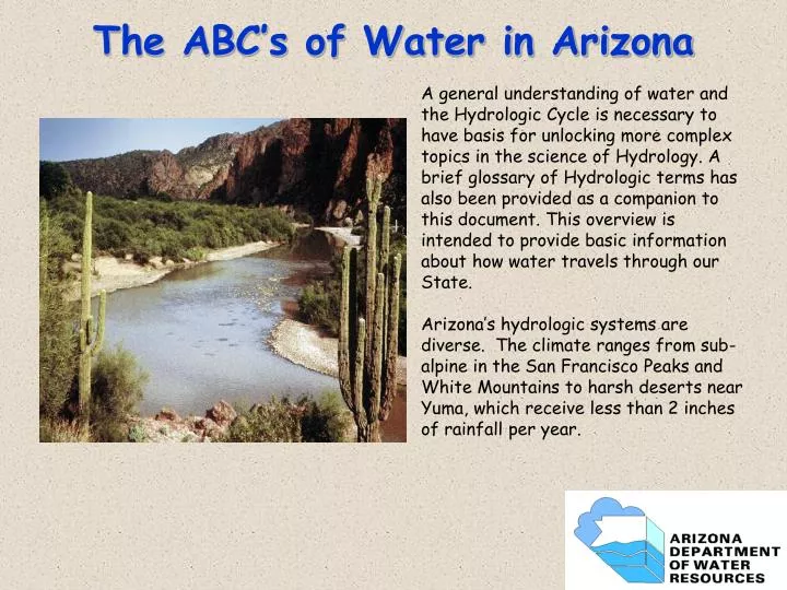
The ABC’s of Water in Arizona A general understanding of water and the Hydrologic Cycle is necessary to have basis for unlocking more complex topics in the science of Hydrology. A brief glossary of Hydrologic terms has also been provided as a companion to this document. This overview is intended to provide basic information about how water travels through our State. Arizona’s hydrologic systems are diverse. The climate ranges from sub-alpine in the San Francisco Peaks and White Mountains to harsh deserts near Yuma, which receive less than 2 inches of rainfall per year.
Physiographic Provinces The physiographic provinces of Arizona are areas of broadly similar landscape, climate, and hydrology. The Plateau Uplands are flat, broad, high elevation plains that receive more snow and rainfall than much of the state. Aquifers are large, but very deep in the western part of the Plateau. The Central Highlands contain most of the perennial streams in Arizona. The aquifers here are small and drought sensitive. The Basin and Range Provinces receive little rainfall and have few perennial streams, but contain very large aquifers.
A Groundwater Checking Account A water budget is an accounting of water going into an aquifer, water removed from an aquifer, and any change in water stored in the aquifer. Water enters the aquifer as recharge along mountain fronts, recharge from streamflow, or from artificial recharge projects. Water is removed by wells, by discharge to streams, and by riparian plant use. Understanding the water budget for a study area is like managing a water “checking account” and is an important step in most hydrologic studies.
PRECIPITATION and WEATHER PATTERNS Winter Storms Arizona has three annual weather patterns. Winters typically bring cold fronts from the north and west. These storms are cold and last several days, bringing snow to higher elevations. Summers bring intense but short lived monsoonal thunderstorms, while occasional late summer tropical depressions may bring heavy prolonged and widespread rain. Tropical Depressions October Monsoon Storms July-August
Arizona Average Annual Precipitation Oregon Climate Services Oregon State University Legend (In Inches) Under 8 24 to 28 8 to 12 28 to 32 12 to 16 32 to 36 16 to 20 Above 36 20 to 24 Most of Arizona receives less than 12” of rainfall per year. This make the areas that do receive higher precipitation, such as the White Mountains, critical in generating surface water that supports streamflows and fills reservoirs HTTP://geography.asu.edu/azclimate/ocs/az.gig
Where does Arizona’s Water Come From? Arizona gets water from four sources: the Colorado River, from streams within the state, such as the Gila, Salt, Verde, and Agua Fria Rivers, from groundwater, and from effluent. Effluent re-use is a small portion of total use now, but will become a vital source of water in the future.
Glossary of Hydrologic Terms • Aquifer: an underground geological formation capable of holding water. • Groundwater: water stored in underground aquifers. • Hydrology: the study of water on the earth surface, underground and in the atmosphere. • Porosity: the amount of space between soil or rock particles where water can be stored. • Watershed: the land area over which rain and snow add water to our lakes and streams. • Water table: the depth underground where water can be found.
More Information? At ADWR: www.azwater.gov ADWR Bookstore (602) 771-8638 At ADEQ: www.adeq.arizona.gov At USGS: www.usgs.gov