Download
1 / 21
210 likes | 344 Vues
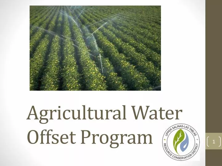
Agricultural Water Offset Program. Background. County Planning Department contracted the RCD to design a water use offset program for agriculture users in Paso Basin. developed in response to the urgency ordinance which requires NEW irrigated Ag to offset their total projected water use.

E N D
Background County Planning Department contracted the RCD to design a water use offset program for agriculture users in Paso Basin. • developed in response to the urgency ordinance which requires NEW irrigated Ag to offset their total projected water use.
More Background 1. Reason for ordinance: Severe Decline 2. What is considered “new irrigated Ag?” * • Crop conversions • Increased crop density • New installations on previously un-irrigated lands *Per urgency ordinance language SLO
Phase I – Technical Analysis • RCD assembled a multidisciplinary project team • Hydrogeologist • Hydrologic engineer • UC Cooperative Extension staff • Cal Poly ITRC department faculty • NRCS Conservationist • GIS specialist • Agricultural manager • Biological Expertise • Analysis of potential for offset credits within regional areas • GIS mapping and verification of crop layer data • Data and methodology review of water use by crop type • Master Water Report • UC Extension input
Draft program Standards • Framework Provisions • Crop Conversions • New irrigated acreage • Increased crop density • Rootstock conversions • Rural groundwater uses not included in domestic program
Flow of Program Determine amount of Water Credit (current crop acreage x water use factor) Determine Potential Acres of New Crop (water credit amount / water use factor) Same Property, Same Well Same Property, Different Well Contiguous Parcel Non-contiguous Parcel
Master Water Report http://www.slocountywater.org
Crop Water Calculations where: ETc = crop evapotranspiration = ETo x Kc ETo = reference evapotranspiration Kc = crop coefficient ER = effective rainfall FP = frost protection LR = leaching requirement IE = irrigation efficiency
Flow of Program Determine amount of Water Credit (current crop acreage x water use factor) Determine Potential Acres of New Crop (water credit amount / water use factor) Same Property, Same Well Same Property, Different Well Contiguous Parcel Non-contiguous Parcel
Same Property, Same Well Same Property, Different Well ContiguousParcel Non-contiguous Parcel Proximity Analysis Meets Standard Neighboring Well Impact analysis Meets Standard Deed Restriction Recorded & Well Meter Installed Annual Verification (3rd Party reporting)
Neighboring Well Criteria • Applicant must identify one domestic and one ag well adjacent to property • Increased pumping cannot significantly impact neighboring irrigation and domestic wells • Domestic wells – 15 feet additional drawdown • Irrigation wells – 30 feet additional drawdown • Simple calculator is used to compute water level drawdown at various distances • Notice sent to well owners so well-specific information can be considered
Proximity of Credit • Must define acceptable distance where credit will likely offset the impact • Simple Calculator is used to determine this distance • Must be similar water bearing zone and depth
Same Property, Same Well Same Property, Different Well ContiguousParcel Non-contiguous Parcel Proximity Analysis Meets Standard Neighboring Well Impact analysis Meets Standard Deed Restriction Recorded & Well Meter Installed Annual Verification (3rd Party reporting)
Decline Map Sample – Paso Basin Credit cannot be used to increase pumping within severe groundwater level decline area as defined by SLO County • Proposed 50’ water decline level • Reviewed annually • Annual map of decline published
Phase II – Public Outreach RCD collaborating with local stakeholders • Paso Robles Wine Alliance • Ag Liaison Committee • Farm Bureau • Cattlemans Association • Vineyard Team • Olive Growers Association • Pro Water Equity • Town Hall meetings
Conclusion • Groundwater basin(s) are natural features that change over time and the program is designed with flexibility and adaptation in mind. • Issue is complex in nature, and program tries to encompass multiple layers of operational complexity. • Program designed to be flexibly tiered, simplified, and user-friendly.
Questions? Thank You