Download
1 / 44
440 likes | 651 Vues
The NOAA Operational Model Archive and Distribution System NOMADS. Overview and Plans Glenn K. Rutledge NOMADS PI National Oceanic and Atmospheric Administration National Climatic Data Center

E N D
The NOAA Operational Model Archive and Distribution System NOMADS Overview and Plans Glenn K. Rutledge NOMADS PI National Oceanic and Atmospheric Administration National Climatic Data Center Earth Science Portal Meeting GFDL Princeton, NJ June 8, 2004
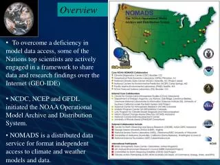
Overview • Until now there existed no long-term archive for Climate and Weather models. • University and Institutional research goes largely untapped by NOAA scientists. Effort is wasted on data receipt and format issues with no infrastructure to collaborate. • Retrospective analysis and model inter-comparison are necessary to verify and improve short term NWP models, seasonal forecasts, climate simulations, assessment and detection efforts.
Overview • To overcome this deficiency, some of the Nations top scientists are actively engaged in a grass-roots framework to share data and research findings over the Internet • NCDC, NCEP and GFDL initiated the NOAA Operational Model Archive and Distribution System. • NOMADS is a distributed data services pilot for format independent access to climate and weather models and data.
History of ESP • Early on in the development of NOMADS, participants saw • a need for a more technical forum to coordinate various • distributed data access and Web and grid portal efforts. • Thus the original NOMADS team formed the Earth Science • Portal (ESP) effort. • One of the initial requests from this group to NOMADS was • “ Glenn- you need to build an archive interface” • The NOMADS is now an operational at NCDC!
Scientific Data Networking? • The users experience is often frustrating— • - What data of interest exist? • - Are they going to be useful to me? • - How can I obtain them in a usable form? • Time and effort are wasted on data access and format • issues. • As a result atmosphere/ocean/climate data are under- • utilized. Model inter-comparison nearly impossible. Source: R. Stouffer (GFDL)
Scientific Data Networking… NOMADS simplifies scientific data networking, allowing simple access to high volume remote data, unifying access to Climate and Weather models: • Data access (client) • Access to remote data in the users normal application • IDL / IDV / Matlab / Ferret • GrADS (GRIB/BUFR w/ GDS) • Netscape / Excel / http (wget) • CDAT (PCMDI) • Any netCDF application (i.e., AWIPS) • Don’t need to know the format in which the data are stored. • Data publishing (server) • Can serve data in various formats • netCDF / GRIB / BUFR / GRIB2 • HDF (3-5) / EOS • SQL / FreeForm • JGOFS / NcML • DSP • ascii, others... • Spatial and temporal sub-setting and host side computations on the fly.
The Partnerships CDC COLA co-PI FSL GFDL co-PI LLNL co-PI NCAR NCDC PI NCEP co-PI PMEL co-PI Unidata BADC (UK) CEOP CEOS ESMF & PRISM LEAD & GTF (NSF) NASA GCMD & ESIP NERC DataGrid NSSL w/UW/SSEC United Nations FAO
Collaborating Programs CAP Climate Action Partnership DOC DOE EPA State Dept CDP Community Data Portal NCAR CEOSGrid Committee on EO Satellites NOAA Representative CEOP Coordinated Earth Obs Period NOAA Representative EPA Air Quality Models (in progress) ESP Earth Science Portal Member European PRISM NASA GCMD Science Advisory Board NERC DataGrid Advisory Committee NSF Cyberinfrastructure Member NSFLEAD GTF GeoScience Tech Forum Planning Committee NVODS / US GODAE / GOOS Data Provider Unidata THREDDS, NSDL, DLESSE Data Provider WCRP World Climate Research Program JSC/CLIVAR
Uses • Climate model output and observations are vital to providing timely assessments of climate change and impacts. • Assess the affect of inadequate spatial and temporal sampling. • Models can be used to guide the spatial and temporal sampling frequency for observing network design and operation to resolve distributions for specific variables. • Accurate estimates of future climate variability and trends. • Long-term protection of climate simulations and NWP analysis.
Uses (cont.) • NCEP Numerical Weather Prediction (NWP) re-run capability. • Model input Data Assimilation fields for Regional model • bndry initialization (e.g., regional climate models, WRF, MM5). • Historical analysis of NWP for operational forecaster training. • Third-world internet access to NWP for forecast operations. • Collaboration between Global Climate Model (GCM) and NWP • researchers using large data volumes of data.
Uses (cont.) • The departure of observations from an external reference state can help identify time-dependent changes in the observing system. • NOMADS can provide high-frequency references states from NWP models and low-frequency references from fixed climatologies. • In the observing system circa 2000, the NWP reference is of high quality due to model improvements - and heavily constrained by wide variety of observations on a global scale. Thus, NWP reference is more independent today than in the past.
The NOMADS Philosophy Multiple paths to format independent data access:
NCDC System Architecture NOAAPort Data Ingest Data Access Earth System Grid & CEOS-Grid Obs, Eta, GFS, RUC Data Management • Data & Directory • structures “merged” • Daily Data Ingest • inter-comparison • QC and R/T Monitoring • Index File generation • Control and OPeNDAP • metadata generation • CVS Backup (code) • NCDC Archive Interface Hi-Res GFS, Eta, NARR and GDAS NOMADS Web/DODS NCEP ftp GigaPOP Unidata IDD NCDC Archive Dual Redundant Ingest
NCDC System Architecture NCDC Archive NOAAPort FSL + Unidata’s Local Data Manager WGRIB* GRIB2CTL.pl* GRIBMAP* NOMADS scripts User Access Order-Based Web Interface Sync_all_idd.csh Rsync HiRes Data WMO Files Merged by Model and FCST Hour NCEP ftp GigaPOP Fast Access Archive /MODEL/YYYYMM/YYYYMMDD Symbolic Links to WMO files Unidata IDD Backup Feed User Access Pdisp Plotter* FTP HTTP GDS Server NOMADSRAID Unidata’s Local Data Manager
Dynamic Ingest Monitoring Dual Site Ingest and Dynamic error reporting for a serially complete archive. QC architecture discovered NOAAPort labeling errors.
NOMADS Hardware Configuration Data Access Data Management On-Line and HDSS Archive Access Data Ingest -NOAAPort -NCDC ftp -Unidata IDD NOMADS on-line volume: 12.7TB NSA_GKR_Jun04
Core Systems / Applications • NOMADS Core: • Inexpensive PC Linux and LINUX Clusters • Fast IDE Level 5 RAID NFS Read only behind firewall • - Red Hat • - OPeNDAP (DODS) + THREDDS Catalog • - GrADS-Data Server -GDS • - Live Access Server -LAS • - LAS/CDAT-Climate Data Analysis Tools (LLNL) • - Globus (Earth System Grid –ESG)
Client GrADS Ferret DODS* client libraries Matlab Data appears to client as local file, in a standard format (i.e, NetCDF) IDV, etc. NCDC GrADS Data Server Server performs analysis operations manages sessions, translates dataset names supports extended request types for analysis, upload Datasets in any format supported by GrADS GrADSbinary GrADS batch mode interface code DODS* server libraries Java servlet GRIB, HDF NetCDF Station data BUFR Internet etc.. Result cache EncapsulatedAnalysis Requests For GRIB and BUFR users, multi-dimensional data (space/time), and data subsets are extracted on the fly. Source: B. Doty (COLA)
NCDC Install of LAS GDS GOAL: Retrieving and Using GRIB/BUFR through GDS and LAS Modified from Hankin ‘03
Framework • NOMADS uses the Open Source XML based OPeNDAP. • OPeNDAP is a binary-level protocol designed for the transport • of scientific data subsets over the Internet. Provides server • side data manipulation on-the-fly (e.g., GrADS-DODS). • Data formats: GRIB, GRIB2, BUFR, HDF, NetCDF, ascii... • Conventions: COARDS, CF, FGDC, DIF....libraries built as • necessary. • APIs: JAVA-OPeNDAP, C++-OPeNDAP, NetCDF, GRIB, • BUFR, THREDDS, Python.
Framework (cont.) Utilize Binary data and metadata through OPeNDAP …
* January Mean 500 Height (1981 to 1989) minus (1990 to 1998) * Mean & Standard Deviation for all 10 ensembles * Time required: 60 secs 'reinit' '!date' * baseURL = 'http://motherlode.ucar.edu:9090/dods/_expr_' * GKR 2/13/03 New NCAR URL baseURL = 'http://dataportal.ucar.edu:9191/dods/' expr = 'ave(z,t=387,t=483,12)-ave(z,t=495,t=591,12)' xdim = '0:360' ydim = '20:90' zdim = '500:500' tdim = '1nov1978:1nov1978' 'sdfopen 'baseURL'_expr_{C20C/C20C_A}{'expr'}{'xdim','ydim','zdim','tdim'}' 'sdfopen 'baseURL'_expr_{C20C/C20C_B}{'expr'}{'xdim','ydim','zdim','tdim'}' 'sdfopen 'baseURL'_expr_{C20C/C20C_C}{'expr'}{'xdim','ydim','zdim','tdim'}' 'sdfopen 'baseURL'_expr_{C20C/C20C_D}{'expr'}{'xdim','ydim','zdim','tdim'}' 'sdfopen 'baseURL'_expr_{C20C/C20C_E}{'expr'}{'xdim','ydim','zdim','tdim'}' 'sdfopen 'baseURL'_expr_{C20C/C20C_F}{'expr'}{'xdim','ydim','zdim','tdim'}' 'sdfopen 'baseURL'_expr_{C20C/C20C_G}{'expr'}{'xdim','ydim','zdim','tdim'}' 'sdfopen 'baseURL'_expr_{C20C/C20C_H}{'expr'}{'xdim','ydim','zdim','tdim'}' 'sdfopen 'baseURL'_expr_{C20C/C20C_I}{'expr'}{'xdim','ydim','zdim','tdim'}' 'sdfopen 'baseURL'_expr_{C20C/C20C_J}{'expr'}{'xdim','ydim','zdim','tdim'}' 'define resa = result.1' 'define resb = result.2' 'define resc = result.3' 'define resd = result.4' 'define rese = result.5' 'define resf = result.6' 'define resg = result.7' 'define resh = result.8' 'define resi = result.9' 'define resj = result.10' say 'got data' 'set lev 500' 'set lat 20 90' 'define mean = (resa + resb + resc + resd + rese + resf + resg + resh + resi + resj)/10' 'define d1 = (pow(resa-mean,2))' ; 'define d2 = (pow(resb-mean,2))' 'define d3 = (pow(resc-mean,2))' ; 'define d4 = (pow(resd-mean,2))' 'define d5 = (pow(rese-mean,2))' ; 'define d6 = (pow(resf-mean,2))' 'define d7 = (pow(resg-mean,2))' ; 'define d8 = (pow(resj-mean,2))' 'define d9 = (pow(resi-mean,2))' ; 'define d10 = (pow(resj-mean,2))' 'define stddev = pow((d1 + d2 + d3 + d4 + d5 + d6 + d7 + d8 + d9 + d10)/10,0.5)' 'set gxout shaded' 'set mproj nps' 'display mean' 'draw title January Mean 500 Height (1981 to 1989) minus (1990 to 1998)' 'set string 3 bc 1' 'draw string 5.5 .5 Mean & Standard Deviation for all 10 ensembles: ‘C20C Climate of the 20th Century Folland/Kinter' *'cbarn' 'set gxout contour' 'set ccolor 0' 'display stddev' '!date' At left is the complete GDS script for generating mean and sdev at 500mb analyzing 18 years of “Climate of the 20th Century” over the Internet: Traditional vs. NOMADS method: Volume transported: 100Gb vs. 2Kb Time to access data: days vs. 60 sec Code development: days vs. minutes Fortran based LOC: ~1000 vs. 50 LOC
Data Availability Overview • CDC: Reanalysis, climate weather models, in-situ GFDL: Coupled Models, Control and Perturbation Integrations and historical 20th century simulations using solar, volcano, GHG and aerosol forcings. FSL: MADIS mesoNets, Hi-Res RUC-II NCAR: Community Climate System Model / Land Surface CO2 predictive models (VEMAP), Reanalysis / Eta NCDC: Archive for NCEP model input/output / Select NCDC Observation datasets, Ocean/Ice WAVE, NARR, SST’s... NCEP: Real-time Input/Output, Reanalysis (I&II), Ensembles, Sea Ice Ocean, CDAS, Hourly Eta, Climate Forecast Models... LLNL: AMIP / Probabilistic information PMEL: Ocean and Climate datasets
NCDC and NCEP Data • NCDC NOMADS Archive • NWP from NCEP • POR: 2002 to Real-Time • Eta (12km); GFS (1 degree); GDAS; NARR 12km 30yrs • RUC-II 20/40km; Ocean and Ice WAVE Models • NCDC Reference Data Sets (Reynolds SST’s, GHCN...) • NCDC Mirror site to NCEP NOMADS for Eta & GFS • NCEP Real-Time NOMADS • Global Forecast System GFS 1 degree • Hourly Eta at 12km • Regional Spectral Model (RSM) and Ensembles • Climate Data Assimilation System (CDAS) • AMIP Climate Monitoring, Climate Forecast Model • NCEP/NCAR Global Reanalysis 1&2
Model Input: NCEP GDAS • NOMADS saves the minimum data necessary to regenerate model output products as close as possible to NCEP operations. • The analysis files will be in the models own coordinate system. • Files are constructed with computer and computational efficiency • in mind, and not in standard coordinate systems. • Programs to convert these files are available upon request: • spectral to gaussian • gaussian to lat/lon • sigma to pressure
Archive and User Statistics • Data Philosophy and Retention • Data are free. • NWP forecast data are retained for five years. • All other data are retained for long term stewardship. • Data Users • Resolution of IP addresses indicate a broad range, and • consistent use of NOMADS available data: • U.S. Agencies, Academic Institutions: K-12 to Research • International governments, (Italy, Japan, countries within • South America and Africa. Many others). • Private Sector and Non-Government Organizations NGO’s • World Bank, United Nations (FAO), others.
Archive and User Statistics (cont.) May 2004 * 5-YR retention Existing and Projected Volume 2004 Stats are Jan thru May only!
NCDC Web Interface (cont.) The NCDC Web Plotter & Interface originally developed at NCEP: NOMADS leverages efforts across the community.
NOMADS “Web Plotter” • NCDC ingest 150K • grids/day. • POR 2002 to present. • Any one of these • accessible in seconds • Via: OpENDAP • GDS • ftp • Web Plotter • LAS (soon)
Next Steps • GDAS Availability: NOMADS can now handle BUFR (thanks to COLA) • NARR: North American Regional Reanalysis • NCDC to use NOMADS Operationally in the Customer Services Division: • Model Data, the Natl, Digital Fcst Database, SRRS, and most graphics. • AWIPS going NOMADS? • Phoncon: FSL indicates next AWIPS will be OPeNDAP enabled. • FSL drafting white paper to NOAA CIO (go NOMADS). • NOMADS to brief NOAA. Request NCEP and GFDL Participation. • Work to Operatinalize NOMADS. How? (GTF Planning Member) • Advance into Climate analysis and detection efforts • Science based user workshops and projects (still) needed.
Next Steps (cont.) • This grass roots effort extremely successful (look at participants). • Funding is now required for... • - Google like search engine. • - Data Management and Science based tools to: • help verify content and location, and generation of metadata (i.e., reanalysis) • - Advance, Support, and Coordinate various OPeNDAP projects: • allows climate / ocean / weather model inter-comparison and access. • Support software development at institutions (COLA, PMEL, OPeNDAP). • - Do not over engineer this process. Build on simple successes with the • existing efforts including a new NOMADS capability within CLASS & thru • Scientific Data Stewardship (SDS). Also GTF effort.
Closing Thoughts • So What? “But I just want the Data” The idea of pulling information, not bytes or data, is new and hard to convey • NOMADS is a pull technology. Users can become data servers. • Why transport millions of files if only a subset is needed? • Will networks ever keep up with growing data sets? • Data Management at the grass roots level with science driven requirements. • Many efforts in distributed access. How best to coordinate efforts? • Vision, planning, and cooperation needed w/ Agency attribution! • A dynamic system, not over engineered and built upon existing users needs but extensible for future requirements.
Closing Thoughts (cont.) NOMADS has become an internationally known project. It is a grass roots effort with no significant base funding. Acknowledgment for the foresight and support therefore is provided to all Center Managers keeping this effort alive particularly Tom Karl (NCDC), Louis Uccellini (NCEP), and Ants Leetma (GFDL). However this high degree of success is mostly attributed to the people that have contributed both software and experience toward distributed data access. Special recognition to: Brian Doty and Jennifer Adams COLA Steve Hankin and Jon Callahan PMEL Dean Williams and Mike Fiorino LLNL Jordan Alpert and Jun Wang NCEP Ron Stouffer and Chris Kerr GFDL
The Grid: An IT Infrastructure for NOAA in the 21st CenturyMark Govett, Mike Doney, Paul Hyder • To meet challenges facing NOAA in the next decade and beyond • 100 Fold Increase in Data Volume in 10 years • GOES-R, NPOESS, IEOS, Radar, GPS • More Complex Modeling Systems • higher resolutions, ensembles, data assimilation, more data • Proposes an Integrated IT Infrastructure based on Grids • Build on existing NOAA Programs (e.g. CLASS, NOMADS) • Develop Compute, Data and Service Grids • Enable Dynamic Data Discovery, Access, Integration • Utilize / Develop Web Services, Grid Portals
Some OPeNDAP Portals CDC: http://www.cdc.noaa.gov/cgi-bin/nph-nc/Datasets/ COLA: http://cola8.iges.org:9090/dods FSL: http://nomads.fsl.noaa.gov/ GFDL: http://nomads.gfdl.noaa.gov/ NCDC: http://nomads.ncdc.noaa.gov/ NCEP: http://nomad1.ncep.noaa.gov/ Unidata: http://www.unidata.ucar.edu/cgi-bin/dods/datasets/
For more information... • For more Program Information see: http://www.ncdc.noaa.gov/oa/climate/nomads/nomads.html • To get data: NOAA NCDC Main Page Climate Model Resources http://nomads.ncdc.noaa.gov • Or contact: Glenn.Rutledge@noaa.gov