Download
1 / 16
160 likes | 269 Vues
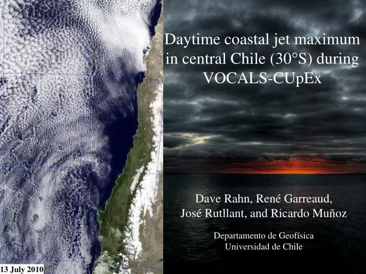
Daytime coastal jet maximum in central Chile (30°S) during VOCALS- CUpEx. Dave Rahn, René Garreaud, José Rutllant , and Ricardo Muñoz Departamento de Geofísica Universidad de Chile. 13 July 2010. Garreaud et al. 2010. Field campaign. VOCALS - Chilean Upwelling Experiment ( CUpEx )

E N D
Daytime coastal jet maximum in central Chile (30°S) during VOCALS-CUpEx Dave Rahn, René Garreaud, José Rutllant, and Ricardo Muñoz Departamento de Geofísica Universidad de Chile 13 July 2010
Garreaud et al. 2010 Field campaign • VOCALS - Chilean Upwelling Experiment (CUpEx) • Data in a previously under sampled region. • Buoy, Ship, Aircraft, Land stations, Radiosonde, Remote Sensing • High resolution numerical simulations. • More details in Garreaud’s talk. • This work addresses the near shore coastal jet instead of the more-studied offshore features.
Coastal jetduring CUpEx 10 10 • Typical offshore low-level jet structure: • High wind > 10 m s-1 • Extends a few hundred kilometers offshore • Centered around 30°S. • High wind period during the intensive observation phase: • 25 Nov. – 3 Dec. • Subsequent analysis is valid for the 8-day high wind period. • Characteristic of other high-wind events as indicated by long-term observations. 12 TCR TCR 12 ASCAT 10-m winds (m s-1) during the high wind period. TCR 5-minute averaged wind speed (m s-1) at Talcaruca (TCR) during the intensive phase of the field campaign. Shaded regions indicate low-wind periods.
Fluid System • Three main features: • Marine Atmospheric Boundary Layer (MBL) • Free troposphere above MBL • Coastal mountains • Result: Two layer fluid system with a lateral boundary. • Supports a wide range of features including: • Coastal Lows • Coastal Jet • Barrier Jet • Coastally trapped wind reversals • Trapped density current • Kelvin wave • Ageostrophic response to topography • Supercritical flow (Fr > 1) allows for hydraulic effects, often used to describe coastal features: • Compression bulges. • Expansion fans. Right: Potential temperature (K, contour) and meridional wind (m s-1, color).
Numerical Simulation • Weather and Research Forecasting (WRF, v3.1.1) model. • Global Forecast System (GFS) analyses (1°x1°) for initialization/B.C.’s • 0000 UTC 20 October 2009 to 0000 UTC 6 December 2009 • Mother Domain: 9 km • Inner Domain: 3 km • Vertical Levels: 56 sigma • ~60 m at 1 km • ~100 m at 2 km • Parameters • Thompson microphysics • Rapid radiative transfer model for longwave radiation • Dudhia for shortwave radiation • Monin-Obukhov (Janjic) surface scheme • Pleim land-surface model • Mellor-Yamada-Janjic boundary layer • Betts-Miller-Janjic cumulus scheme • Second order turbulence and mixing • Horizontal Smagorinsky first-order closure eddy coefficient.
Mean simulated 10-m wind • 1200 UTC • Minimum (~11 m s-1) • Acceleration (directional) into Tongoy Bay. • Large west-east gradient into bay. • Characteristics suggest an expansion fan. • 2100 UTC • General increase ~2 m s-1 in the entire coastal region. • Development of local maximum (~16 m s-1) north of Lengua de Vaca (LdV) • Increases 3-10 m s-1 • Increase of wind • Displacement into the Bay Left: Average 10-m wind (m s-1) from model. 1° ≈ 100 km
WEST EAST Mean zonalcross section • Typical jet structure • Maximum at inversion base • MBL sloping down toward coast • Diurnal difference • Maximum daytime heating (~6 K) over the bay collocated with the valley to the south. • Maximum increase in jet (10 m s-1) concentrated north of point LdV. Left: Meridional wind speed (m s-1, color), in-the-plane (u, z) vectors (m s-1), and potential temperature (K, contours) along 30°S (terrain at 30.4°S depicted by transparent green silhouette) at (a) 1200 UTC and (b) 2100 UTC. (c) 2100 – 1200 UTC potential temperature difference (K, color), meridional difference (m s-1, contours), and in-the-plane (u,z) vector difference (m s-1).
SOUTH NORTH Mean meridional cross section • General structure • Southerly wind under 1.5 km. • Westerly wind (onshore) in the bay. • Minimum in MBL depth in the southern part of the Bay. • Diurnal difference • Daytime heating extends far offshore and rides above the MBL in the bay. • Increase in the westward wind over the bay (~6 m s-1). Right: Zonal wind speed (m s-1, color), in-the-plane (v, z) vectors (m s-1), and potential temperature (K, contours) along 71.6°W at (d) 1200 UTC and (e) 2100 UTC. (f) 2100 – 1200 UTC potential temperature difference (K, color), zonal wind difference (m s-1, contours), and in-the-plane (v, z) vector difference (m s-1).
Pressure response TCR TGY • Over Tongoy Bay • Afternoon surface pressure drops rapidly in the bay under the warming temperatures. • Offshore • Small changes in temperature and surface pressure. • Result: a large localized gradient along coastal range axis. • 5 K warming in a 500 m column produces a surface pressure drop of ~1 hPa. Above: Average diurnal temperature difference. • Offshore pressure drop of 0.2-0.4 hPa TGY Right: The mean 300-m temperature (°C, color) and surface pressure (hPa, contours). TCR
Diurnal pressure differences • Data from high wind period. • Mean removed from model and observations from both stations to remove offsets. • Range and diurnal cycle of observations and model agree well from 12 to 21 UTC. • Discrepancy at 0900 UTC. • From 12 to 21 UTC pressure difference decreases 1.2 hPa indicating pressure drops faster in TGY. • Remaining (~0.4 hPa) drop likely from regional diurnal tide that impacts both sites. 1.2 hPa 1.2 hPa
Ageostrophic Wind (1) (2) Va: Ageostrophic wind f : Coriolis Parameter Vg: Geostrophic Wind Advective Component Isallobaric Component • Acceleration to the left of ageostrophic wind. • Advective component: Northwest ~20 m s-1 • Large in the vicinity of large PGF gradients • Isallobaric component: • Large changes indicates change in pressure gradient force over time. • Morning: east, acceleration southward • Afternoon: west, acceleration northward 1000-hPa Surface 1000-hPa Surface (05 AM LT) (11 AM LT) Rahn and Parish 2007 Isallobaric wind 11 AM LT 40.5 N 40 N JET MAX
Topography Modification • Remove coastal range • Maximum change 8 m s-1 • Greater northward extent of warming • Enhance coastal topography • Maximum change >10 m s-1 • Smaller northward extent of warming • Even with modification, the maximum exists. • Changes of topography impact the temperature gradient/ surface pressure. D4K
Summary • Local 10-m wind maximum (~16 m s-1) in the afternoon extending ~60 km north of LdV. • Induced by enhanced zonal gradient: • Small T/p changes offshore • Large T/p changes over the bay • Warm air (+4-6 K) advected above Tongoy Bay from the valley to the south. • Average pressure difference 1.6 hPa at TGY • ~1.2 hPa from DT • ~0.4 hPa from regional diurnal tides • Isallobaric components illustrate the contribution of pressure changes over time. • Late Morning: Large northward acceleration • Late Night: Large southward acceleration
Conclusions • Basic thermal differences dominate the forcing of the jet maximum in the afternoon. • Not dominated by expansion fan dynamics! • Topography sensitivity tests suggest wind maximum exists regardless if the terrain is present, but: • Coastal range enhances the local temperature (pressure) gradient that drives the daytime maximum north of LdV. • Topography inversely proportional to northward extent of high winds. • High topography blocks southerly wind. • Ongoing work… • Surface stations continue to record data • Long-term variability • Aircraft measurements along the coast and in Tongoy Bay. • Implication on ocean circulation in the bay. • Wind stress • Wind stress curl http://www.dgf.uchile.cl/~darahn/
Pressure contribution calculated from DT • Pressure profile calculated using the hypsometric equation and iterating down. • Same starting point, but using the different temperature profiles. • Note: Maximum change at coast! Farther north into the bay it decreases (especially were the MBL). Farther into the bay/offshore, more like 1 hPa. • While the path is not equal, model and observations reach the same surface pressure change. • Resulting pressure difference from morning to night: ~1 hPa. p: pressure z: height g: gravity R: dry gas constant Tv: virtual temperature
Froude Number Observations • Supercritical (>1) can support hydraulic features. • Both model and observations indicate supercritical numbers during the high-wind period. Model