Download
1 / 23
240 likes | 670 Vues
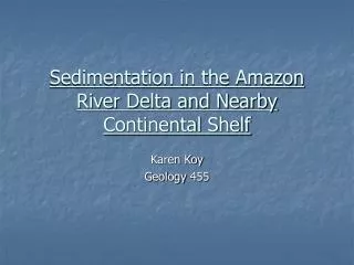
Sedimentation in the Amazon River Delta and Nearby Continental Shelf. Karen Koy Geology 455. Introduction. The Amazon River contributes 20% of the global runoff into oceans (Degens et al ., 1991) Its annual discharge is 6,300 km 3 /yr (Milliman and Meade, 1983)

E N D
Sedimentation in the Amazon River Delta and Nearby Continental Shelf Karen Koy Geology 455
Introduction • The Amazon River contributes 20% of the global runoff into oceans (Degens et al., 1991) • Its annual discharge is 6,300 km3/yr (Milliman and Meade, 1983) • Makes an important contribution to the sedimentation and geomorphology of the northeastern coast of South America • Summary of the current literature • Make some predictions about the future of this region
Introduction The Amazon River flows from the Andean mountain range east across South America as an anastomozing river, with numerous fluvial islands and channel bars finally ending at the Atlantic Ocean (Hoorn, 1994). From Nittrouer et al., 1995
From Warne et al, 2002 Amazon River Mouth • The river mouth is fixed in place by a graben (Dunne et al., 1998) • Characterized by estuarine-like processes (Warne et al., 2002; Gibbs, 1969; Gibbs and Konwar, 1986) • Tidal influence can be seen ~100 km inland (Hoorn, 1994)
Amazon River Mouth • The deepest portions reach >40m deep, yet there is no saltwater intrusion (Gibbs, 1969; Gibbs and Konwar, 1986) • The freshwater lens extends 120 km offshore (Gibbs, 1969) From Gibbs & Konwar, 1986
Sediment Discharge • Sediment discharge is 1.2x10⁹ m3 annually (Nittrouer et al., 1995) • 1-2% is bedload (Warne et al., 2002) • 85-95% is suspended silt and clay (Warne et al., 2002; Gibbs and Konwar, 1986) • Mean grain size of 4μm (Gibbs and Konwar, 1986)
Sediment Discharge • Eighty-four percent of dissolved salts and solids sampled were nearly identical to the Andean sediments (Gibbs, 1967) • Suspended sediments come predominantly from the Andes Mountains, which cover only 12% of the total drainage basin area (McDaniel et al., 1996; Gibbs, 1967) • The relief and physical weathering of the Andes Mountains appears to be a major control on the geochemistry of the Amazon River (Gibbs, 1967)
Sediment Discharge • Even though it covers a majority of the drainage basin area, the lower tropical rainforest contributes very little to the suspended load of the Amazon River (McDaniel et al., 1996; Gibbs, 1967) • It is likely the high level of vegetation in the rainforests retards surface erosion • The Amazon River channels and tributaries meander and migrate, producing elaborate scrollwork geomorphology (Mertes et al., 1996), reworking the fluviolacustrine sediments • The reworked sediments may comprise the majority of the bedload • The composition of the Amazon River bedload has yet to be investigated
From Warne et al, 2002 Amazon River Delta • A subaqueous deposit located seaward of the river mouth on the continental shelf (Nittrouer et al., 1995; Vital and Stattegger, 2000; McDaniel et al., 1996; Gibbs and Konwar, 1986) • 50 km wide at the proximal end, 300 km wide distally, and 650 km long, running northwest and parallel to the coast (de Alencar Costa and Figueiredo, 1998) • The delta plain contains estuarine islands (Warne et al., 2002) • During a previous lowstand, sediments were deposited in the Amazon Fan located in the deep ocean (McDaniel et al., 1996)
Amazon River Delta Underlying the delta is a transgressive sand layer, which is the top of a series of mud and sand layers 25-30 m thick (Figueiredo and Nittrouer, 1995; de Alencar Costa and Figueiredo, 1998) From Figueireda and Nittrouer, 1995
Amazon River Delta • The topmost sandy layer increases in thickness towards the river mouth (Alexander et al., 1986) • The mud layers are interpreted as regressive, prodelta sediments • The sand layers are interpreted as transgressive strata from delta progradation (Figueiredo and Nittrouer, 1995)
Amazon River Delta • Modern sediment accumulation occurs in an offshore depocenter >30 m deep, which includes the outer topset and foreset strata (Allison et al., 2000; Nittrouer et al., 1995; Alexander et al., 1986) • The sediment accumulation rate increases seaward (Kuehl et al., 1986) • Sediment accumulation rates in the foreset region: • 5.0-7.3 cm/yr (Dukat and Kuehl, 1995) • 8-10 cm/yr (Alexander et al., 1986) • 10.3 cm/yr (Kuehl et al., 1986)
Amazon River Delta Suspended sediment from the river plume flocculates and settles out along the delta and northwest along the continental shelf with decreasing grain size distally (Gibbs and Konwar, 1986 ; de Alencar Costa and Figueiredo, 1998). From Gibbs & Konwar, 1986
The Continental Shelf Northwest of the Amazon River is the longest continuous accretionary mud coastline in the world (Allison et al., 2000; Wells and Coleman, 1981; Rine and Ginsburg, 1985)
The Continental Shelf • The Amazon sediment plume travels northwest along the coast in a 20-40 km wide zone (Froidefond et al., 1988) • Travel at a rate of 40-80 cm/s (Nittrouer et al., 1995) • These sediments can still be found up to 1600 km updrift (Froidefond et al., 1988; Gibbs, 1977) • The sediments from the Amazon River travel in two basic forms: • as suspended sediment • as mudbanks
The Continental Shelf • ~100 million m3/yr suspended sediments travel up the coast (Froidefond et al., 1988; Wells and Coleman, 1981 • The North Brazilian Current is the primary force moving the sediment plume (Nittrouer et al., 1995; Wells and Coleman, 1981; Gibbs, 1969) • Easterly trade winds combine with the North Brazilian Current to reach a maximum migration rate during the months of August and September (Nittrouer et al., 1995; Wells and Coleman, 1981; Rine and Ginsburg, 1985; Gibbs, 1969)
The Continental Shelf • >150 million m3/yr sediment travel alongshore in the form of mudbanks (Froidefond et al., 1988; Allison et al., 2000; Wells and Coleman, 1981). • Mudbanks are volumetrically stable, can travel over 900 m/yr (Froidefond et al., 1988; Wells and Coleman, 1981) • Remain subaqueous (Vital and Stattegger, 2000) • Linear, shore-attached migrating shoals are similar to features found on sandy coastlines • Distributed every 30-60 km northwest along the coast, have <5m relief, and thin towards the shore and seaward (Wells and Coleman, 1981) • They act as barriers to wave energy at low tide, trapping and storing finer-grained sediments (Wells and Coleman, 1981)
The Continental Shelf • The coastline adjacent to the Amazon River mouth is eroding and contributing sediment to the updrift mudbanks (Allison et al., 2000) • A shoreline retreat rate of 0.5-1.0 m/yr, due to tidal and wave induced currents (Allison et al., 1995)
The Continental Shelf • The shelf sedimentation rate reaches its maximum in the upper tidal zone, and increases seaward across the shelf (Kuehl et al., 1986; Allison et al., 1995) • There is an overall upward/seaward progradation of the coastal plain (Nittrouer et al., 1995) • Contrary to previous belief, the fine-grained sediments along this muddy coastline are deposited by high-energy waves and currents (Rine and Ginsburg, 1985).
Conclusions • The majority of sediment carried by the Amazon River is suspended sediment derived from the Andes Mountains to the west • It is deposited in a subaqueous delta, and northwest along the continental shelf, fining with increasing distance from the river mouth • The topset and foreset regions of the delta have the highest sedimentation rates, causing the delta to prograde outward and upward • The coastline is being eroded near the river mouth, and muddy sediments are deposited updrift along the continental shelf as migrating mud shoals
Conclusions: Further Investigation • The composition and origins of the bedload • Why so little sediment is derived from the non-Andean source areas • The mechanism that would cause or maintain estuarine conditions in the Amazon River mouth
Conclusions: Predictions • If the current data are accurate, and the sedimentation and erosion patterns along the coastal shelf do not change: • The sediments from the Amazon River, and those being eroded from the nearby shelf, will continue moving northwest along the coast • The muddy coastline will continue to migrate even further north, possibly extending past the Orinoco River mouth • The Amazon River delta will most likely remain subaqueous
Conclusions • If sea-level were to fall: • The delta and mudbanks would become subaerial • If sea-level achieves a lowstand: • Sediments from the Amazon River may once again be deposited in the deep marine Amazon Fan