Download
1 / 54
540 likes | 656 Vues
a large carbon sink in the woody biomass of northern forests. Title. Myneni, Dong Tucker Kauppi Liski Kaufmann Zhou Alexeyev Hughes. department of geography, boston university, 675 commonwealth av., boston, ma 02215, usa

E N D
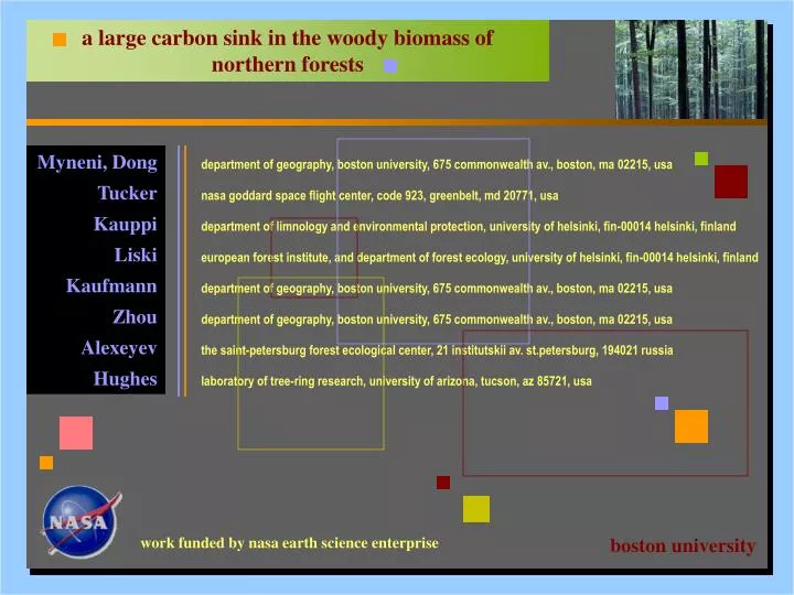
a large carbon sink in the woody biomass of northern forests Title Myneni, Dong Tucker Kauppi Liski Kaufmann Zhou Alexeyev Hughes department of geography, boston university, 675 commonwealth av., boston, ma 02215, usa nasa goddard space flight center, code 923, greenbelt, md 20771, usa department of limnology and environmental protection, university of helsinki, fin-00014 helsinki, finland european forest institute, and department of forest ecology, university of helsinki, fin-00014 helsinki, finland department of geography, boston university, 675 commonwealth av., boston, ma 02215, usa department of geography, boston university, 675 commonwealth av., boston, ma 02215, usa the saint-petersburg forest ecological center, 21 institutskii av. st.petersburg, 194021 russia laboratory of tree-ring research, university of arizona, tucson, az 85721, usa work funded by nasa earth science enterprise boston university
abstract Abstract • The terrestrial carbon sink, as of yet unidentified, represents 15 to 30% of annual global emissions of carbon from fossil fuels and industrial activities. Some of the missing carbon is sequestered in vegetation biomass and, under the Kyoto Protocol of the UNFCCC, industrialized nations can use certain forest biomass sinks to meet their greenhouse gas emissions reduction commitments. • Therefore, we analyzed 19 years of data from remote-sensing spacecraft and forest inventories to identify the size and location of such sinks. • The results, which cover the years 1981-99, reveal a picture of biomass carbon gains in Eurasian boreal and North American temperate forests and losses in some Canadian boreal forests. • For the 1.42 billion hectares of northern forests, roughly above the 30th parallel, we estimate the biomass sink to be 0.68 0.34 billion tons carbon per year, of which nearly 70% is in Eurasia, in proportion to its forest area and in disproportion to its biomass carbon pool. • The relatively high spatial resolution of these estimates permits direct validation with ground data and contributes to a monitoring program of forest biomass sinks under the Kyoto protocol. abstract
motivation Motivation • About 1 to 2 giga (109) tons of carbon (gt c) a year are suggested to be somehow sequestered in pools on land in the temperate and boreal regions.1 • Debate is currently underway regarding which of the forest biomass sinks can be used by the Annex 1 parties, the industrialized nations, to meet their greenhouse gas emissions reduction commitments under the kyoto protocol of the united nations framework convention on climate change. • Thus, characterizing the location and mechanism of carbon sinks is of scientific and political importance. motivation 1. Bousquet, P., Peylin, P., Ciais, P., Qu\'er\'e, C.L., Friedlingstein, P. & Tans, P.P. (2000) Science290, 1342-1346.
introduction Land carbon pool • Carbon on land is contained in various pools such as,1 land carbon pools - vegetation - detritus - black carbon residue from fires - soil - harvested products, etc. • This study is limited to analysis of the carbon pool in the woody biomass of temperate and boreal forests of the northern hemisphere, which cover an area of about 1.4 to 1.5 billion hectares.2 1. Schulze, E.-D., Wirth, C. and Heimann, M. (2000), Science, 289:2058-2059. 2. Liski, J. and Kauppi, P. (2000), in Forest Resources of Europe, CIS, North America, Australia, Japan and New Zealand (industrialized temperate/boreal countries), UN-ECE/FAO contributions to the Global Forest Resources Assessment 2000, (United Nations, New York), pp. 155-171.
definitions (1 of 2) Forest • We define forests as the following remote sensing land covers • - broad leaf forests - mixed forests • - needle leaf forests - woody savannas this land cover definition is broadly consistent with land use definitions of a forest but not of forest and other wooded land used by the FAO. forests 0 10 20 30 40 50 60 forest fraction (% of pixel area)
definitions (2 of 2) Woody biomass • Woody biomassconsists of- wood - twigs • - bark - stumps • - branches - roots • of live trees, shrubs and bushes. • The vegetation pool • gains carbon from productivity investment in these components • loses carbon due to woody biomass - aging - mortality - disease - harvest - insect attacks - fire - windthrow
data (1 of 9) Data • Forest biomass cannot be directly measured from space yet. • Year-to-year changes in biomass are quite small, about two orders of magnitude smaller than the biomass pool. At decadal and longer time scales, the biomass changes can be considerable due to accrual of differences between gains and losses. • Potentially, these can be observed as low frequency variations in climatological greenness, in much the same way as greenness changes at century and longer time scales are suggestive of successional changes. remote sensing of biomass
data: satellite (2 of 9) Satellite data • normalized difference vegetation index (NDVI) • global • 15-day maximum value composite • 8 km resolution • july 1981 to december 1999 processing included • cloud screening • calibration • El Chichon & Mt. Pinatubo corrections • research quality assessed1 satellite data 0.0 0.2 0.4 0.6 0.8 average greenness (81-99) 1. Zhou et al. (2001), J. Geophys. Res., 106(D17): 20069-20083.
-7.5 -2.5 0 5 10 15 20 25 data: satellite (3 of 9) Satellite data • In regions of distinct seasonality, as in the north, the cumulative growing season NDVI succinctly captures both the average seasonal level of greenness and the growing season duration, and is therefore an ideal measure of seasonal vegetation greenness. • We assume that climatological seasonal greenness total to be a surrogate for biomass in these northern forests. climatological seasonal greenness total change in NDVI total per year (80s &90s)
data: inventory (4 of 9) Inventory data • We analyzed 1980s and 90s inventory data of stem wood volume from 171 provinces in six countries (Canada, Finland, Norway, Russia, Sweden and USA) covering over one billion hectares (ha) of northern temperate and boreal forests. • The inventory data were converted to above-stump and total biomass using country specific coefficients.1 • These data represent a wide variety of inventory practices, provincial forest area, ecosystem types, age structures, fire and insect dynamics, management practices and time periods. forest inventory data 1. Liski, J. & Kauppi, P. (2000) in Forest Resources of Europe, CIS, North America, Australia, Japan and New Zealand (industrialized temperate/boreal countries), UN-ECE/FAO contributions to the Global Forest Resources Assessment 2000, (United Nations, New York), pp. 155-171.
30 20 10 0 Frequency (%) 0 2 4 6 8 10 12 14 16 18 20 0 1 2 3 4 5 provincial forest area (million ha) data: inventory (5 of 9) Forest area distribution • About 54% of the provinces had forested area less than 1.5 million ha (37% less than 625 thousand ha). About 27% had area greater than 5 million ha (12% greater than 20 million ha). provincial forest area distribution
Not stocked (1.56%) Others (5.55%0 Larch (0.53%) Oak (37.1%) Fir (11.3%) Birch (8.02%) Spruce (8.93%) pine (27%) USA 0 50 100 150 200 forest area (million ha) data: inventory (6 of 9) Forest area by genus • The dominant forest type is needle leaf (spruce, pine, fir and other conifers in Canada, >60%; larch, pine, spruce in Russia, > 70%; spruce and pine in Finland, Norway and Sweden, 70-90%). forest area by genus • The area of broad leaves (mostly oak) in the USA is comparable to that of needle leaves (pine, fir and spruce), about 40%.
Unclassified (15.3%) Unspecified broadleaves (5.08%) Other broadleaves (2.1%) Maple (2.66%) Birch (3.87%) Polar (7.85%) Unspecified conifers (6.06%) Other conifers (1.49 %) Larch 0.38%) Hemlock (1.99%) Fir (8.5%) Spruce (26.3%) Pine (16.3%) Canada 0 20 40 60 80 100 Russia Others (11.6%) Aspen (2.4%) Oak (1.3%) Fir (2.2%) Birch (12.9%) Larch (37.1%) Spruce (10.8%) Pine (21.7%) 0 50 100 150 200 250 300 350 forest area (million ha) data: inventory (7 of 9) forest area by genus
data: inventory (8 of 9) Age structure • About 40% of the forest area in Canada and 55% in Russia is under mature and over mature forests.The area under immature forests in Canada is about 30% (23% middle-aged forests in Russia). The forest area under regression is less than 10% in Canada (20% in Russia). • Thus, in a broad sense, the Canadian and Russian forest age structure are comparable. • In the USA, fully three fourths of the forest area is under forests younger than 85 years. forest age structure 100 80 60 40 20 0 All species Pine Oak Birch Fir Spruce Others USA Forest area (million ha) 0-20 20-50 50-85 85-120 >120 years
data: inventory (9 of 9) 400 300 200 100 0 All species Pine Spruce Larch Fir Birch Russia forest age structure forest area (million ha) Early Advanced Middle-aged Premature Mature 100 80 60 40 20 0 Canada forest area (million ha) Regeneration Immature Mature Overmature Unclassfied
methods: GIS (1 of 5) GIS-1 • The methodology is illustrated here, using Sweden as an example. • Sweden spans a latitude range of about 55N to 70N, with 24 provinces for which the inventory data are available (Fig. 1). The data reported are stem wood volume (106 m3) and forest area (103 ha) for various tree types and trunk size classes. • A remote sensing land cover map is required to match these provincial inventory estimates to NDVI data (Fig. 2). This map is at a spatial resolution of 1x1 km.1 Forests are defined as the following remote sensing land covers: broad leaf and needle leaf forests, mixed forests and woody savannas. matching inventory and ndvi data 1. Hansen, M.C., DeFries, R.S., Townshend, J.R.G. and Sohlberg, R.(2000), Int. J. Remote Sens., 21, 1331-1364.
methods: GIS (2 of 5) matching inventory and ndvi data evergreen needleleaf forests evergreen broadleaf forests deciduous needle forests deciduous broadleaf forests mixed forests woody savannas savannas closed shrublands open shrublands grasslands croplands barren (1) (2)
methods: GIS (3 of 5) GIS-2 matching inventory and ndvi data • For each province, in a geographical information system, we evaluate the cumulative growing season greenness from NDVI data layers, by averaging over forest pixels, as identified from the land cover map. This assures that the resulting provincial cumulative growing season greenness is assembled from NDVI data of forested regions only. • The degree to which total forest area estimates from inventory and remote sensing match, provides some confidence in both inventory and remote sensing data.
Forest and land area in each province Remote sensing estimates Inventory report (1982-86) Inventory report (1993-97) 0 1 2 3 4 5 Area (million ha) Forest Area (million ha) 0 2 4 6 8 10 Land Nbtn Vbtn Jmtl Vnrl Gavl Kopp Vrml Oreb Vstm Upps Sthm Sadm Ostg Skbg Alvs Jkpg Kron Kalm Gotl Gtbg Hall Blek Skan methods: GIS (4 of 5) matching inventory and ndvi data
methods: GIS (5 of 5) GIS-3 • The inventory stem wood volume data are converted to total and above stump biomass, and then plotted against the provincial growing season cumulative NDVI, as in Fig. 1. A similar plot for Russia is shown in Fig. 2. matching inventory and ndvi data (1) (2)
methods: regression model (1 of 4) Regression relation • Satellite and inventory data shown below (without outliers) were transformed to estimate a statistically significant relation between biomass and seasonal greenness totals. • 1/Biomass = a + [(1/NDVI)/Latitude2] + g Latitude ndvi biomass relation Biomass: inventory estimate of biomass (tons/ha) NDVI: cumulative growing season NDVI averaged over a five year period prior to inventory date Latitude: the centriod of the area sampled by forest inventory in a province , and : regression coefficients
methods: regression model (2 of 4) ndvi biomass relation
methods: regression model (3 of 4) ndvi biomass relation
methods: regression model (4 of 4) Regression tests • There is a statistically meaningful relation between NDVI and biomass in nearly every nation and sample period. • There is statistically meaningful relation between biomass and NDVI for values of NDVI that exceed 80. • The relation between NDVI and biomass for values of NDVI above 80 is not statistically different from the relation between NDVI and biomass for values of NDVI equal to or less than 80. • There is a relation between NDVI and biomass for nearly all values for NDVI. • There is a statistically meaningful relation between NDVI and biomass, regardless of latitude. • The spatial relation between biomass and NDVI in Sweden is not statistically different from the temporal relation between biomass and NDVI in Sweden. • Tests indicate that it is highly unlikely that the size the carbon sink reported in the text is a statistical artifact of uncertainty regarding the relation between biomass and NDVI. statistical tests
results: spatial patterns (1 of 8) • Because of their high spatial resolution, relative to provincial inventory measurements, biomass estimates from satellite data provide spatial detail of the carbon pool and where changes in the pool have occurred. • To document these regional features, we evaluated forest woody biomass carbon pools during the early 1980s (1982-86) and late 1990s (1995-99) with the regression model and pixel-level NDVI data. • Changes in the carbon pool were then evaluated as simply the difference between these two pool estimates, pixel-by-pixel, and quoted on a per year basis. spatial pattern of pools
0 10 20 30 40 50 60 Carbon Pool (tons C/ha) 1995 to 1999 results: spatial patterns (2 of 8) Pool pattern • The biomass map indicates larger average pools, in tons C/ha, in North America compared to Eurasia (51vs. 39). • The average pool size in Europe and the USA is larger than in Canada and Russia (54-58 vs. 38-44). • Amongst the European countries, Austria, France and Germany have notably large average pools (60, 67 and 73, respectively). • The estimates for Finland, Norway and Sweden are comparable to Russia (35-40 vs. 38). spatial pattern of pools
0 10 20 30 40 50 60 Carbon Pool (tons C/ha) 1995 to 1999 results: spatial patterns (3 of 8) Canada (pool) pool pattern in canada area: 239.5 Mha pool size: 10.56 Gt C sink: 0.073Gt C/yr
0 10 20 30 40 50 60 Carbon Pool (tons C/ha) 1995 to 1999 results: spatial patterns (4 of 8) USA (pool) pool pattern in the usa area: 215.5 Mha pool size: 12.48 Gt C sink: 0.142Gt C/yr
0 10 20 30 40 50 60 Carbon Pool (tons C/ha) 1995 to 1999 results: spatial patterns (5 of 8) Russia (pool) pool pattern in russia area: 642.2 Mha pool size: 24.39 Gt C sink: 0.284Gt C/yr
0 10 20 30 40 50 60 Carbon Pool (tons C/ha) 1995 to 1999 results: spatial patterns (6 of 8) Europe (pool) area: 161.1 Mha pool size: 8.71 Gt C sink: 0.136Gt C/yr pool pattern in europe
0 10 20 30 40 50 60 Carbon Pool (tons C/ha) 1995 to 1999 results: spatial patterns (7 of 8) China & japan (pool) pool pattern in china japan area: 161.6 Mha pool size: 4.58 Gt C sink: 0.05054Gt C/yr
-0.3 0 0.3 0.6 0.9 Source Sinks Changes in Carbon Pool (tons C/ha/yr) 1980s & 90s results: spatial patterns (8 of 8) Pool changes • Carbon gains, in excess of 0.3 tons C/ha/yr, are seen in Eurasian boreal and North American temperate forests. • The gainsare observed in Eurasia over a large, broad, nearly contiguous swath of land, from Sweden, through Finland, European Russia, central Siberia to trans-Baikalia • In North America, similarly large gains are seen in the eastern temperate forests of the USA and in southern Ontario and Quebec below the 50th parallel. spatial pattern of pool changes • Carbon losses, greater than 0.1 tons C/ha/yr, are seen in Canadian boreal forests, from Newfoundland to Northwest territories, except in smaller fragments in northern Saskatchewan and Alberta, where gains are observed.
results: uncertainties (1 of 3) Uncertainty • The average absolute difference between remote sensing and inventory estimates is (next two slides) • 10.4 tons C/ha for above-stump biomass (27%) • 16.1 tons C/ha for total biomass (33%) • 0.33 tons C/ha/yr for changes in pool size (50%) • There is no bias in the estimation of biomass pools and changes to the pools. • The national inventory sink estimates were derived from wood volume increment and loss data (natural and fellings), unlike remote sensing estimates which are biomass differences between two time periods. The comparability of the two estimates is thus noteworthy. uncertainties in remote sensing estimates
results: uncertainties (2 of 3) uncertainties in remote sensing estimates
results: uncertainties (3 of 3) uncertainties in remote sensing estimates
results: pool estimates (1 of 3) Countrywise (pool) • We estimate the carbon pool in the woody biomass of 1420 million hectares (Mha) of temperate and boreal forests in the northern hemisphere to be 61 20 Gt C during the late 1990s. • This is comparable to the TBFRA-2000 which reports a carbon pool of 80 Gt C, but on 2477 Mha of forests and other wooded land. • Both these estimates are considerably lower than the estimate, 147 Gt C on 2410 Mha of forests and other wooded land, quoted by the IPCC.1 • Earlier studies may have overestimated carbon pools possibly because of unrepresentative samples, which tend to bias towards sites with larger than average pools. If this has occurred for tropical forests and savannas, the current estimate of global vegetation carbon pool, 466 Gt C, may also be too large.1 NH pool estimate 1. IPCC, 2000, Land use, Land-use change, and Forestry, Cambridge University Press, Cambridge, United Kingdom.
results: spatial pattern (12 of 12) results: pool estimates (2 of 3) Countrywise (pool) country pool estimates • The average pool size in Europe and the USA is larger than in Canada and Russia (54-58 vs. 38-44). Amongst the European countries, Austria, France and Germany have notably large pools (60, 67 and 73, respectively). • The estimates for Finland, Norway and Sweden are comparable to Russia (35-40 vs. 38).
results: pool estimates (3 of 3) country pool estimates
results: sink estimates (1 of 2) Countrywise (Sink) • Our estimate for the woody biomass sink during the 1980s and 90s is 0.680.34 Gt C/yr. • This is in the mid-range of estimates by Sedjo1 for mid-1980s (0.36 Gt C/yr) and TBFRA-20002 for early and mid-1990s (0.81 Gt C/yr). NH sink estimates 1. Sedjo, R.A., 1992, Ambio, 21: 274-277. 2. Liski, J. & Kauppi, P., 2000, in Forest Resources of Europe, CIS, North America, Australia, Japan and New Zealand (industrialized temperate/boreal countries), UN-ECE/FAO contributions to the Global Forest Resources Assessment 2000, United Nations, New York, pp. 155-171.
results: sink estimates (2 of 2) North amer. & euriasia • It is instructive to compare the sink estimates of North America and Eurasia in view of a large terrestrial North American sink and weak Eurasian sink reported for the 1988-92 time period.1 • The average sequestration rate, in tons C/ha/yr, is highest in Europe (0.84) and the USA (0.66), and least in Canada and China (0.27-0.31), with values for Russia in between (0.44). • Consequently, the average sequestration rate is comparable between North America and Eurasia, (0.47-0.49), unlike the average pool sizes (51 vs. 39 tons C/ha). • Thus, nearly 70% of the biomass sink is in Eurasia (0.47 Gt C/yr), in proportion to its forest area and in disproportion to its pool size. eurasia vs. north america 1. Fan et al., 1998, Science, 282: 442-446.
results: country estimates (1 of 6) Canadian estimates • The estimates of the three large countries, Canada, Russia and the USA, are crucial to overall accuracy because they account for 78% of the pool, 73% of the sink and 77% of the forest area. • The losses observed in some Canadian boreal forests are consistent with reports of disturbances from fires and insects during the 1980s and 90s. • For Canada, we estimate a sink of about 0.073 Gt C/yr, which is comparable to an inventory estimate by the Canadian Forest Service (0.091 Gt C/yr). 1 canadian estimates 1. Canadian Forest Service, The State of Canada's Forests 1993, Nat. Resour. Can., Ottawa, Ontario, Canada.
results: country estimates (2 of 6) USA estimates • Our pool, sink and forest area estimates for the USA are comparable to TBFRA-2000 estimates. • Our sink estimate for the USA (0.142 Gt C/yr) is comparable to most estimates for the 1980s (0.02-0.15 Gt C/yr). usa estimates • Our pool (10.6 Gt C) and forest area (239 Mha) estimates for the late 1990s are also comparable to the TBFRA-2000 estimates (11.9 Gt C and 244 Mha).
results: country estimates (3 of 6) Russia estmates • Estimates for Russia differ. • The remote sensing estimate of forest area, 642 Mha, is about 130-180 Mha lower, possibly due to the resolution of satellite data, which may be too coarse for detecting russian estimates • tree stands in the forest-tundra of Russia, where small lots of sparse stands with extremely low growing stock are distributed between the vast peatlands. • When expressed on per ha forest area basis, • The various pool estimates are comparable (38-43 tons C/ha). • The difference in sink estimates between remote sensing and TBFRA-2000 is smaller (0.44 vs. 0.53; in tons C/ha/yr).
results: country estimates (4 of 6) sinks (Mt C/yr) 0 50 100 150 200 250 300 Russia* USA Canada Sweden Germany Japan Italy France Romania Spain Poland Turkey Finland UK Bulgaria Austria Belarus* Czech* Norway Greece Portugal Latvia* Ukraine* Switzerland Lithuania* Estonia* Hungary Belgium Netherlands Denmark annex 1 countries: sinks annex 1 countries# #Australia, Iceland, Ireland, Luxembourg, New Zealand are not included. 0 2 4 6 8 10 12 14 16
results: country estimates (5 of 6) sinks to emissions 0 0.2 0.4 0.6 0.8 1 annex 1 countries: sinks to emissions ratio Sweden Latvia* Russia* Canada Finland Norway Lithuania* Austria Portugal Estonia* Bulgaria Romania Turkey Belarus* Greece Spain Switzerland USA Italy Czech* France Poland Hungary Germany Japan UK Ukraine* Denmark Belgium Netherlands annex 1 countries# *Annual mean emissions are from 1992 to 1998. The others are from 1982 to 1998. #Australia, Iceland, Ireland, Luxembourg, New Zealand are not included.
results: country estimates (6 of 6) sinks to emissions per capita (10-8 ) 0 5 10 15 20 25 30 35 40 Latvia* Estonia* Sweden Norway Finland Lithuania* Austria Bulgaria Portugal Canada Belarus* Switzerland Greece Czech* Romania Hungary Russia* Spain Turkey Italy Poland Denmark France Belgium Germany UK USA Japan Netherlands Ukraine* annex 1 countries: sinks to emissions per capita annex 1 countries# *Annual mean emissions are from 1992 to 1998. The others are from 1982 to 1998. #Australia, Iceland, Ireland, Luxembourg, New Zealand are not included. 0 0.5 1 1.5 2 2.5 3 3.5
discussion: reasons (1 of 6) Reasons • The reasons for the observed changes in the forest woody biomass pool are not known. • This implies uncertainty regarding the future of biomass sinks and therefore the need for monitoring. • But, the spatial patterns offer some clues. reasons • Woody encroachment and longer growing seasons from warming in the northern latitudes possibly explain some of the changes, and
-0.3 0 0.3 0.6 0.9 Source Sinks Changes in Carbon Pool (tons C/ha/yr) 1980s & 90s discussion: reasons (2 of 6) Canada (sink) • Increased incidence of fires and infestations in Canada. pool changes in canada
-0.3 0 0.3 0.6 0.9 Source Sinks Changes in Carbon Pool (tons C/ha/yr) 1980s & 90s discussion: reasons (3 of 6) USA (sink) • Fire suppression and forest regrowth in the USA. pool changes in usa
-0.3 0 0.3 0.6 0.9 Source Sinks Changes in Carbon Pool (tons C/ha/yr) 1980s & 90s discussion: reasons (4 of 6) Russia (sink) • Declining harvests in Russia. pool changes in russia