Download
1 / 55
590 likes | 1.03k Vues
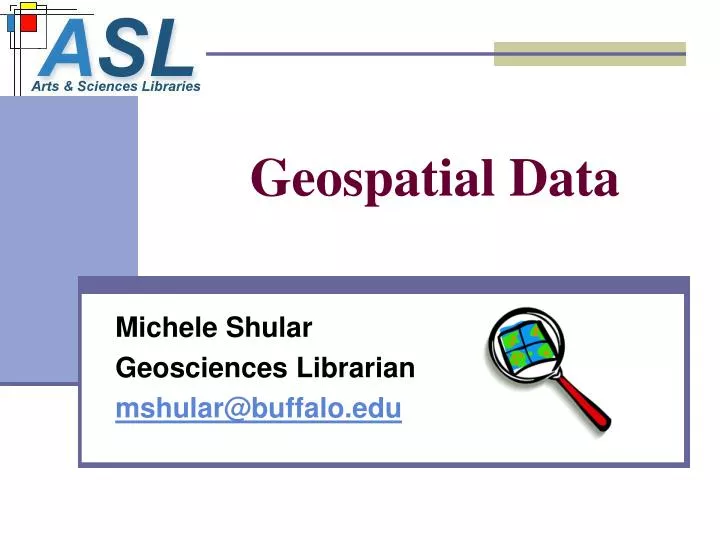
Geospatial Data. Michele Shular Geosciences Librarian mshular@buffalo.edu. UB Libraries GIS Services Where we are now…. One Public Access GIS Workstation Science & Engineering Library ESRI ArcGIS 9.0, ArcView 3.3 & Network Analyst Patron Assistance Locating and Retrieving Data

E N D
Geospatial Data Michele Shular Geosciences Librarian mshular@buffalo.edu
UB Libraries GIS Services Where we are now… • One Public Access GIS Workstation • Science & Engineering Library • ESRI ArcGIS 9.0, ArcView 3.3 & Network Analyst • Patron Assistance • Locating and Retrieving Data • Using Data & Software Help • ESRI Virtual Campus Courses
ESRI Virtual Campus Courses • Free to UB faculty, staff, students • 50+ courses and workshops • Registration form online • 15-25 hours per course • All needed data provided • Certificate for course completion • http://ublib.buffalo.edu/libraries/asl/gis/GIS-training.html
12 Factors in Choosing Geospatial Data • Source • Coverage & Extent • Time Period • Scale • Positional Accuracy • Attribute Availability
Originating Sources of Geospatial Data • Government • Local • Regional • State • Federal • International • Utilities • Universities & Research Centers • Commercial • usually originate from govt. sources, but are value added
12 Factors in Choosing Geospatial Data • Source • Coverage & Extent • Time Period • Scale • Positional Accuracy • Attribute Availability
12 Factors in Choosing Geospatial Data • Source • Coverage & Extent • Time Period • Scale • Positional Accuracy • Attribute Availability
12 Factors in Choosing Geospatial Data • Source • Coverage & Extent • Time Period • Scale • Positional Accuracy • Attribute Availability
Scale • Ratio of map units to real world units • Choose scale inversely proportional to extent • Standard Scales: • 1:12,000 • 1:24,000 • 1:100,000 • 1:250,000 • 1:1,000,000, etc. LARGE SMALL
12 Factors in Choosing Geospatial Data • Source • Coverage & Extent • Time Period • Scale • Positional Accuracy • Attribute Availability
Positional Accuracy Tiger Streets (federal) DOT Streets (state) County Streets (local)
12 Factors in Choosing Geospatial Data • Source • Coverage & Extent • Time Period • Scale • Positional Accuracy • Attribute Availability
12 Factors in Choosing Geospatial Data cont’d • File Size • File Format • Projection & Datum • Tiling Scheme • Metadata Availability • Use Restrictions & Access
File Size: Feature Subset Wessex Streets 5.0 TIGER Data .shp file: 4.67 mb ESRI Major Roads TIGER Subset .shp file: 0.22 mb
12 Factors in Choosing Geospatial Data cont’d • File Size • File Format • Projection & Datum • Tiling Scheme • Metadata Availability • Use Restrictions & Access
Formats BIP MrSID Orthophotos TIFF BMP JPEG
12 Factors in Choosing Geospatial Data cont’d • File Size • File Format • Projection & Datum • Tiling Scheme • Metadata Availability • Use Restrictions & Access
Common NYS Projections State Plane NAD83 Geographic Coordinates State Plane NAD27 UTM Zones 17 & 18
12 Factors in Choosing Geospatial Data cont’d • File Size • File Format • Projection & Datum • Tiling Scheme • Metadata Availability • Use Restrictions & Access
Common TilingSchemes • Counties (soils) • Sub-county (digital orthophotos) • USGS Quad (1:12k, 1:24k, 1:100k, 1:250k) • River Basin or Sub-basin (streams) • State
Tiling Issues • Small Tiles • need to merge data sets: time consuming, possible software limits • Large Tiles • need to clip data sets: time consuming, possible software limits • Incongruous Tiles • Counties and River Basins • need to both merge and clip data
12 Factors in Choosing Geospatial Data cont’d • File Size • File Format • Projection & Datum • Tiling Scheme • Metadata Availability • Use Restrictions & Access
Metadata Availability • Federal data is required by U.S. law to be accompanied by FGDC compliant metadata • State, Local and Commercial data producers are not required, and therefore, many do not • Some data producers may provide metadata for a dataset, but not for individual layers
12 Factors in Choosing Geospatial Data cont’d • File Size • File Format • Projection & Datum • Tiling Scheme • Metadata Availability • Use Restrictions & Access
Data Use Restrictions & Access • Federally produced unclassified data is in the public-domain. • State, local, and commercial data are generally under distribution agreements that limit their use for educational purposes only. • Distribution of data for “un-seeable” features (underground infrastructure) is being stopped for homeland security.
GIS Data Types • Feature Data • Digital Imagery & Photography • Tabular data
USGS Datasets • Digital Raster Graphic (DRG) • Digital Line Graph (DLG) • National Hydrography Dataset (NHD) • National Land Cover Dataset (NLCD) • Digital Orthophoto Quadrangle (DOQ) • Digital Elevation Model (DEM) • National Elevation Dataset (NED) • Geographic Names Information System (GNIS)
DLGs Nine Categories of Attributes • Public Land • Boundaries • Transportation • Hydrography • Hypsography (elevation) • Non-vegetative Features • Survey Control and Markers • Manmade Features • Vegetative Surface Cover
More Federal Types… • FEMA: flood zones • NOAA: coastal data • EPA: environmental data • NRCS: soil surveys, agricultural data • FWS: Natl. Wetlands Inventory (NWI), wildlife • NPS: recreational, historic data • USDA: forest, agriculture, natural resources
Tabular Census Data • Population Census • Economic Census • Agricultural Census • State Data Centers
CensusPopulation Data • Year 2000 latest complete data • Varied geographies to census blocks • Population, race/ethnicity, income, housing, family structure, employment, education, etc. • SF1 = short form, 100% count • SF3 = long form, about 17% count, more attributes • Join tabular data to Census geography shapefiles • UB Libraries Census Resources Information Guide • http://ublib.buffalo.edu/libraries/asl/guides/busdoc/census.html
Census Data Resources Online • Generate tables from American Factfinder • http://factfinder.census.gov/ • Be sure to get a geographic ID field to join your tables to the shapefiles. Download TIGER shapefiles from ESRI • http://www.esri.com/data/download/census2000_tigerline/index.html • Some basic tables can be downloaded here too
Internet Mapping Services (IMS) • Interact with GIS data via Web browser • GIS access for those without: • Expensive GIS software • GIS-capable computer equipment • GIS expertise • High networkbandwidth • Data storage space
Erie County Internet Mappinghttp://erie-gis.co.erie.ny.us/website/erie_help/help.htm
Local Data – Typical Layers • Cadastral (tax parcels) • Digital Orthophotos • Street centerlines • Topographic contours • School, sheriff, fire, EMS districts • Voting precincts • Miscellaneous cultural and infrastructure
CUGIR Cornell Univ Geospatial Information Repository • http://cugir.mannlib.cornell.edu/ • Adirondack Park Agency • Cornell Department of Natural Resources • National Atlas • NYS Dpt of Agriculture and Markets • NYS Dpt of Environmental Conservation • Tompkins County ITS/GIS • US Census Bureau • US Geological Survey • USDA Natural Resources • Conservation Service
GNIS Database - USGS • Geographic Names Information System • http://geonames.usgs.gov/redirect.html Can query: • State • County • Feature Class • Topo Map Name