Download
1 / 30
300 likes | 430 Vues
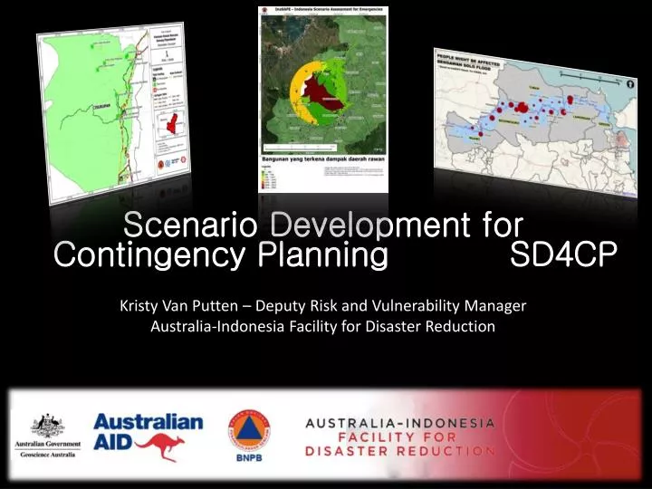
Scenario Development for Contingency Planning SD4CP Kristy Van Putten – Deputy Risk and Vulnerability Manager Australia-Indonesia Facility for Disaster Reduction. Scenario Development for Contingency Planning . Kenapa ? Apa ? Bagaimana ? Siapa ? Kapan ? Mau?. Why? What? How?

E N D
Scenario Development for Contingency Planning SD4CP Kristy Van Putten – Deputy Risk and Vulnerability Manager Australia-Indonesia Facility for Disaster Reduction
Scenario Development for Contingency Planning • Kenapa? • Apa? • Bagaimana? • Siapa? • Kapan? • Mau? • Why? • What? • How? • Who? • When? • Want?
KonsepInaSAFE Didukungoleh: www.inasafe.org
Apakahperangkatkeselamatan (relief items) cukupuntuksebanyakX jumlahorang? • Bila YA, Dimanalokasipenyimpanandanbagaimanapendistribusiannya? • Bila TIDAK, dimanaperangkatkeselamatanbisadidapatdandikirimkelokasi? • Apakahtambahansumberdaya yang diperlukanuntukXperempuanhamil,XjumlahbayidanXjumlahlansia? • Dimana murid2 darisekolah yang terdampakakanbersekolah? • Dimanapasiendari RS didaerahterdampakakandirawatdanbagaimanaakandipindahkan? KhususBanjir • Apakahperahu yang dimilikimampumengevakuasiXjumlah orang? KhususGempaBumi • Apakah unit identifikasikorbancukupuntukmengidentifikasiXjumlah orang?
Add Jakarta movie Didukungoleh: www.inasafe.org
Real time earthquake Didukungoleh: www.inasafe.org
Communities change, science improves, • Hence repetition of the process in necessary • By using InaSAFE updating CP is easy!
Mau Tahulebihbanyak?
Just ask! either AIFDR or HOT can assist • InaSAFE and Developing new features • OpenStreetMap • Data Management • Making Maps • Spatial Analysis • Open Source Solutions
For more information • Website www.openstreetmap.org www.openstreetmap.or.id www.inasafe.org www.learnosm.org • Resources http://bit.ly/inasafe_resources Or contact me: Kristy.vanputten@gmail.com
OpenStreetMap (OSM) • OpenStreetMap is a free map of the entire world. • It works just like Wikipedia, you can login to add information, fix mistakes and map what interests you. • People have created 1,000,000 accounts already!
OpenStreetMap JOSM – Desktop Application Pushpin - Mobile Potlatch - Online Walking Papers – Paper & Forms
Institutionalizing OSM in Indonesia June 2011 – March 2012 • Test if OSM could be populated and used in both rural and urban areas • Identify tools and materials that are needed to continue adoption • Is the data useful during an emergency or for contingency planning • Illustrate how OSM can be used across Indonesia. August 2012 – Current • Develop a comprehensive training package for Scenario Development including: • Data Collection (OpenStreetMap - HOT) • Impact analysis (QGIS/InaSAFE – UGM/HOT) • Training to be part of a national disaster management agency training curriculum • Linked to Contingency Planning Training
Indonesian building Statistics Pilot Program Technical Training Program
Achievements – to date • 1,226,448 buildings mapped in Indonesia (17/10/13) • All OSM training material and software have been created/translated into Indonesian • OSM has been trained in 10 provinces (~500 people) • 30 people across 6 provinces have been trained to train OSM and other spatial software (Master Trainers) • The spatial information collected is being used to create realistic disaster scenarios for contingency planning
Replication of OSM • OSM integrated into curricula of 3 Universities (Jakarta, Yogyakarta, Makassar) • ACCESS continues to use and train OSM, funds were provided by local government to continue mapping. • National Mapping Agency are working on integrating OSM into their one map policy • Software created as part of the grant is now being used world wide • Training material have been translate into 6 languages • Partners are adopting OSM into their programs
Pemetaan DKI Jakarta • Memetakanbatas RW DKI Jakarta Memetakanbangunapenting di DKI Jakarta • MemperkenalkanOpenStreetMapkepadaperwakilankelurahan • Menyediakanperwakilankelurahandenganmemeberikanpengertianbagaimanadarainidapatmemberikankeuntunganuntukmenghadapibencana
Pemetaan Padang • OSM Tasking Server Upayainternasional • Digitasimelalui Microsoft bing imagery • Pemetaan Padang • Lebihdari 95,000 bangunanterpetakan • Downfall, tidakadainformasitentangbangunan– hanyalokasispasialsaja http://tasks.hotosm.org/
Waode Angkalo Village in Buton Utara, South-East Sulawesi A Village in Takalar, South Sulawesi