Download
1 / 31
330 likes | 536 Vues
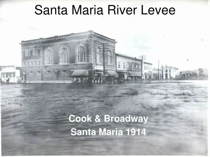
Santa Maria River Levee. Cook & Broadway Santa Maria 1914. Santa Maria River Levee. 26 Miles Compacted Sand Rock Slope Protection Facing. Santa Maria. Guadalupe. Levee Cross Section. Base Road. Compacted Sand.

E N D
Santa Maria River Levee Cook & Broadway Santa Maria 1914
Santa Maria River Levee • 26 Miles Compacted Sand • Rock Slope Protection Facing Santa Maria Guadalupe
Levee Cross Section Base Road Compacted Sand City River x x x Rock Slope Protection
SM River Levee Quick Facts • Built 1959 – 1963; Part of Santa Maria Project • Built by Feds – US Army Corps of Engineers • Designed to a flow of 150,000 cfs • Owned and Operated by Santa Barbara County Flood Control District
So What is the Problem? • River Flows 20-25 Feet Per Second • Failure is from Below (Scour) • Rock Facing is Inadequate (18” thick)
Santa Maria River Damage History • 1966 – Revetment Damages • 1969 – Near Breach • 1978 – Revetment damages • 1983 – Revetment damages • 1995 – Revetment Damages • 1998 – Total Breach, other Revetment Damage • 2001 – Revetment Damage
SM River Levee – Critical Areas Suey Rd East of Landfill
Levee Break Inundation Area – Corps of Engineers March 1980 “Supplement to Design Memorandum 2” Suey Road Breach
Santa Maria River Levee – Suey Breach Inundation Breach Point
Levee Break Inundation Area – Corps of Engineers March 1980 “Supplement to Design Memorandum 2” Bradley / SM Landfill Breach
Santa Maria River Levee – SM Landfill / Bradley Breach Inundation Breach Point
Historic Photos – 1966 - 1969 Below – SM Levee in 1966 Failed Section Above – SM Levee in 1969 Note Flow Patterns
1998 Breach – North Levee • Meandering Flows Impinge in Levee • 1000 feet of Levee lost • Flow was less than 30,000 cfs • Breach Plugged in 24 hours