Download
1 / 16
160 likes | 276 Vues
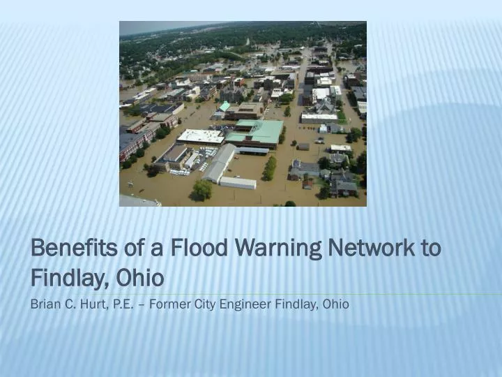
Benefits of a Flood Warning Network to Findlay, Ohio Brian C. Hurt, P.E. – Former City Engineer Findlay, Ohio. Located in Northwest Ohio 40 miles from Toledo Population: 40,000 Contains Highest number of National Flood Insurance Program (NFIP) p olicies in the State of Ohio

E N D
Benefits of a Flood Warning Network to Findlay, Ohio Brian C. Hurt, P.E. – Former City Engineer Findlay, Ohio
Located in Northwest Ohio 40 milesfrom Toledo Population: 40,000 Contains Highest number of National Flood Insurance Program (NFIP) policies in theState of Ohio Approximately 1,500 properties inside FEMA Flood Hazard Area Fast facts of Findlay, Ohio
Findlay has experienced 4 of its top 10 historical floods since August 2007 Recent summary of Flood History Top 10 Historical Crests 03/1913 18.50 ft. 1 Benchmark 03/2011 16.42 ft. 6 03/2009 15.41 ft. 9 02/2008 16.50 ft. 5 08/2007 18.46 ft. 2 06/1997 15.42 ft. 8 06/1981 17.43 ft. 3 02/1959 16.76 ft. 4 01/1959 16.10 ft. 7 12/1927 15.40 ft. 10
Addition of 4 new USGS Stream Gages (Oct. 2007) • All Gages have Precipitation Monitors • Inundation Mapping (Apr. 2009) Findlay’s flood warning network
Funded through a Partnership between City of Findlay and USGS USGS office in Columbus, OH completed all technical aspects of the mapping National Weather Service host maps on their River Forecast Site for the Blanchard River at Findlay Inundation Mapping
August 2007 Flood Benefits of a flood warning network • River Crested within ½ inch of the highest crest ever recorded • Flood Warning Network was NOT in place • Only one USGS stream gage existed at this time which was located DOWNSTREAM of Findlay
August 2007 Flood Benefits of a flood warning network • During the event there was no sure way to tell what the river was doing upstream • NWS and Local officials did not have the information to properly predict an accurate crest
March 2011 Flood Benefits of a flood warning network • Findlay experienced 6th largest flood on Record • 3rd Major Flood that occurred after the installation of the Flood Warning Network • NWS used historical Data from new stream gages to aid in their river crest predictions
March 2011 Flood Benefits of a flood warning network • NWS predicted a 70% chance of major flooding 3 days before the event • NWS predicted crest within 1 inch directly after the rain event • Findlay Officials used a Reverse 911 system to notify residents of impending danger
March 2011 Flood Benefits of a flood warning network • With early warning residents sandbagged or moved valuables to higher ground • Inundation Maps were used by Findlay Officials to direct residents around flood waters during the event • A meaningful 3 day warning of major flooding was unprecedented in Findlay
Early Warning is the Most Effective way for Findlay to Limit Flood Damage Until a Corps of Engineers Flood Reduction Project is Implemented Benefits of a flood warning network