Download
1 / 32
320 likes | 445 Vues
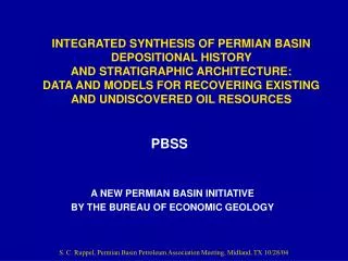
INTEGRATED SYNTHESIS OF PERMIAN BASIN DEPOSITIONAL HISTORY AND STRATIGRAPHIC ARCHITECTURE: DATA AND MODELS FOR RECOVERING EXISTING AND UNDISCOVERED OIL RESOURCES. PBSS. A PROPOSAL FOR A NEW INITIATIVE BY THE BUREAU OF ECONOMIC GEOLOGY. PROGRAM GOALS.

E N D
INTEGRATED SYNTHESIS OF PERMIAN BASIN DEPOSITIONAL HISTORY AND STRATIGRAPHIC ARCHITECTURE: DATA AND MODELS FOR RECOVERING EXISTING AND UNDISCOVERED OIL RESOURCES PBSS A PROPOSAL FOR A NEW INITIATIVE BY THE BUREAU OF ECONOMIC GEOLOGY
PROGRAM GOALS • Produce a detailed, comprehensive history of Paleozoic depositional and reservoir systems in the Permian Basin • Create spatially integrated data bases of depositional, stratigraphic, lithologic, and petrophysical properties
TARGET RESOURCES • Development Target: : 23 billion barrels of mobile oil remaining in existing reservoirs • Exploration Target: 3.5 billion barrels of undiscovered oil and NGL resources
VALUE • Provide fundamental stratigraphic and reservoir-specific data in a readily accessible and useable format. • Integrated data will decrease the risk and increase the efficiency of exploitation • Integrated data will define newopportunities for drilling. • Integrated data will form the basis for newengineering approaches and completion practices
SOURCE DATA • Reservoir studies • Cores • Wireline logs • 3D & 2D seismic • Outcrop studies • Published reports • Company data
DELIVERABLES • Text: Written synthesis of history, stratigraphy, facies, structural history, and reservoir development in Permian Basin. • Data: ARC/INFO GIS-based regional structure maps, facies maps, cross sections, core descriptions and data, outcrop descriptions and sections, core data, reservoir data, production data, publications, etc for each play.
TEXT • First-year report on depositional history and stratigraphy of the Cambrian-Permian • Incremental play reports as completed.
PLAY DATA • Regional structure and facies maps • Regional cross sections • Core descriptions and data • Core photographs • Reservoir cross sections • Reservoir models
REGIONAL STRUCTURE MAPS Woodford Structure
REGIONAL CROSS-SECTIONS • Sequence stratigraphic framework • systems tracts • bounding surfaces/unconformities • Unit correlations • Facies correlations • Unit correlations • Facies correlations • Payzone continuity • Wireline attributes
CORE PHOTOGRAPHS Ooid/skeletal Lime Grainstone Separate Vug Porosity Porosity: 23.1 %; Permeability: 17 md
RESERVOIR CROSS-SECTIONS • Cycle stratigraphic framework • Facies stacking patterns • Reservoir architecture • Payzone continuity • Wireline attributes
PLAY DATA (continued) • Outcrop models • Depositional models • Seismic models • Production data • Publications
500 ms 1000 ms 1 mile SEISMIC SECTIONS NW SE Yates Grayburgreservoir Queen Grayburg Lowstandwedge Glorieta platform margin U San Andres M L Clear Fork
DATA DELIVERY FORMATS • Written summary reports on each play • Digital & paper delivery • Digital data (GIS ARC-View) • CD format • Online web-based (ARC-IMS)
FUNDING • Industry Sponsorship • DOE Awards • Bureau of Economic Geology Leveraging • RCRL • State of Texas • University System • Other Sources • Expected Funding Levels: $1.5 - $2 million (3 years)
PROJECT STAFF • BEG: Steve Ruppel (PI), Charlie Kerans, Bob Loucks, Scott Tinker, Bob Hardage, Frank Brown, Jerry Lucia, Shirley Dutton • UT Jackson School: Bill Galloway • Students • Other
TENTATIVE* WORK PLAN • Year 1: Regional Paleozoic synthesis; Devonian chert play; Devono-Mississippian basin-center shale play, [Leonardian platform carbonate play]. • Year 2: San Andres platform carbonate play; Leonardian/Wolfcampian slope debris carbonate play; Grayburg platform carbonate play. • Year 3: Ellenburger carbonate play, Silurian platform carbonate play, Delaware Mtn. Group deep-water sandstone play. * To be determined by funding level and interest
COST OF SPONSORSHIP • 1 year sponsorship - $18,000 • 2 year sponsorship - $33,000 • 3 year sponsorship - $45,000
BENEFITS OF SPONSORSHIP • Exclusive priority access to data products and deliverables for minimum of 1 year. • Access to data digitally as it becomes available. • Input as to focus and deliverables of project. • Direct access to project staff. • Attendance at annual project meetings.
PROJECT START DATE AND TERM • Expected Start: November 1, 2004 • Initial term: 3 years • Continuation based on funding availability. • Continuation sponsorship levels guaranteed for active sponsors
SPONSOR COMMITTMENT • Statement of desire to participate: ASAP • Letter of Intent: due before startup • Sponsorship payment: due at startup.
PROJECT CONTACTS • Steve Ruppel • 512-471-2965 • Stephen.ruppel@beg.utexas.edu • Charlie Kerans • 512-471-1368 • Charles.kerans@beg.utexas.edu • Bob Loucks • 512-471-0366 • Bob.loucks@beg.utexas.edu