Download
1 / 34
340 likes | 500 Vues
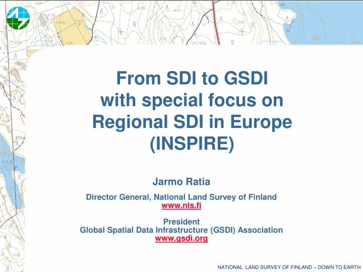
From SDI to GSDI with special focus on Regional SDI in Europe (INSPIRE). Jarmo Ratia Director General, National Land Survey of Finland www.nls.fi President Global Spatial Data Infrastructure (GSDI) Association www.gsdi.org. Information Society and further on…. Industrial society

E N D
From SDI to GSDI with special focus on Regional SDI in Europe (INSPIRE) Jarmo Ratia Director General, National Land Survey of Finland www.nls.fi President Global Spatial Data Infrastructure (GSDI) Association www.gsdi.org
Information Society and further on… • Industrial society • Service society • Information society • Network society ? • Knowledge society ??
First transistor 1960 First computer 1980 100 000´s of users First graphical userface 1995 1 000 000´s of users Global network 2005 100 millions of users Digital services 2020Billions of users The amount of personal computers will soon exceed the population of the world. Development to Information Society
Information Society andSDI, RSDI and GSDI • National Spatial Data Infrastructure (NSDI) • Regional Spatial Data Infrastructure (RSDI) • Global Spatial Data Infrastructure(GSDI) Steps towards knowledge society through information and network society
International development • USA 1994, Executive order by Clinton • GI2000 1995, European Union • GSDI 1, Bonn, Germany, September 1996 • EuroGeographics 2002 • GSDI Association 2004 • INSPIRE, European Union proposal 2004, will be in force from spring/summer 2007
SDI, RSDI and GSDI • The emergence of Spatial Data Infrastructures (SDIs) is considered to be the major development in the GI-world the last ten years. • Considerable amounts of money are invested in their development • Intensive discussions are held on the development of a Global Spatial Data Infrastructure (GSDI). • The Europe INSPIRE-directive (INfrastructure for SPatial InfoRmation in Europe)
Does your nation have an active or proposed initiative for developing a national spatial data infrastructure (or its equivalent)? Yes (GSDI questionnaire in 1998) Antarctica Australia Canada Columbia Finland France Germany Greece Hungary Indonesia India Japan Kiribati Macau Malaysia Netherlands Northern Ireland Pakistan (PROPOSED) Russian Federation (STARTING) South Africa Sweden United Kingdom United States In 2003 120 countries considering SDI Projects (Ian Masser)
Dynamic spatial data infrastructure in an ubiquitous information society • Spatial data is created, processed and delivered in real-time • More and more sensors and detectors are used • Traditional SDI will broaden to more versatile snapshot systems which depict natural phenomenon and human activity in real-time Risk management - Tsunami warning system - Hurricane warning systems in the Caribbean - Earthquake warning systems in Japan - Flood control systems - Tracking of icebergs in Northern-Atlantic
The National Geographic Information Strategy of Finland
The Finnish SDI strategy • prepared by the Finnish Council for GI (accepted in August 2004) • the INSPIRE process was followed closely during the preparation • part of the Government Information Society Programme • includes guidelines and working program (23 actions) for: • co-operation structures and mechanisms • standards and specifications • harmonisation of the core data sets • metadata and metadata services • GI services • use and access policy • user applications • research and education • communication
User applications Search, view, download ... Information and discovery services Clear use andaccess policy Metadatacatalogue on line service Service chain Systematic updating Standards Real estatedata Topographic data Addressdata Orthophotos TematicGI …….. Interoperable GI databases GOs, municipalities, companies, research bodies ….. Coordinated co-operation Research and education Communication Framework of the strategy: the general SDI model (INSPIRE)
General status of the implementation of SDI • The Finnish Council for Geographic Information (Coordination body) • Official national advisory board in GI affairs • Current term until end of 2007 • 18 members: key stakeholders (government, research, industry, ...) • Main task: implementation of the SDI strategy • Part-time secretariat • Supporting working groups • metadata • harmonisation • data services • research and education • first implementation actions (preparatory steps) • INSPIRE follow up • political awareness raising
Implementation actions • standards and specifications • - several national recommendations in process • harmonisation of the core data sets • - identification of the harmonisation needs ongoing • metadata and metadata services • - draft profile in consultation phase • - new metadata service in development • GI services • - drafting of the interphase recommendation ongoing • use and access policy • - analysis of models ongoing • user applications • - general map viewing service exists • - GI lending facility • research and education • - analysis of development needs ongoing • communication • - national independent magazine exists • - annual GI related fair exists • - preliminary analysis of national GI/SDI portals
Challenges in the implementation of the national strategy in Finland • Political support & long term funding • Feasibility with the INSPIRE directive; form & timetable • Delopment of national budget policy; funding & pricing ? • Structure and role of the local level administration in future • Co-operation between organisations; new national legislation ? • Resources for co-ordination; on voluntary basis ?
INSPIREThe INfrastructure for SPatial InfoRmation in Europe Directive of the European Parliament and of the Council establishing a Infrastructure for Spatial Information in the European Community
INSPIRE-directive • Aims at making available relevant, harmonised and quality geographic information for the purpose of formulation, implementation, monitoring and evaluation of Community policy-making Principles • Data should be collected once and maintained at the level where this can be done most effectively • It should be possible to combine seamlessly spatial data from different sources and share it between many users and applications • Spatial data should be collected at one level of government and shared between all levels • Spatial data needed for good governance should be available on conditions that are not restricting its extensive use • It should be easy to discover which spatial data is available, to evaluate its fitness for purpose and to know which conditions apply for its use.
INSPIRE - Some practical points - the National Land Survey of Finland- the Finnish Maritime Administration • INSPIRE – good achievement towards uniform quality, availability and joint use of geographic information • Especially important is the joint use of GI between public bodies – as well as the cooperation in the production of data • Financing of the implementation of INSPIRE left to Member States to decide upon: • Expenses depend on the level of implementation Cost-benefit –analyses important
INSPIRE - Some practical points • The Finnish Maritime Administration • Wolrdwide standards: how they will be taken into account in INSPIRE implementation? • For example in ocean charting standard (S-57) there are already unique identifiers in use • …. a new standard because of INSPIRE???
INSPIRE - Some practical points - the National Land Survey of Finland (NLS)- the Finnish Maritime Administration (FMA) • National SDI Strategy in line with INSPIRE • Development projects and plans in FMA and NLS in line with INSPIRE • For NLS some new tasks may come up in implementation of INSPIRE • National geoportal? • National coordination? • New information services needed because of INSPIRE? • Update (or small enhancement) of SDI Strategy in Finland maybe needed because of INSPIRE?
The National INSPIRE working group (Finland) • Broad-based with 6 Ministries and 4 stakeholders • February 1 – December 31, 2007 • Tasks • to assess the needed new legislation • to assess the national functional and economical impact of INSPIRE • to produce a proposal on the needed services, GI portal and the maintenance and financing of those • to produce a proposal on activities required by INSPIRE to secure • the easy access to data and • to secure the opportunity to produce data of good quality • to produce a proposal on national cooperation and coordination structures required by INSPIRE
Global Spatial Data Infrastructure Association Vision Foster SDI development locally to globally
GSDI – Goals • Promote and developawareness and exchanges • Facilitate data access/discovery via clearinghouse, portal web services • Stimulate & conduct capacity building • Conduct and sponsor SDI development research • Engage partners to help
GSDI – members and partners • Membership • 26 Charter members • Many global • Commercial, Government, NGOs, etc • 26 Individual members • 8 successful meetings • 250-400 participants • 52 countries • Multiple training experiences • Collaboration with multiple partners
Grant Programs • GSDI Small Grants Program • The grants are limited to US$ 2500 each • Activities may focus on technical or institutional initiatives, as long as there are concrete/tangible outputs and that several institutions collaborate • 2004: 12 grants awarded • ESRI Global Map GSDI Grant Program • One copy of the ArcGIS system • Maintenance (technical support and upgrades) • Intergraph International Grant Program • Open Interoperabililty Grants for Global Map Project • 1 full license each of GeoMedia Professional and GeoMedia WebMap • Twelve (12) months of software maintenance
GSDI works through regional Committees Permanent Committees for: • Europe (EuroGeographics, EUROGI) • Asia & the Pacific (PCGIAP) • Americas (PCIDEA) • Africa (CODI and partners)
GSDI Standing Committees • Technical Working Group • Legal and Economic Working Group • Communications Committee • Membership Committee • Sponsored Projects Committee • Conference Planning Committee
Newsletters • Newsletters are prepared by an editor and issued on a quasi-regular basis • SDI-Africa Newsletter • SDI-Latin America & Caribbean Newsletter • SDI-Asia & Pacific Newsletter • FGDC Newsletter • EUROGI Newsletter • GSDI Newsletter • Current Editor: GSDI Board • Its purpose is to report activities of interest to the SDI community around the globe
Developing Spatial Data Infrastructures: The SDI Cookbook Version 2.0 2004 Release for Review at the Fourth Global Spatial Data Infrastructure Conference, Cape Town, South Africa Disclaimer: This draft represents a work-in-progress that has been compiled from numerous contributions and available online documents contributing organisations. Full acknowledgement of contributions and citations will be provided in the initial public draft. Document Available At: http://www.gsdi.org/gsdicookbookindex.asp Editor: Douglas D. Nebert, Technical Working Group Chair, GSDI
Cookbook Objectives • Define a reference environment for building compatible spatial data infrastructures for use by all communities • Promote best practices, technologies, and guidance for their implementation in a changing Internet environment with low-cost reference implementations, wherever possible • Create an online resource and information web for dissemination
Additional Information Global Spatial Data Infrastructure Associationwww.gsdi.org INSPIRE http://www.ec-gis.org/inspire/ EuroGeographicswww.eurogeographics.org European Umbrella Organisation for Geographic Information www.eurogi.org EuroGlobalMap 1:1 million EuroRegionalMap 1:250 000 EuroBoundaryMap http://www.eurogeographics.org/eng/04_products.asp Global Mapping http://www.iscgm.org/cgi-bin/fswiki/wiki.cgi