Download
1 / 4
40 likes | 148 Vues
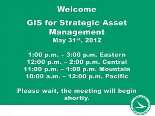
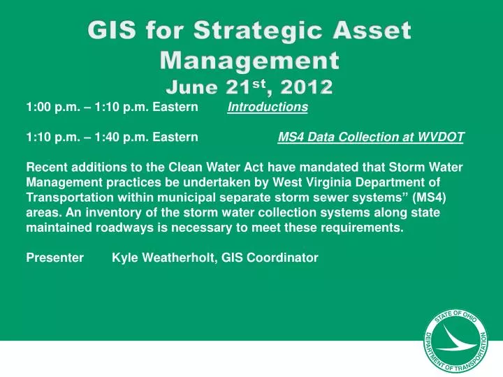
GIS for Strategic Asset Management June 21 st , 2012. 1:00 p.m. – 1:10 p.m. Eastern Introductions 1:10 p.m. – 1:40 p.m. Eastern MS4 Data Collection at WVDOT

E N D
GIS for Strategic Asset Management June 21st, 2012 1:00 p.m. – 1:10 p.m. EasternIntroductions 1:10 p.m. – 1:40 p.m. Eastern MS4 Data Collection at WVDOT Recent additions to the Clean Water Act have mandated that Storm Water Management practices be undertaken by West Virginia Department of Transportation within municipal separate storm sewer systems” (MS4) areas. An inventory of the storm water collection systems along state maintained roadways is necessary to meet these requirements. Presenter Kyle Weatherholt, GIS Coordinator
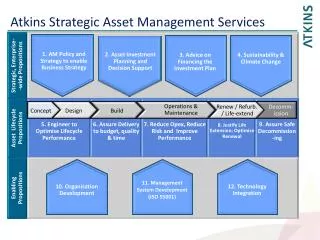
GIS for Strategic Asset Management June 21st, 2012 1:40 p.m. – 2:10 p.m. EST Intergraph using GeoMedia Smart Client for Asset Management GeoMedia Smart Client completes your existing desktop GIS by engaging a larger audience with your geospatial assets. Geospatial datasets and maps produced from a desktop GIS feed a smart GIS with content, while leveraging a web GIS’ advantages in delivering light and application specific solutions to more users. With GeoMedia Smart Client, individuals across your organization can create data, maps and reports for their projects, rather than having to rely on a GIS specialist or outsource this work. Ultimately this enables non-GIS experts to exploit advanced GIS functionality in a smart way! Presenter James Brown and Bruce Aquila
GIS for Strategic Asset Management June 21st, 2012 2:40 p.m. – 3:00 p.m. EST Maintenance Operations’ Key Role in Hydraulic Infrastructure Asset Management - Minnesota DOT Bonnie Peterson, Minnesota Department of Transportation, supports their culvert and storm drainage system inspection program and database called HydInfra. HydInfra includes culverts less than 10 ft. span and storm drainage system features (pipes, structures, ponds, special structures, water quality devices, MS4 outfalls, illicit discharge reporting). She develops training including instructions for GPS inspection and methods to use the data for maintenance and construction projects. Bonnie is currently serving as panel member for the Federal research project NCHRP 14-26 Culvert and Storm Drain System Inspection Manual. Presenter Bonnie Peterson
GIS for Strategic Asset Management June 21st, 2012 • 2:40 p.m. – 3:00 p.m. EST Wrap-up • Culvert Inventory results - Shawn Blaesing-Thompson • https://extranet.dot.state.oh.us/groups/gsam • Next meetings will be: • Aug 23rd 2012 • Nov 8th 2012