Download
1 / 15
150 likes | 224 Vues
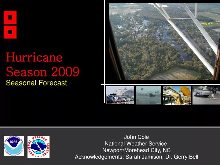
Hurricane Season 2009 Seasonal Forecast. John Cole National Weather Service Newport/Morehead City, NC Acknowledgements: Sarah Jamison, Dr. Gerry Bell. Outline and Disclaimers. Climatology The 2009 NOAA Atlantic Seasonal Hurricane Forecast

E N D
Hurricane Season 2009 Seasonal Forecast John Cole National Weather Service Newport/Morehead City, NCAcknowledgements: Sarah Jamison, Dr. Gerry Bell
Outline and Disclaimers • Climatology • The 2009 NOAA Atlantic Seasonal Hurricane Forecast • The driving atmospheric and oceanographic features and their associated climate signals. • Something to remind you that no matter what the seasonal forecast says, always be prepared – it only takes one to have a disaster. • Disclaimer 1: NOAA does not make seasonal hurricane landfall predictions. Hurricane landfalls are largely determined by the weather patterns in place as the hurricane approaches, which are only predictable when the storm is within several days of making landfall. • Disclaimer 2: I am not a seasonal forecaster
Hurricane Season • North Atlantic hurricane season officially runs from 1 June to 30 November • That doesn’t mean you can’t get them outside of the time frame. Remember 2005? • Peak occurs during the August-October • An average hurricane season features: • 11 named storms (maximum sustained surface winds of at least 39 mph) • six hurricanes (maximum sustained surface winds of at least 74 mph) • two major hurricanes (maximum sustained surface winds exceeding 110 mph, categories 3-5 on the Saffir-Simpson scale)
Tropical Storms and Hurricanes Impacting Cape Hatteras in last 137 years: 132 Eastern North Carolina has a Hurricane Problem.
NOAA 2009 Hurricane Season Outlook A collaborative effort from scientists at NOAA agencies Climate Prediction Center, Hurricane Research Division, and National Hurricane Center Issued in May and August http://www.cpc.ncep.noaa.gov/products/outlooks/hurricane.shtml
NOAA Tropical Outlook 70% Probability Or, about a normal season
Historical Atlantic Seasonal Activity NOAA’s 2009 Atlantic hurricane outlook (Red bar) indicates a 70% chance that the ACE range will be 65%-130% of the median. The outlook reflects the ongoing high-activity era, with possible competing influences if EL Niño develops and/or eastern Atlantic temperatures remain below average.
NOAA Tropical Outlook • Forecast Methodology: 3 factors • The Ongoing High Activity Era in the Atlantic Basin • ENSO (The El Niño/ La Niña cycle) • Atlantic SSTs
Factor 1: The Ongoing Multi-Decadal Signal (since 1995) during August-October is expected to continue: Favorable for development This climate pattern produces key ingredients of an active hurricane season: warmer waters, reduced vertical wind shear, and favorable winds that strengthen cloud systems coming from Africa.
Factor 2: El Nino may currently be developing: Somewhat Unfavorable for development El Niño La Niña Many of the climate models are either predicting El Nino neutral conditions to persist, or for El Nino to develop. Why do we care? El Nino is less conducive for Atlantic hurricane development .
Factor 2: El Nino may currently be developing: Potentially Unfavorable for development El Nino Watch is in Effect. ENSO-neutral conditions persisted across the equatorial Pacific Ocean during May 2009. However, sea surface temperatures (SST) increased for the fifth consecutive month, with above-average temperatures extending across the equatorial Pacific Ocean by the end of May. This prompted the EL NINO WATCH from CPC. El Nino is less conducive for development, but it surely doesn’t mean we are out of the woods: It only takes one!
Factor 3: SST’s in the eastern tropical Atlantic are below average: Unfavorable for development Below Average Sea-surface temperatures (SSTs) during March-April 2009 were below average in the eastern tropical Atlantic for the first time since 1997.
Remember, it only takes one. Andrew occurred in a below average, weak El Nino year. Andrew led to $25 billion in damage and was directly responsible for 26 deaths.
Summary • This area is historically very prone to Tropical Storms and Hurricanes – especially the Outer Banks. • The NOAA Seasonal Hurricane Outlook for the Atlantic calls for a near normal year. • The forecast is tricky this year due to conflicting climate signals: The ongoing multidecadal signal is favorable while a developing El Nino and cooler than normal SST’s may be unfavorable for development. • For the Atlantic basin, a near normal season is most likely (50% chance), with a 25% chance each for above and below-normal seasons. • Regardless if this year is above, below, or near normal: It only takes one. Remember Andrew.