Download
1 / 17
170 likes | 276 Vues
Global Climate Observing System. Dr. William Westermeyer GCOS Secretariat. The GCOS Mission. To ensure that the data required to meet the needs of users for climate information is obtained and made available for: Climate system monitoring and climate change detection and attribution

E N D
Global Climate Observing System Dr. William Westermeyer GCOS Secretariat
The GCOS Mission To ensure that the data required to meet the needs of users for climate information is obtained and made available for: • Climate system monitoring and climate change detection and attribution • Assessing impacts of and vulnerability to climate variability and change, e.g., extreme events, terrestrial ecosystems etc. • As inputs to adaptation analyses • Research to improve understanding, modelling and prediction of the climate system; • Application to sustainable economic development
Relevant UNFCCC/COP Decision Decision 5/CP.5: Research and Systematic Observation • Invites Parties to provide detailed reports on global climate observing systems by Nov 2001, using guidelines developed by GCOS • GCOS Steering Committee proposed the Second Report on the Adequacy of the Global Observing Systems for Climate • WMO EC & SBSTA endorsed its preparation • Requests GCOS Secretariat to organize regional workshops to identify priority capacity-building needs and deficiencies in climate observing systems • Urges Parties to address deficiencies in observing systems, capacity building needs and funding options • Voluntary Donor Fund
GCOS Strategy • Work with sponsors and scientific community to implement observing systems to GCOS Standards • Baseline Networks - e.g., GSN, GUAN, Argo, hydrology • Comprehensive observations - e.g., WWW/GOS, satellite observations, regional networks • Reanalysis • Engage intergovernmental, regional, and national bodies • UNFCCC / COP on systematic observation (Decision 5/CP.5) • GCOS sponsors and partners on developing requirements & stds • National and regional entities to address deficiencies • Resource mobilisation • Multi-governmental funding / national support
GCOS Networks • Atmosphere • GCOS Upper Air Network (GUAN) (152 stations, 80 countries) • GCOS Surface Network (GSN) (981 Stations, 145 countries) • Global Atmosphere Watch (GAW) (22 global, 300+ regional stations) • Ocean • Ship of Opportunity Program (SOOP) (~120 ships/27,000 XBTs, 7 countries) • Data Buoy Cooperation Panel (DBCP) components (~1300 drifting buoys, plus moored buoys, subsurface floats; 21 countries) • Voluntary Observing Ships (VOS) (~7000 ships, 52 members) • ENSO Observing System (TAO/Triton Array, tide gauges, VOS) • Automated Shipboard Aerological Programme (ASAP) (22 units, 9 members) • Global Sea-Level Observing System (GLOSS) (~300 global stations) • Argo (up to 3000 profiling floats, 14 countries) • Terrestrial • Global Terrestrial Network for Glaciers (GTN-G) (~750 glaciers monitored) • Global Terrestrial Network for Permafrost (GTN-P) • Global Terrestrial Network for Ecology (GTN-E) (ILTER, Fluxnet, TEMS) • Global Terrestrial Network for Hydrology (GTN-H)
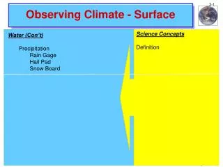
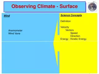
Table 1:Essential Climate Variables • Atmospheric • Surface – Air temperature, Precipitation, Air pressure, Surface radiation budget, Wind speed and direction, Water vapour • Upper Air – Earth radiation budget (including solar irradiance), Upper-air temperature (including MSU radiances), Wind speed and direction, Water vapour, Cloud properties • Composition –Carbon dioxide, Methane, Ozone, Other long-lived greenhouse gases, Aerosol properties. • Oceanic • Surface – Sea-surface temperature, Sea-surface salinity, Sea level, Sea state, Sea ice, Current, Ocean colour (for biological activity), Carbon dioxide partial pressure • Sub-surface:Temperature, Salinity, Current, Nutrients, Carbon, Ocean tracers, Phytoplankton • Terrestrial • River discharge, Water use, Ground water, Lake levels, Snow cover, Glaciers and ice caps, Permafrost and seasonally-frozen ground, Albedo, Land cover (including vegetation type), Fraction of absorbed photosynthetically active radiation (FAPAR), Leaf area index (LAI), Biomass, Fire disturbance.
Convention to Combat Desertification Article 10 – National Action Programmes shall: 2(d) enhance national climatological, meteorological, and hydrological capabilities and the means to provide for drought early warning; and may include: 3(a) establishment and/or strengthening, as appropriate, of early warning systems (b) strengthening of drought preparedness and management
Convention on Biological Diversity Article 7. Identification and Monitoring Each Contracting Party shall, as far as possible and as appropriate… (c) Identify processes and categories of activities which have or are likely to have significant adverse impacts on the conservation and sustainable use of biological diversity, and monitor their effects through sampling and other techniques
Second Report on the Adequacy of theGlobal Observing Systems for Climate--Some Conclusions-- Full implementation of integrated global observing systems for climate, sustained on the basis of a mix of high-quality satellite and in situ measurements, dedicated infrastructure and targeted capacity-building will require commitment of all Nations. • Achieving global coverage and climate-quality observations for the essential climate variables (see Table 1) is essential to meet the needs of the UNFCCC and IPCC. • Adherence to the principles of free and unrestricted exchange of data, particularly for the Essential Climate Variables (See Table 1). • Adherence to the GCOS Climate Monitoring Principles for global climate observations from both in situ networks and satellites. • Ensure that observations and associated metadata, including historical observations, are available at international data centres.
Second Adequacy Report SomeMajor Recommendations • Integrated global “climate-quality” products • Those dependent on satellite observations • Benefiting from the reanalysis of homogeneous historical data • Adherence to the GCOS Climate Monitoring Principles for in situ and satellite systems • International mechanism for developing standards for terrestrial observing systems, data, and products • Esp., for terrestrial observing systems • Data exchange and availability • Impact & adaptation will require high resolution data • Need to define essential variables (for climate) • Capacity-building and system Improvement • Global framework of observations for defining regional impacts • Cal/val for satellites / downscaling models • Voluntary Donor Fund
GCOS Regional Workshop ProgrammeGoals • Assess the contribution of the region to the GCOS Baseline Networks • Identify national and regional needs and deficiencies in climate data • Understand the guidelines for reporting on systematic observation to the UNFCCC • Promote interaction between generators and users of observations • Initiate development of regional Action Plans for improving observing systems
Schedule of Completed and PlannedRegional Workshops • Pacific Islands-August 2000 • Eastern and Southern Africa-October 2001 • Central America and the Caribbean-March 2002 • Southeast Asia-September 2002 • West Africa-Spring 2003 • South America-Fall 2003 • Southwest Asia-Spring 2004 • Mediterranean Basin-Fall 2004 • Eastern and Central Europe-Spring 2005 • Central Asia-Fall 2005
Regional Action Plans • Based on needs identified in workshop • Understanding on deficiencies in and needs for climate observing and related systems • Consensus on priorities for action • Comprised of projects to improve regional capacities for climate observations • GCOS Networks • Regional Priorities • National Programs • Co-ordination • Issue: Regional Action Plans and Funding
Common Themes of First FourRegional Action Plans • Sustaining/improving operational observing networks • Recovering historical data • Improving national and regional co-ordination • Education, training, and capacity building • National planning and reporting in a regional and global context
Why a Regional Approach? • The global nature of climate and climate change requires cooperation • A need to define priorities at regional level (e.g., impacts) • Allow for regional implementation: • Priorities for donors set within regional framework • Allocation of limited funding for systematic observation • Seldom cost-effective for every country to acquire the same facilities or capabilities • Budget restrictions and/or lack of trained personnel make it impossible for some countries to undertake a full suite of climate-related activities. Sharing desirable
Data for Impact Assessment Conclusion of Second Adequacy Report Nations will need to operate climate-observing networks with a denser distribution of stations and often more frequent observations, in addition to the GCOS baseline networks, for impact assessment and the development of adaptation strategies. These regional and national networks, to the greatest extent possible, should also be operated in accordance with the GCOS Climate Monitoring Principles.