Download
1 / 32
320 likes | 433 Vues
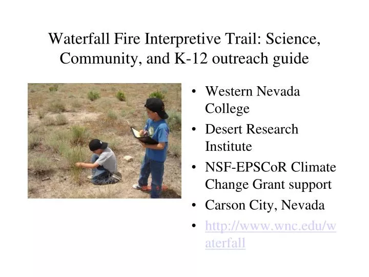
Waterfall Fire Interpretive Trail: Science, Community, and K-12 outreach guide. Western Nevada College Desert Research Institute NSF- EPSCoR Climate Change Grant support Carson City, Nevada http://www.wnc.edu/waterfall.

E N D
Waterfall Fire Interpretive Trail: Science,Community, and K-12 outreach guide • Western Nevada College • Desert Research Institute • NSF-EPSCoR Climate Change Grant support • Carson City, Nevada • http://www.wnc.edu/waterfall
The 9000+ acre wildfire, the Waterfall Fire of 2004, ravaged homes and land in Carson City.
Study Objectives • Compare lowland shrub and forest understory plant communities in burned and unburned areas • Evaluate the success of post-fire seeding • Listing of wildflower and grass species • Climate change effects on re-vegetation • Sheep grazing impacts, if any
Plant Surveys took place at each Study Site along the trail at intervals during the Spring and Summer. There are eight study sites that contain 3 plots each staked 2m x 2m square.
Appendix A lists the plant species observed or collected and identified at the Waterfall Fire Study sites during the Spring and Summer months of 2009. Appendix A
Plot 1c: Drill seeded burned lowland shrub This area has been successfully drill seeded with crested wheatgrass and is located along the bike path south of WNC.
Plot 1a: Unburned lowland shrub This unburned area is primarily a sagebrush community with few grasses or forbs of any kind located at Vicee Canyon along the bike path.
Plot 2c: Aerial Seeded burned lowland shrub This area is poorly seeded, and contains cheatgrass, erodium, and some native grasses and forbs along the bike path directly west of the WNC Aspen bldg.
Plot 1b: Burned lowland shrub unseeded This area is sorely infested with cheatgrass and erodium located to the south of the planetary walkway near the Observatory.
Plot 2a: Unburned lowland shrub This area is an unburned sagebrush community that has been subjected to mechanical firebreak clearing with native wildflowers and shrubs to the north and east of the planetary walkway.
Plot 3c:Drill seeded burned lowland shrub, sheep grazed This area has drill-seeded crested wheatgrass, mixed with cheatgrass, tumble mustard, Russian thistle, and native wildflowers located to the west of the Observatory.
Plot 1e: Unburned forest understory This area is an unburned forest understory eastern Sierra Nevada Ponderosa (Jeffrey) pine community, with manzanita, rabbitbrush, bitterbrush, and native grasses and forbs, and no invasive weeds, located in Lakeview Park, Carson City.
Plot 1g: Burned forest understory, seeded and replanted This area has been aerial seeded and replanted with pine trees. The tree planting success is minimal and the area is infested with cheatgrass, covered in dead debris (pine needles) mixed with native grasses, located in Lakeview Park, Carson City
30 Burned lowland sites 20 Green cover (May 2009, %) 10 0 Unseeded Seeded
80 Burned lowland sites 60 Plant density (May 2009) (per 2 x 2 m2) 40 20 0 Unseeded Seeded
40 Burned lowland sites 30 n.s. Green cover (May 2009) (%) 20 10 0 Drill seeded Aerial seeded
Study Findings • Desert Wheatgrass, not Siberian, predominated the drill seeded grass mixture • Native shrubs, forbs and grasses thrive 5 years post-fire • Unseeded burned areas predominate in cheatgrass and other non-native species • Unburned shrub and forest understory have little to no non-native plants (cheatgrass)
Community and K-12 Outreach The Waterfall Fire Interpretive Trail as an outdoor classroom to study climate change and impacts on wildfire regimes
The trail begins at the Jack C. Davis Observatory parking lot. There might be a lecture or discussion within the observatory for groups when arranged with the college.
Star Party night at the Observatory is each Saturday at dusk weather permitting. You can also access the weather station for current and historical data.
The trail descends along the WNC Observatory Planetary Walkway.
The trail follows down the bike path south and west of the college.
Measure height of plants on trail • Measure soil temperature • Observe what kinds of plants there are for each season
Measure soil temperature at different locations, shade and sunny, and times of the day • This simple thermometer has a built-in shovel as a base
Assistance from a teacher or grandparent makes for a fun learning environment • Kids tend to see more, and adults tend to focus on specific, plants
Plants, cones, seeds, can be collected, but in limited supply for group study. • Plants that are pressed allow each participant to document their discovery on the trial.
AcknowledgementsDr. Jay Arnone, Research Professor, Desert Research InstituteAnn Bollinger, Naturalist, Open Space Division, Carson CityAlice SadyRobert Collier, Director WNC Jack C. Davis ObservatorySean Sady and Ashton Sady, featured in showMike Sady, WNC Science Professor, presentation and photos 775-445-4400