Download
1 / 53
560 likes | 726 Vues
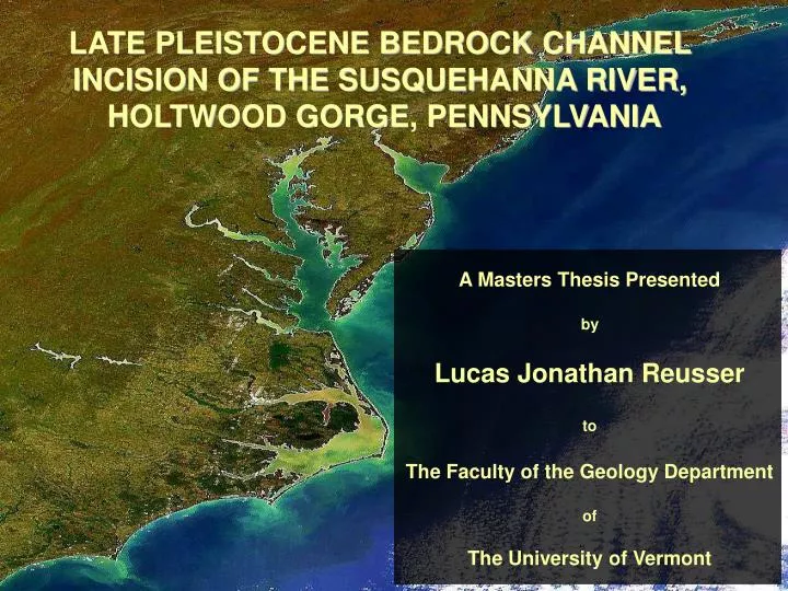
LATE PLEISTOCENE BEDROCK CHANNEL INCISION OF THE SUSQUEHANNA RIVER, HOLTWOOD GORGE, PENNSYLVANIA. A Masters Thesis Presented by Lucas Jonathan Reusser to The Faculty of the Geology Department of The University of Vermont. Presentation Outline. Problem statement and background

E N D
LATE PLEISTOCENE BEDROCK CHANNEL INCISION OF THE SUSQUEHANNA RIVER, HOLTWOOD GORGE, PENNSYLVANIA A Masters Thesis Presented by Lucas Jonathan Reusser to The Faculty of the Geology Department of The University of Vermont
Presentation Outline • Problem statement and background • Dating river incision with 10Be • Holtwood Gorge field area • Timing and style of bedrock channel incision • Potential drivers of incision • Conclusions • Future avenues of research
Susquehanna Basin Late Wisconsinan Glacial Limit Holtwood Gorge Mather Gorge Potomac Basin
Cosmic ray bombardment in situ 26Al, 21Ne, 3He Si 10Be,14C, 3He O Quartz 5.2 atoms/g/yr
High 10Be Concentration Older Model Age Lower 10Be Concentration Younger Model Age Dating Bedrock Terraces Model Age ~ Terrace Abandonment
Significance of Research • River incision through bedrock has important implications for landscape development. • Recent efforts to directly measure or model rates of incision with numerical simulations may not capture the timing and/or nature of dominant erosional processes. • Very little is known about how, when, or why passive margin rivers incise through bedrock. • Age control is mandatory to decipher how passive margin rivers respond to glaciation, climate, land-level, and/or sea-level.
Goals of The Project: • Estimate the age of bare-rock • strath terraces within Holtwood Gorge. • Investigate the spatial patterning of • erosion. • Determine the timing and rate of • incision within the gorge. • Consider potential drivers of incision. • Refine this new application of cosmogenic dating.
Holtwood Gorge ~0.5 m/km ~1.0 m/km Long-Profile of the Susquehanna Oversteepening: Flexural response to Offshore sediment loading And Isostatic response to denudation
Holtwood Gorge Field Area • Located approximately 50 km upstream from Chesapeake Bay and immediately below Holtwood Dam. • Carved into the Wissahickon Schist of the Appalachian Piedmont. • Harbors three distinct levels of bedrock terraces. • Accessible by canoe. • Abundant extractable quartz.
Bedrock Terrace Levels 4 3 2 Level 1 Strath Level 3 Terrace Level 4: Heavily Weathered High Point Level 2 Terrace 1 ~ 80 Bedrock Samples 3 Well Preserved Terraces Heavily Weathered High Points
Lab Work and Nuclide Measurement (From Piles of Rocks to Piles of Numbers) • Quartz Purification • Chemical Isolation of 10Be (Jen’s Magic) • Accelerator Mass Spectrometer Measurement at the Lawrence Livermore National Laboratory
Laboratory and Measurement Replication LR-04c 14.0 +/- 1.5 ka LR-04cX 14.2 +/- 1.6 ka +/- 1.0 % LR-37 17.4 +/- 1.9 ka LR-37X 17.9 +/- 1.9 ka +/- 1.9 % Does the Livermore Accelerator really work??
Level3 small-scale variance 26.8 +/- 2.9 ka 25.0 +/- 2.7 ka 26.0 +/- 2.8 ka Does One Sample Represent the AgeOf An Entire Bedrock Surface?? +/- 3.8% (geomorphically Identical)
18.6 +/- 2.0 ka 18.2 +/- 2.0 ka 17.5 +/- 1.9 ka +/- 3.3% (geomorphically Identical) Level 2 small-scale variance
13.9 +/- 1.5 ka 14.1 +/- 1.6 ka +/- 8.5% (Much more variable than surfaces higher in the gorge) 16.4 +/- 1.8 ka Level 1 small-scale variance (lowest bedrock terrace)
Terrace Level 3: Longitudinal Incision Rate Highest, Well Preserved Strath Terrace No Relationship Between Distance and Model Age Inferred River Gradient = 2.0 m/km R2 = 0.9 14 Samples Over 4.5 km
Terrace Level 2: Longitudinal Incision Rate Mid-Level Strath Terrace Significant Age Gradient 1.4 ky/km upstream Older Ages Downstream Knickpoint Retreat? Inferred River Gradient = 1.5 m/km R2 = 0.9 20 Samples Over ~5 km
Terrace Level 1: Longitudinal Incision Rate Lowest Level Modern Strath No Relationship Between Distance And Model Age Inferred River Gradient ~1.5 m/km R2 = 0.9 10 Samples Over ~2.5 km
Lower Limiting Ages Average Terrace Ages >90 ka Mean Age =36 +/- 7 ka Mean Age =20 +/- 3 ka Mean Age =14 +/- 1 ka How Old Are The Holtwood Terraces??
Incision Ceased ~14 Level 1 Mean Age Increase at ~20 ka Level 2 Abandonment Acceleration at ~35 ka Level 3 Abandonment Maximum Rate Since ~100 ka When and How Quickly Did The Susquehanna River Incise??
Middle Gorge Cross-Section Height above river bed (m) Model Age (ka) Are Rates of Downcutting At Specific Locations Similar to Gorge Wide Averages? n=22 Incision Rate = 0.52 m/ka R2=0.72
Upper Gorge Cross-Section Height above river bed (m) Model Age (ka) Are Rates of Downcutting At Specific Locations Similar to Gorge Wide Averages? n=13 Incision Rate = 0.60 m/ka R2=0.96
Late Pleistocene Rate 20 X - 60 X Faster ~15 My Long-Term Rate ~12 m/My GORGE Long- vs. Short-Term Rates of Incision along the Susquehanna River Episodic Incision Piedmont
Rates in active regions measured with cosmogenic isotopes:(Indus River, Himalayas) 1 to 12 m/ka Driven primarily by uplift
Level 1 Terrace Relative Probability LR-54 17.0 +/- 0.7 ka Model Age (ka) An alternative approach to considering the timing of terrace abandonment:(Probability Modeling: Balco et al., 2002)
An alternative approach to considering the timing of terrace abandonment:(Probability Modeling: Balco et al., 2002) Level 1 Terrace Cumulative Probability Summed Probability Model Age (ka)
Mean = 14.4 ka Peak = ~14 ka Mean = 19.8 ka Peak = ~18 ka Mean = 36.1 ka Peaks at 26, 32 and 45 ka Rapid Incision From ~50 ka to ~10 ka An alternative approach to considering the timing of terrace abandonment:(Probability Modeling: Balco et al., 2002) Normalized Cumulative Probability Normalized Summed Probability Model Age (ka)
Thousands of Years Before Present Rapid Incision From ~50 to 10 ka At 0.4 to 0.6 m/ka Elevation Susquehanna River Holtwood Gorge Holtwood Gorge Mather Gorge Rapid Incision From 37 to 13 ka At 0.5 to 0.8 m/ka Potomac River Elevation Mather Gorge Similar Incision Histories
Regional Forcings: • Land-Level • Base-Level • Global and Regional Climate What Caused this Pulse ofLate Pleistocene Incision? • Glaciated Susquehanna Basin • Unglaciated Potomac Basin • Similar Timing • Similar Rate
Land Level Change… (The Growing Glacial Forebulge) ~Location of Our Gorges • Crustal Response to mantle • displacement by advancing • ice load ICE Timing and extent uncertain Where was the ice front? Probably didn’t initiate Incision, But likely helped maintain it Increased River Gradients Tens of m of uplift Right Place Modeling by: Jon Pelletier University of Arizona
Base Level Change… (Global Sea-Level Through The Last Glacial Cycle) Timing of Sea-Level Fall Uncertainties Exposure Age Modeling Uncertainties Rate and Process of Upstream Translation Through BedrockNot Know Elevation Glaciated Susquehanna River Holtwood Gorge Unglaciated Potomac River Elevation Mather Gorge Thousands of Years Before Present Mean Global Sea-Level (Huon Peninsula) Meters Below Present
Base Level Change… (Global Sea-Level Through The Last Glacial Cycle) ~70 mbp At 50 ka ~150 mbp At ~20 ka Continental shelf edge Upstream effect uncertain Paleo-Shorelines Holtwood Gorge Thousands of Years Before Present Mean Global Sea-Level (Huon Peninsula) Meters Below Present
Global Climate Change… (GISP2 ice core records) Terrace formation and rate increase coincident with glacial Max in PA Thousands of Years Before Present Susquehanna River Potomac River Paleostorminess GISP2 sea salt (Mayewski et al., 1997) s.s. Na ppb Paleotemperature GISP2 (Cuffey et al., 1997) Degrees C 0 25 75 100 50 Storminess in Northeast Through Holocene (Noren et al., 2003) Temperature trends correlate To Florida (Grimm et al.), And Blue Ridge (Litwin et al., 2004)
What Do Temperature and Storminess Have to do with Bedrock Incision?? Floods Hurricane Isabel October, 2003 Incision Threshold…Critical Shear Stress Frozen Ground…More Runoff?? • Discharge Concentration: • Snow Melt Floods • Rain on Snow Events • Stormier Climate
Conclusions Bedrock strath terraces record a pulse of rapid incision Downcutting increased between ~50 and ~35 ka; Incision ceased near the Pleistocene/Holocene transition Influence of glacial retreat on Susquehanna River; But regional first order drivers for the initiation of incision on both rivers. Correlation to GISP2 climate proxy records
Implications and Future Research 10Be dating is a useful tool for investigating the tempo and style of bedrock channel incision around the globe The episode of incision measured in Holtwood Gorge represents one pulse in an ongoing period of river adjustment operating over geologic time scales This study just scratches the surface: • Similar approach on other major Appalachian drainages • Tributary response to changing boundary conditions • and landscape conectivity • Many questions regarding climate driven process rates • still remain
Acknowledgements: Field Assistance etc.: -Eric Butler -Joanna Reuter -Jen Larsen -UVM Geology Department -Paul Bierman -Staff at Holtwood Dam -George and Melody Funding: -NSF -D.O.E.
Hecras Modeling: <10% average adjustment for water shielding
Modeling explains ~32% of the model Age variance between Level 1 samples Hecras Modeling:
Cosmic ray bombardment in situ 26Al, 21Ne, 3He Si 10Be,14C, 3He O Ca, K, Cl 36Cl, 3He
Inferred Paleo River Gradients Paleo River Gradients Level 3 Gradient = 2.0 m/km Level 2 Gradient = 1.5 m/km Level 1 Gradient = 1.5 m/km