Download
1 / 19
200 likes | 355 Vues
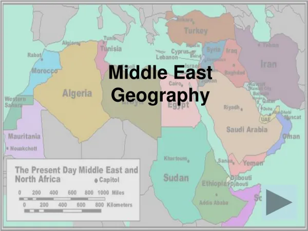
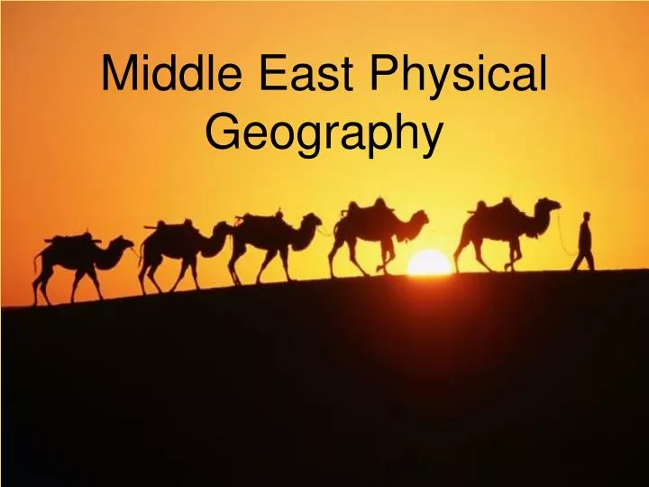
Middle East Physical Geography. The Middle East. Many people refer to this region as the Middle East because of its location. For centuries empires and kingdoms have fought for control of these lands. One reason is the location-whoever held control of the region influenced trade. Trade Routes.

E N D
The Middle East • Many people refer to this region as the Middle East because of its location. • For centuries empires and kingdoms have fought for control of these lands. • One reason is the location-whoever held control of the region influenced trade. Trade Routes
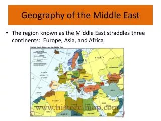
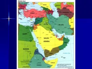
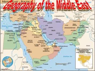
Location • SW Asia is referred to as the crossroads of continents because it is located between 3 major continents: Europe, Africa, Asia
Deserts • SW Asia is mostly covered by deserts.
Deserts NegevDesert SinaiDesert Libyan Desert ArabianDesert Rubal-Khali Sahara Desert
Importance of Deserts • Deserts serve as a natural barrier against invasion. • Deserts have also led to a way of life developed around surviving the harsh conditions. • People (Bedouins – desert nomads) have managed to live in the desert in tent camps and survive as sheep and camel herders. • They trade animals and handmade goods with those who live in towns on the desert’s edge.
Climates in the Middle East • A large majority of the Middle East is arid and semi arid. • Mountain ranges block moisture coming from the oceans and seas nearby; most of the interior is desert ( it can reach 140° F in the desert!).
Climates Defined • Arid is word that means dry. An arid climate is one that is hot and dry all year with very little rain. • A semiarid climate has hot, dry summers and cool, dry winters.
How Climate Affects Agriculture • Huge portions of the Middle East cannot be farmed without water. • Some countries such as Israel uses desalination plants which remove the salt from water.
Farming is Difficult • Many people in the ME practice subsistence agriculture: growing small amounts of crops to take care of local needs. • Because the climate is hot and dry, farmers must irrigate their fields. • There is some commercial agriculture: growing crops for industrial markets, but it is limited by lack of water.
Rivers in the Middle East • 3 major river systems are located in the Middle East • Euphrates River • runs through Turkey, Syria, Iraq, and Kuwait • Tigris River • runs through Turkey, Iraq, and Kuwait • Jordan River • part of the border of Syria, Jordan, the West Bank, and Israel
The Tigris & EuphratesRiver System Mesopotamia: ”Land Between the Two Rivers”
TheJordan RiverSystem: Israel & Jordan--A Fight OverWater Rights?
Importance of Tigris, Euphrates, and Jordan Rivers • Water for drinking • Water for irrigation • Water for transportation and trade • Boundaries between nations • Major cities are located on or near these rivers – centers of industry (jobs)
Water Creates Conflict • Water is a critical resource as a source of life and a route for trade. • The Tigris and Euphrates Rivers have been a source of many political conflicts because they are shared by more than one country. • Several countries have built dams across their portions of the rivers to create lakes for irrigation and to generate hydroelectric power. • Each dam cuts down on water available to countries downstream.
Name two geographic features that might affect population. Where do you predict the most people will live???
Where do people live? • Most people in SW Asia live near the rivers where most major cities are located. These cities are the center of industry jobs.
How People Make a Living???? • Between 10%-35% of all the people make a living in agriculture. • Between 65% and 90% are involved in services and industry. • Those living in the desert areas trade animals and handmade goods with those who live in towns on the desert’s edge.