Download
1 / 24
260 likes | 544 Vues
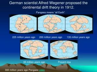
Pangaea is: . Large, ancient landmass that was composed of all the continents joined together. Theory of PlateTectonics is: . Theory that the Earth’s crust and upper mantle are broken into plates that float and move around on a plastic-like layer of the mantle. Continental Drift is: .

E N D
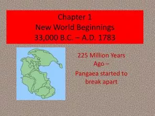
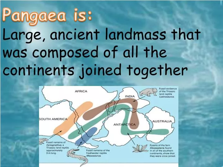
Pangaea is: Large, ancient landmass that was composed of all the continents joined together
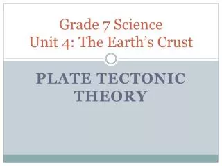
Theory of PlateTectonicsis: Theory that the Earth’s crust and upper mantle are broken into plates that float and move around on a plastic-like layer of the mantle
Continental Drift is: Wegener’s hypothesis that all continents were once connected in a single , large land mass that broke apart about 200 million years ago and drifted slowly to their current positions
Sea Floor Spreading is: Hess’s theory that new seafloor is formed when magma is forced upwards toward the surface at the mid-oceanic ridge
Convection current is: Currents in Earth’s mantle that transfers heat in Earth’s interior and is the driving force for plate tectonics
Subsidence is: Motion of the Earth’s surface as it shifts downward relative to a datum such as sea=level
Boundary: Indicates a border
Convergent boundary is: Formed when two sections of Earth’s crust is colliding – coming together
DivergentBoundary is: Forms where lithospheric plates are moving away from each other.
Transform Boundary is: Boundary between two lithospheric plates that are sliding past each other.
Rift is: Long crack that forms between tectonic plates moving apart at plate boundaries
Fault is: Fracture that occurs when rocks change their shape by breaking can form as a result of compression, being pulled apart by shear
Subduction zone is: Area in which one lithospheric plate slides under another, occurs at converging plate boundaries
Ridge is: A chain of mountains or hills that form as continuous elevated crest for some distance
Trench is: Depression in the ground, generally defined by being deeper than they are wide.
Asthenosphere is: Plastic-like layer of the Earth on which the lithospheric plates float and move around
Lithosphere is: Rigid layer of Earth about 100 km thick, plates moving apart at plate boundaries
Relief map is: A physical map showing vertical features with a drawing such as shaded mountains
Topography is: Features of a land area caused by differences in elevation.
Topographic Map is: A map that shows the shape and elevation of the land surface using contour lines, and shows other land features using symbols and colors
Contour lines are: On a map, lines that connect point of equal elevation above sea level.
Elevation is: Height above average sea level
Intervals is: Distance between contour lines on a topographic map
Benchmark is: A permanently affixed mark that establishes the exact elevation of a place; used by surveyors in measuring site elevations