Download
1 / 31
310 likes | 319 Vues
Marin County Watershed Stewardship Program Marin County Department of Public Works. Countywide Watershed Program.

E N D
Marin County Watershed Stewardship Program Marin County Department of Public Works
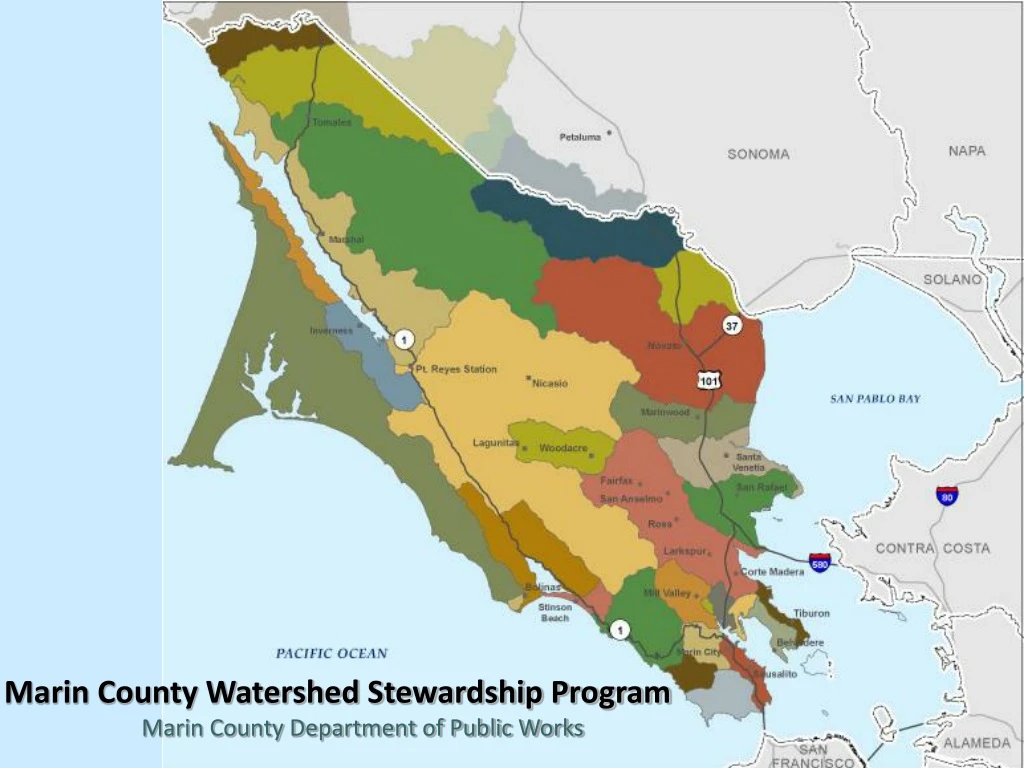
Countywide Watershed Program The watershed program provides a framework to integrate flood protection, creek and wetland restoration, fish passage and water quality improvements with public and private partners to protect and enhance Marin’s watersheds.
Why A Watershed Approach? • Why now? We have momentum and support from our partners and the County. • The issues identified by the community aren’t going away so this program allows us to be ready when the economy recovers and new funding programs come on line. • Supports and guides protection and enhancement of significant natural resources • Ensuresalignment with State and Federal resource agency goals which should support timely project implementation • Leveragesfunding to attract State and Federal sources • Dedicatesstaff to search for and pursue funding
Board of Supervisors Flood Control and Water Conservation District • Policy Advisory Committee: • BOS FC District Rep • City Council Reps • Flood Zone Advisory Board Reps • Water and Sanitary Board Reps • Operations and Finance Committee: • City Managers & County DPW Director • Technical Working Group: • Municipal Directors • Local, State & Federal Agency Reps • Watershed Groups • Homeowner’s Association Reps Stakeholder Process
Objectives • Provide an increased level of flood protection • Reduce on-going maintenance costs and impacts • Develop projects that provide multiple benefits i.e restoration and flood protection • Ability to permit as a self-mitigating project • Respond to sea level rise • Opportunities to improve ecological benefits • Ability to meet multiple partner agency objectives
Next Steps • Continued improvements to the website • Watershed-level planning • Habitat Assessments • Hydrology and Hydraulics studies • Watershed Master Plans • Continued review of grants and other funding opportunities
Habitat Assessment • 2009 Fish and Game creek assessments • Goal is to translate their data into an informative and accessible manner • Spatial or GIS analysis is the tool • Fish passage barriers • Pipelines and other infrastructure • Storm drain system • Restoration opportunities • Habitat features • Flow history and stream persistence • Other relevant information
Hydrology and Hydraulics • Collecting field data including topography, rainfall, stream flow, and sediment transport • Using the field data, a model is developed to show: • How water moves in the creek • Water depth outside the creek • How will the model be used? • Representation of past and predicted storms • Depict the footprint and elevation of flood waters • Show the benefit of any proposed alternative • Can be altered to include new information in the future
Hydrologic model development Model is a predictive tool to test the effectiveness of various flood control measures 5,400 cfs 1700 cfs
H & H Study outcomes • Understanding of the flood benefit and estimated cost for all proposed projects. • Clear understanding of the current flood impacts for a series of storm events • Model will be a tool that quantifies the flood impact • Shows the extent and depth of flooding before and after for a given alternative or a suite of alternatives • Can be adapted for future conditions
www.marinwatersheds.org For more information contact: Liz Lewis, Principal Planner 499-7226 Chris Choo, Senior Planner 499-7586