Download
1 / 7
70 likes | 195 Vues
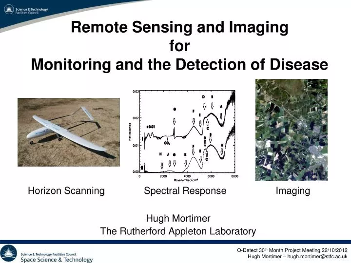
Remote Sensing and Imaging for Monitoring and the Detection of Disease. Hugh Mortimer The Rutherford Appleton Laboratory. Horizon Scanning. Spectral Response. Imaging. Outline. Horizon scanning study of remote sensing instrument platforms

E N D
Remote Sensing and Imaging for Monitoring and the Detection of Disease Hugh Mortimer The Rutherford Appleton Laboratory Horizon Scanning Spectral Response Imaging
Outline • Horizon scanning study of remote sensing instrument platforms • Satellites, High Altitude Platforms (HAPS), Aircraft, Unmanned Aerial Vehicles (UAV’s), Balloons. • Infrared spectral identification of infected plants • Develop an automated identification system based on high-resolution infrared reflectance spectra. • Satellite Imagery • Use pattern recognition analysis on high spatial resolution spatial satellite imagery to identify and monitor infected locations.
Horizon Scanning Reviewing remote sensing solutions Satellites Manned UAV Imaging Capability 2 - 20cm 0.5 - 20cm 50 - 1500cm FOV 0.5 to 5km 50m – 5km 10 – 50km Costs €/h 510 to 2700 85 to 1360 342 to 1650 (dedicated) €/year 1M to 4.5M 0.1M to 2.6M 3M to 14.5M Future Miniaturisation and Hyper spectral LIDAR, SAR, Imaging Spectrometers Future Platforms High Altitude Platforms – Stratollites, HALE UAV’s
EUFP7 project: Q-Detect • Mid Infrared Spectral Reflectance Analysis Ave. Healthy Japanese Larch Ave. Diseased P. Ramorum
Q-Detect – MORFIS Object based morphological model based on Morphological model – geometric, colour
Validation using UAV and the Forestry Commission Helicopter Images