Download
1 / 20
200 likes | 306 Vues
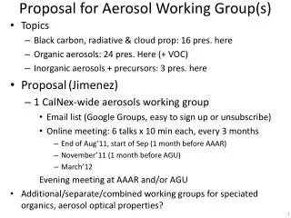
ACE - Aerosol Working Group Science Traceability Matrix. Category 1: Aerosols, Clouds and Climate Category 2: Aerosols, Clouds and Precipitation. Introduction Objectives :

E N D
ACE - Aerosol Working Group Science Traceability Matrix Category 1: Aerosols, Clouds and Climate Category 2: Aerosols, Clouds and Precipitation
Introduction • Objectives: • Anticipate what gaps in our understanding of aerosol-cloud-precipitation interactions we will have in ACE (~2020?) timeframe. • Improve the representation of aerosol-cloud-precipitation processes in future climate models => improved climate prediction (global & regional). • Assumptions: • Future climate models will be more complex compared to present-day models [higher spatial, temporal resolution; more physically based; explicit representation of a wider range of processes; more coupled (atmosphere-ocean-biosphere…)]. • Increased complexity in future models will lead to larger (not smaller) discrepancies amongst different models (i.e., IPCC model comparisons get worse, not better with model complexity). • With increased model complexity there is an increasing need for observ-ational constraints. The observations must provide more detailed quantitative information on the more uncertain processes. • Approach • Assume ACE is part of integrated program that combines climate modeling, coordinated suborbital measurements and satellite observations.
Science Traceability Matrix - Aerosol Working Group Category 1: Aerosols, Clouds and Climate Focused Questions: • How do different types of aerosols influence cloud develop-ment, microphysics and extent? • How do anthropogenic aerosols affect within-atmosphere, top-of-atmosphere and surface radiation budgets? • How do aerosol and cloud distributions vary over decadal time scales?
Global measurements of aerosol & cloud microphysics, aerosol absorption and precipitation will radically improve our understanding of these processes.
A-Train Heating rate profile Co-latitude Radiative effect of Cirrus, cloud overlap, cloud-aerosol overlap Seiji Kato
Approach: • Establish an integrated program that combines climate modeling, coordinated suborbital measurements and ACE satellite observations. Strategy: • Conduct dedicated field observations of aerosol and cloud microphysics to improve cloud formation process models in global models. • Use ACE satellite products to evaluate global model distributions of column averaged and vertically resolved aerosol amount, microphysics and absorption. • Segregate ensembles with similar joint relationships between aerosol type, cloud type, and atmospheric state to establish aerosol-cloud effects not caused by meteorology or large-scale forcing. • Compare aerosol-cloud relationships in the satellite data with those from climate models. • Quantify decadal changes in cloud and aerosol properties by comparing ACE-derived global distributions of clouds and aerosols with those from prior missions (e.g., A-Train, EarthCARE).
Derived Parameter Requirements (1): • Spectral (UV-VIS-SWIR) AOT, column • Aerosol morphology • Separation of aerosols and clouds with confidence • Global coverage over all surfaces: land, ocean, polar, deserts, cloud tops • Aerosol spectral (UV-VIS-SWIR) absorption • Aerosol spectral UV-VIS-SWIR) real part of the refractive index • Aerosol size distribution (resolved into bimodal) • Aerosol number concentration • Cloud optical thickness • Cloud droplet effective radius • Cloud droplet number concentration and size distribution • Cloud horizontal and vertical extent • Column precipitable water vapor
Derived Parameter Requirements (2): Vertically resolved retrievals of: • aerosol backscatter • aerosol extinction • discrim of nonsphericity • aerosol absorption • complex refractive index • effective radius • number concentration • surface concentration • volume concentration Vertically resolved measurements made with TBD beams in the cross track: • spacing between beams =TBD • Total field of regard = TBD • Vertically resolved cloud optical thickness, effective radius, size distribution, thermodynamic phase and horizontal extent. • Cloud and aerosol retrievals consistent with those from heritage instruments (A-Train, EarthCARE).
Instrument Requirements (1): Multiangle, multispectral, polarimetric imager • Spatial and temporal coverage sufficient to capture significant aerosol events in monthly mean statistics at global model grid resolutions. • Horizontal resolution sufficient to retrieve aerosol in heterogeneous conditions. • Sufficient absolute radiance calibration and polarization accuracy to meet derived parameter requirements • Sufficient spectral resolution and range, angular resolution and range to meet derived parameter requirements • May not meet all requirements across swath. Concentrate highest capability along lidar track.
Instrument Requirements (2): Lidar • Vertical resolution sufficient to meet parameter requirements. • Minimum dual wavelength and dual polarization • HSRL or other technique to obtain direct determination of extinction. For vertically resolved microphsysical retrievals, extinction profiles at 355 nm and 532 nm and backscatter measurements at 355, 532, and 1064 nm. • Better SNR and depol than CALIPSO for daytime obs. • Extended measurements beyond nadir.
Platform Requirements: • Orbit at 410 to 650 km for 2-day coverage. Active instruments prefer lower orbit. • Sun-synchronous 10:30 am or 1:30 pm equatorial crossing time. Other Needs: • • Temperature and humidity profiles • • Earth radiation budget measurements at TOA • Coordinated suborbital measurements (aerosol microphysical properties, size-resolved aerosol composition and hygros-copicity, CCN, AOD, spectral irradiance, cloud property evolu-tion, updraft velocity, humidity profiles)
Science Traceability Matrix - Aerosol Working Group Category 2: Aerosols, Clouds and Precipitation Focused Questions: • Do aerosols significantly influence the initiation, timing or total amounts of precipitation, and if so, how?
Approach: In addition to the approach and measurements necessary for answering the climate questions (previous STM), the following additional measurements are needed: • Differentiate between precipitating and non-precipitating cloud condensates, and identify the type of condensate. • Segregate by various categories such as aerosol type, cloud type or atmospheric state and composite ensembles by same types, then look for correlations between increases of aerosol or absorbing aerosol and changes in precipitation parameters. • Isolate apparent aerosol-precipitaiton effects from meteorology and large-scale forcing. • Compare relationships and trends found in the satellite record with same relationships in climate models. Apply critical constraints from the satellite record to the models.
Derived Parameter Requirements: • Measurements to retrieve accurate total column aerosol and cloud properties, as above. • Measurements to retrieve vertically resolved aerosol properties, as above. • Measurements of vertical profiles of cloud condensates with the ability to identify the type of condensate and span the size distribution from precipitating to non-precipitating. • Measurements with sufficient resolution to resolve tall towers in the horizontal and stratus in the vertical. • Global quantification of ice water content, bulk water and precipitation will provide critical constraint on global climate models.
Instrument Requirements: Polarimeter (same as in previous STM) Lidar (same as in previous STM) Cloud Radar - vertical resolution: 120 m (or better) - horizontal footprint: 1 to 2 km - Sensitivity of better than -30 dBZe (-40 dBZe desired) - Dual frequency (94&34GHZ) - Scanning or Multibeam capability recommended but not critical (nadir only) High Frequency µ-wave High frequency microwave radiometer for IWC and cloud ice properties in combination with millimeter radar. Conically scanning ~53 deg incidence angle: 800-183 Ghz with 10 km footp Low Frequency µ-wave Wide swath microwave radiometer for bulk water contents and precipitation also to be matched to radar. Conically scanning ~53 deg incidence angle: 10.66 – 183 Ghz with 10 km footprint.
Platform Requirements: • Orbit at 410 to 650 km for 2-day coverage. Active instruments prefer lower orbit. • Sun-synchronous 10:30 am or 1:30 pm equatorial crossing time. Other Needs: • Temperature and humidity profiles