Download
1 / 13
130 likes | 220 Vues
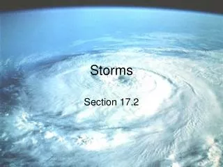
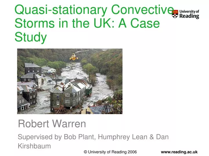
Quasi-stationary Convective Storms in the UK: A Case Study. Robert Warren Supervised by Bob Plant, Humphrey Lean & Dan Kirshbaum. Background. Quasi-stationary convective storms (QSCSs) Repeated triggering and training of cells over a localised area for an extended period of time

E N D
Quasi-stationary Convective Storms in the UK: A Case Study Robert Warren Supervised by Bob Plant, Humphrey Lean & Dan Kirshbaum
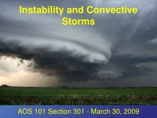
Background • Quasi-stationary convective storms(QSCSs) • Repeated triggering and training of cells over a localised area for an extended period of time • Potential for significant rain accumulations and flash flooding • Numerous case studies, most from USA and Mediterranean region • Key project questions: • How common are QSCSs in the UK and how does their occurrence vary seasonally, geographically and with synoptic conditions? • What are the typical mechanisms of storm anchoring in UK QSCSs? • How well are QSCSs represented in a high-resolution operational NWP model (MetUM, UKV)? Climatology Case studies
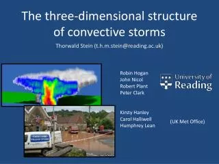
Case Study, 21/07/2010 Rain Rate Rain Accumulation
Key Questions • How does this event compare with the Boscastle storm of 16/08/2004? • By what mechanism were storms repeatedly triggered in the same location? • What caused the line of storms to propagate inland after 15 UTC? • How well is the event simulated by the Met Office UKV model?
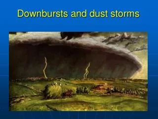
Comparison with Boscastle Storm • Higher rain rates and longer persistence of storm lead to extreme accumulations and severe flash flooding in Boscastle case.
Simulation Strategy • MetUM - UKV model: • Resolution: 1.5-km inner domain, stretching to 4-km outer domain • Explicit convection • 70 vertical levels • Initialised from operational 04 UTC UKV analysis; LBCs from operational NAE run • Smaller domain with same resolution nested within UKV to reduce expense
Sensitivity Tests – Methodology • Control simulation reveals that storms were forced by a persistent, narrow convergence line • We want to know what factors were important in the development and maintenance of this feature
Sensitivity Tests – Results Bottom line: land-sea temperature contrast was the primary control on the convergence line; land-sea roughness contrast, orography and cold pools all had only a minor influence.
Key Questions Revisited • How does this event compare with the Boscastle storm of 16/08/2004? Higher rain rates and a longer storm duration generated significantly higher accumulations and flash flooding in the Boscastle case. These differences were related to greater instability and column moisture, and a slower synoptic evolution. • By what mechanism were storms repeatedly triggered in the same location? A persistent, narrow convergence line, which appears to be a sea breeze front maintained in place by a slight offshore wind component (c.f. Golding et al. 2005). • What caused the line to propagate inland after 15 UTC? Sudden veering of low-level wind ahead of an approaching surface trough. • How well is the event simulated by the Met Office UKV model? Storms form too late and too far north along coast, and are too intense during late afternoon, but the overall accumulation pattern is captured fairly well.
500m Simulation 500m run has significantly stronger convergence and thus triggers convection earlier, more in line with observations; however, still some issues with organisation and intensity of precipitation.
Future Work • 21/07/2010 case study • Investigate reasons for convection spacing issues in simulations • QSCS climatology • Automatic identification of quasi-stationary storms using archived NIMROD data • Analysis of the characteristics of these storms and their environments • Other case studies • Idealised modelling • Investigate stationary sea breeze fronts using simple topography and a variety of wind profiles and land-sea temperature contrasts