Download
1 / 27
270 likes | 455 Vues
LEISA Atmospheric Corrector (AC) on EO1. George McCabe NASA/Goddard Space Flight Center Code 693 Greenbelt, MD 20771. LEISA Development History. 1993 Selected for Pluto Express (PE) Mission under Advanced Technology Insertion Program

E N D
LEISA Atmospheric Corrector (AC) on EO1 George McCabe NASA/Goddard Space Flight Center Code 693 Greenbelt, MD 20771
LEISA Development History • 1993 Selected for Pluto Express (PE) Mission under Advanced Technology Insertion Program • 1993 Baseline IR spectral imager for Highly Integrated Pluto Payload System (HIPPS) • 1994 Chosen for Small Satellite Technology Initiative (SSTI) Lewis Mission • 1996 Chosen for New Millennium Program Earth Observing-1 (EO-1) Mission • 1997 Space Act Agreement, participation in Field Studies with Boeing Commercial Space Company, Resource21 • 2001 Phase B development New Horizons for NASA Pluto-Kuiper Belt Mission
Instrument Characteristics • Correct Atmospheric Effects in High Spatial Resolution Multispectral Imager Data • Hyperspectral Imager • Moderate Spectral Resolution (<10 nm) • Moderate Spatial Resolution (<300 meter) • Maximum Sampling Flexibility • Minimum Impact on Spacecraft Resources
Contribution to EO-1 • Validation of Wedged Filter Approach for Spacecraft Instrumentation • Atmospheric Correction for ALI Multispectral Images. • Atmospheric Correction for Landsat-7 Images (Formation Flying). • Direct Study of Spatial Resolution Degradation (Cross-Comparison with Hyperion). • Retrieved Atmospheric Parameters. • Cross-Comparisons with MODIS.
EO-1 Landsat-7 Less Than 1 Minute Hyperspectral Atmospheric Correction (185 km @ 125 / 250 m) AVIRIS Underflight (10 km @ 20 m) Multispectral Images (36 km @ 30 m) TRWIS Underflight (Variable) 705 km Altitude 36 km Landsat Multispectral Images (185 km @ 30 m) 7.7 km Grating-based Hyperspectral Images (7.5 km @ 30 m) 185 km
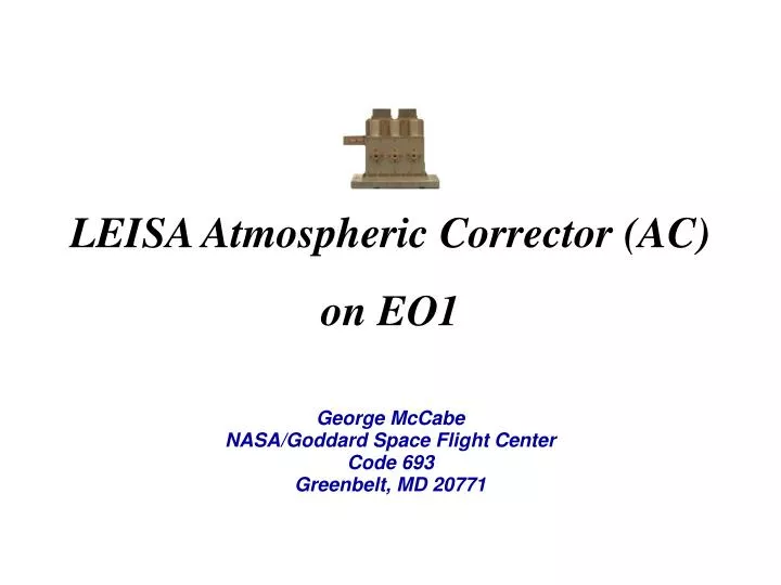
AC Instrument Specifications • Spectral Coverage: 0.89 - 1.58 μm; 256 Bands Selected for Optimal Correction of High Spatial Resolution Images • Spectral Resolution 2 Filter Sections: Section 1 ~35 cm-1 (Δλ: 5 nm @ 1.2 μm, 9 nm @ 1.6 μm) Section 2 ~55 cm-1 (Δλ : 4 nm @ 0.9 μm, 8 nm @ 1.2 μm) • Swath Width: ~185 km; Matches Landsat • Spatial Resolution (pixel): 356 μradian (250 meter @ 705 km) • Three 256 x 256 Element InGaAs Arrays; TEC Stabilized (<285 K) • Three 15 Degree FOV 3 Element Lenses • Two Modules: “Bolt-on”Optics Module and Electronics Module • Mass: 10.5 kg (EM, 4.4 kg; OM 3.9 kg; Cable 2.2 kg) • Power: 48 W (Peak); <15 W (Orbit Average)
In-Flight Calibration • Solar Calibration • Radiometric Calibration (Relative and Absolute) • Radiometric Stability • Variable Light Level Response • “Fixed Pattern” Noise Correction • Lunar Calibration • Radiometric Calibration • Image Quality • Extended Duration Dark Current Stability • Surface Targets • Radiometric/ Spectral Calibration (Ground Campaigns) • Dark Earth Looks • Dark Current Stability
Extended Calibration • “Fixed Pattern” Signal Apparent After Launch • Predominantly Additive Contribution • Constant in Position and Time • Reduced Accuracy in Low Illumination • Modified Radiometric Correction Procedure • Requires Measurements Unaffected by Atmospheric Absorption, Use Scanning Solar Data • Scale Calculation Replaced by Calibration Lookup Table
Atmospheric Corrector Calibration System Level-1 Products EO1 Level-0 Data ACCS EXTRACT REDUCE ARCHIVE VERIFY DELIVER Temporary Storage Permanent Database
./rsi/idl_5.3 ./ncsa/HDF4.1r3 ./ncsa/4.1r3_irix64-64 ./idldev/L0 ./idldev/ACCS ./idldev/ACCS/bin ./idldev/ACCS/dev ./idldev/ACCS/doc ./idldev/ACCS/lib ./idldev/ACCS/data ./idldev/ACCS/install ./idldev/varosi ./idldev/astron ./idldev/freudenreich ./idldev/sterner_98apr ./gdaac/hdfeos Calibration System Software • 150+ program modules
Processing Options accs@fastie-bin-2 LAC_Option -l to_level 1R # 1R, 1G keepall_prod yes # no (highest only), yes eo1q_execute standard # none, standard, extended null_calibration no # no, yes offset_source local_dark # default, local_dark scale_source default # default, extended, local_cal replace_bad yes # no, yes force_cal no # no, yes cal_matchkey preset2 # preset2, facist3, preset1, anarchist0 enhance_qlook yes # yes, no deliver_to lacsend # lacsend, tarsend, tape, null archive_file lacstor # lacstor, tape, null post_cleanup yes # no, yes do_tapels both # both, tape, eo1tape, none mail_report yes # no, yes getsome_sleep yes # yes, no lookforward2_vacation yes # yes, no
Session Logs • goACCS_EO1###.log • LAC_Extract/Reduce0/Deliver/Archive-YYYYMonDD@HHMMSS.log • goClean.log • dat3/dlt4_ACCS###.lst • Scenes_Processed.lst
ACCS Performance • > 1500 scenes processed • 8.5 Gb of data per session • 1.5 hrs/Gb total processing time* ( Extract + Reduce + Archive ) * excepting extended calibration
HDF File Creation Example L0 = LACDATA+‘/lac/20013010839_AKS/EO11520372001301112K0/’+ $ ‘AC2001301054952_AKS_01.L0’ GENICAL, L0, /VERBOSE, /OFFSET, $ MATCH={TYPE:1,TIME:1.0,ARRAY1T:10,ARRAY2T:10,ARRAY3T:10,STAT:'0111'} GENHDF, L0, RUN_LABEL='2002Jan23@064222', /VERBOSE, /NON_INTERACTIVE L1 = VERYGEN1R( L0 ) TIMEUPDT, L1 GEN1RSDS, L1 RDUPDT, L1, /NON_INTERACTIVE
Associated Files • YYYY_DDD_lac/gps/acs.hdf • 00indexEO1### • ACYYYYDDDHHMMSS_RRR_##.L0_calcoef.b4 • " .L0_calpnotes.txt • " .L0_stats • " .L0_stats-M/S.bmp • " .L0_trace0/C • " .L0/1R_wint • " .L0_update • " .L1R_q-bands/frames.jpg • " .L1R_geo
Science Data Formats • instrument clock, header data • pixel pointing map, filter frequency map • spacecraft meta data (YYYY_DDD_lac/gps/acs.hdf) • Ii,j,t Ix,y, Level-1G Level-1R
Color Composite Image Cuprite, NV Mar. 1, 2001 red=1.32, green=1.03, blue=0.98 (m)
Spectra Cuprite, NV March 1, 2001
Cuprite, NV Scene-ID: EO10410342001060111PP Lake Frome Scene-ID: EO10970812001021111PP Rochester, NY Scene-ID: EO10160302001125111PP Snake River Scene-ID: EO10410302001140111PP Suez Canal Scene-ID: EO11760392001046111PP Venice Scene-ID: EO11920282001158112PP