Download
1 / 5
50 likes | 139 Vues
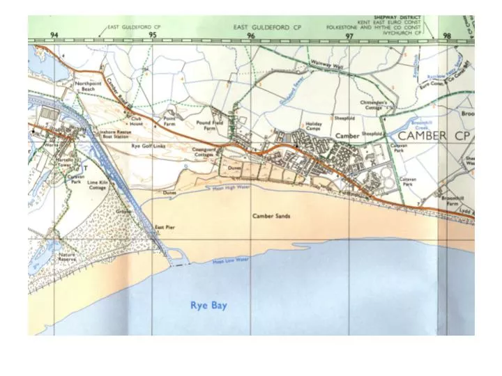
How has human activity affected the dunes at Camber? Introduction Location – Where are the dunes? What is their area? What land uses are around them? Use annotated OS maps 1:25 000, 1:10 000, and aerial photo.

E N D
How has human activity affected the dunes at Camber? Introduction Location – Where are the dunes? What is their area? What land uses are around them? Use annotated OS maps 1:25 000, 1:10 000, and aerial photo. Formation – What is the source of the sand? Why is it deposited at Camber? What factors are required for coastal dune formation? Include photos from Internet. Human activity Describe the human activity at Camber, e.g. dune conservation, visitors, coastal defence, recreation. Why investigate how human activity has affected the dunes? Why are the dunes important? Why are they threatened? Who will be affected if they are not conserved?
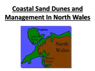
IntroductionLocationWhere are the dunes? What is their area? What land uses are around them? Use annotated copies of OS maps 1:25 000 http://www.ryebay.demon.co.uk/cambersands.htm
Draw and annotate a sketch map to show the location and key features of the study area. Include the following: • the coastline between Camber and Fairlight • the soft sandstone cliffs at Fairlight • the direction of the prevailing wind • the direction of longshore drift • Name and label – Rye Bay, Fairlight, Camber, mean low water line, mean high water line. • shade the sandy beach exposed at low tide • estimate and show on your map the approximate distance from Fairlight to Camber • give your map a title • give the meanings of all symbols used in a key • include a north pointer • include an approximate scale