Download
1 / 1
10 likes | 25 Vues
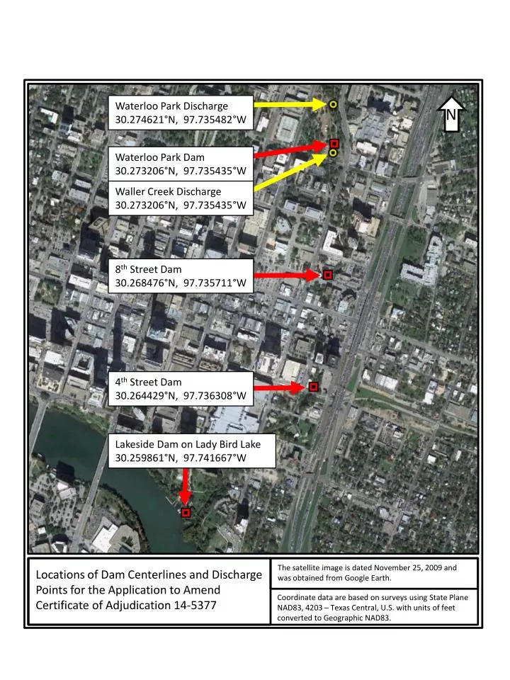
Waterloo Park Discharge 30.274621°N, 97.735482°W. N. Waterloo Park Dam 30.273206°N, 97.735435°W. Waller Creek Discharge 30.273206°N, 97.735435°W. 8 th Street Dam 30.268476°N, 97.735711°W. 4 th Street Dam 30.264429°N, 97.736308°W. Lakeside Dam on Lady Bird Lake

E N D
Waterloo Park Discharge 30.274621°N, 97.735482°W N Waterloo Park Dam 30.273206°N, 97.735435°W Waller Creek Discharge 30.273206°N, 97.735435°W 8th Street Dam 30.268476°N, 97.735711°W 4th Street Dam 30.264429°N, 97.736308°W Lakeside Dam on Lady Bird Lake 30.259861°N, 97.741667°W The satellite image is dated November 25, 2009 and was obtained from Google Earth. Locations of Dam Centerlines and Discharge Points for the Application to Amend Certificate of Adjudication 14-5377 Coordinate data are based on surveys using State Plane NAD83, 4203 – Texas Central, U.S. with units of feet converted to Geographic NAD83.