Download
1 / 25
250 likes | 386 Vues
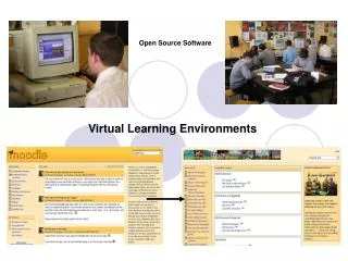
Dutch ministry implements Open(Source) WebGIS. Wim de Haas Chiel Stroeven Michel Grothe Geo-Information and ICT Department. Agenda. Introduction Survey & business case WebGIS Proof-of-concept Implementation GeoServices Experiences with Open Source Software Future developments

E N D
Dutch ministry implements Open(Source) WebGIS Wim de Haas Chiel Stroeven Michel Grothe Geo-Information and ICT Department
Agenda • Introduction • Survey & business case WebGIS • Proof-of-concept • Implementation GeoServices • Experiences with Open Source Software • Future developments • Demo time • Q&A
Mission V&W The core tasks of V&W are: • to guarantee safe, versatile and reliable accessibility both over land and water, through the air, and for telecommunications and post • to offer protection against floods • to ensure clean and sufficient water • 2003 Budget: 6.4 Billion EUR • 2003 Staff: 15.000 fte
Organization V&W policymaking execution inspection
Mission Geo-Information & ICT Dept to service RWS with accurate geo-information to deliver the generic ICT infrastructural needs and systems
Survey results Bottleneck webGIS applications: • Diversity webGIS software no interoperability!; • Many app-hosting companies; • Maintenance: lack of time and knowledge; • Strict budget cuts! Remarkable: • 90% of all data and 75% of all functionality is in common
Agenda • Introduction • Survey & business case WebGIS • Proof-of-concept • Implementation GeoServices • Experiences with Open Source Software • Future developments • Demo time • Q&A
Implementation GeoServices • Fully OGC compliant • WMS • WFS • GML • Web Map Context • Styled Layer Descriptor • ISO and CEN • Use of Open Source Software as well as closed source software • Geodan contractor with support from DMSolutions
OpenGIS web services 2. Requestor localizes services Registry 1. Provider publishes data and services at Registry Find Publish Requestor Provider Bind 3. Requestor starts service
Geoservices Application Architecture Presentation layer Browser ArcGIS OSS OSS OSS Service layer Apache/ Chameleon OSS WMS Geodan OSS OSS IIS WFS Geodan WMS WFS WFS ESRI OSS OSS Deegree WCAS Geocoder MS4W ArcIMS 4.0.1/ ArcMapServer ISO 19119 CEN metadata Geodan Location Database Geodata Geodata Data layer
Agenda • Introduction • Survey & business case WebGIS • Proof-of-concept • Implementation GeoServices • Experiences with Open Source Software • Future developments • Demo time • Q&A
Experiences OSS (1) • OSS crossed our path • Open mind • Quality • Required functionalities available • Proven stability • Security • Price • No license fees (saving of 50 kEUR) • Benefit from others • Costs of development equal to closed source software
Experiences OSS (2) • Support • Active developers and user community with short response times • Quick bug fixing by DMSolutions through support-contract • Development • Anticipating latest developments
Experiences OSS (3) • License • No GPL, MIT or ASF style license model • Limits the use in mission-critical applications • Need CVS for provenance tracking • MP’s support for OSS and Open Standards
Agenda • Introduction • Survey & business case WebGIS • Proof-of-concept • Implementation GeoServices • Experiences with Open Source Software • Future developments • Demo time • Q&A
Future developments (1) • Spring 2005 a new network for V&W • 350 locations, 14.000 users • Bandwidth of 2 Mbps - 1 Gbps • Internet access max. 2 x 1 Gbps • RWS technology standards • LDAP, Active Directory • J2EE • .NET
Future developments (2) • Feature services: WFS • Web-editing • Mobile clients • Webclients • Geometry and attributes • Semantics • Towards a GDI
Thank you for your attention Contact: Michel Grothe: m.j.m.grothe@agi.rws.minvenw.nl Chiel Stroeven: m.h.stroeven@agi.rws.minvenw.nl Wim de Haas: w.c.a.dhaas@agi.rws.minvenw.nl
Adding kaartbeeld Request meta-informatie Geoservices user experience (2)