Download
1 / 22
220 likes | 340 Vues
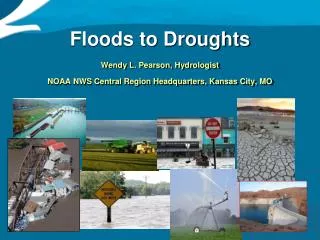
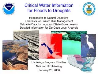
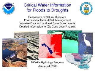
Using Satellites to Address Issues Related to Transboundary Waters, Droughts, Floods, and Climate Change in Africa and Asia. World Water Week Stockholm. Sweden September 5, 2013 Rick Lawford (MSU) David Toll (NASA) (with thanks to many NASA-funded investigators whose work is cited ).

E N D
Using Satellites to Address Issues Related to Transboundary Waters, Droughts, Floods, and Climate Change in Africa and Asia World Water Week Stockholm. Sweden September 5, 2013 Rick Lawford (MSU) David Toll (NASA) (with thanks to many NASA-funded investigators whose work is cited)
Africa and Asia are two priority areas for GEO and CEOS Africa is an area of special interest because the needs of some nations are large and the developed world can all contribute to this region without stepping into another major Space Agency’s “territory”. Asia is an area of special interest because 60% of the world’s population lives in this area and are affected by the extremes and climate changes that are taking place there. GEO Water in Africa GEO Water in Asia NASA: SERVIR and WISP NASA: SERVIR ESA: TIGER ESA: DRAGON Japan: AfWCCI Japan: AWCI
Water Management in Transboundary River Basins
Asia and Africa have a large number of transboundary basins which complicate water management • UNEP/GEF Volta TDA -priority transboundary concerns: • (From Dr. Jacob TUMBULTO) • Changes in water quantity and seasonality of flows • Degradation of Aquatic Ecosystems • Degradation of Surface Water Quality/Pollution • Invasive Aquatic Species • Land Degradation/ Loss of Vegetative Cover • Loss of Biodiversity • Water related diseases • Coastal Erosion In practice, while some nations basin-wide planning is done in some TB basins, the sharing of information and data is limited in many other TB basins.
The Nile River Basin is an example of the challenges of a • transboundary basin. • In the past water use in • the upstream and the • downstream nations have • been a source of conflict and • tension. The lack of data • sharing has led to conflicts • over: • infrastructure planning, • flood preparation, • irrigation. subbasins countries
NASA launched Project Nile to deal with these this lack of information-sharing Goal: improved hydrometeorological information for research, planning, and water management in the Nile basin. • Components: • Land cover mapping and simulation • Satellite-derived evapotranspiration • Optimized models for hydrological analysis • Integration to Decision Support
Applications:Hydropower optimization Long-term satellite data records which are continuous in space, land data assimilation products, and hydrological model outputs provided data that helped in the design of a plan for hydropower station.
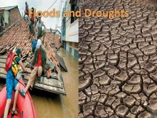
Coping with drought impacts to support food security
Many parts of Africa are threatened by drought and the associated food shortages. With effective monitoring and prediction it is possible for Aid Agencies to ensure that food is available at the right locations when it is needed. FEWSNET (USAID, USGS) has been providing monitoring and forecast information for a number of years. Satellite remote sensing and land data assimilation fill gaps in areas with sparse in-situ measurement networks, and provide the basis for early detection of agricultural drought
Areas of Agricultural Drought are mapped with the Water Requirement Satisfaction Index (WRSI) (after J. Verdin) Food prices determine the cost of food aid. WRSI WRSI = f (ppt, pet, WHC, Crop Type, SOS, EOS, LGP) Kc - FAO FAO soils map
FEWS NET – Food Security Outlook Food Security Situation: March 2011 • Current status (Mar), projection period (Apr-Sep) Pastoral areas; poor households; basic survival needs not met, food deficits in marginal cropping areas Current status (Mar) Multi-agency participation Apr-May-Jun Jul-Aug-Sep FSNWG Food Security & Nutrition Working Group Central and East Africa
The Famine Early Warning Systems Network (FEWS-NET) • Using NASA Land Information System (LIS) to Help Extend Coverage beyond Sub-Sahara • Satellite Precipitation • Satellite Snow Cover and Snow Water Equivalent • Satellite Vegetation Greenness • Yield Forecasting Red – Current countries Yellow – Weather/agricultural outcomes & availability/access monitoring Green – Weather/agricultural outcomes
Climate Change is affecting: • The rate at which glaciers are melting. • The beginning and the end of the snow season and the • proportion on precipitation that falls as snow. • - The timing of snow melt. (J. Dozier) The accumulated snow water varies considerably from year to year. With climate change new trends with lower accumulations are expected to emerge The Hindu Kush -Himalayan (HKH) region, which extends 3,500 km and includes many mountain glaciers, is the source of the 10 major rivers in Asia.
NASA has been developing tools and products that will allow users to monitor the impact of these trends on water resources Snow Water Volume Charts Snow Accumulation/Depletion Curves
John Bolten (PI), Code 617, NASA GSFC Enhancing Floodplain Management in the Lower Mekong River Basin Using NASA Vegetation and Water Cycle Satellite Observations Figure 1. The Mekong River Basin Figure 4. USGS co-investigators are building a Graphic Visualization Tool (GVT) to work in concert with the output of the Soil and Water Assessment Tool (SWAT) model.
Floods: Satellite data are critical pre-event, during flood events and for post-event flood response Pre-event: The saturation of the soil and the water stored in reservoirs either serve as storage areas for excess precipitation or they aggravate flooding conditions be enabling more water to run off Precipitation measurements will allow better estimates of the rainfall amounts and more accurate flood forecasts. (e.g., TRMM rainfall over North Korea - Adler) Post-event: The SWOT mission holds promise of enabling emergency managers to get better information on inundated areas and thereby help in cleanup operations.
Water Information System Planning: Mapping water stress in the MENA USAID with World Bank Water Availability Using a NASA Land Data Assimilation System (LDAS) for the ‘MENA’ Matt Rodell, John Bolten, David Toll, Shahid Habib (NASA/GSFC), Edwin Engman (NASA/GSFC/SAIC), Joseph Nigro (NASA/GSFC/SSAI), and Mutlu Ozdogan (U. Wisconsin) Elevation Precipitation GRACE terrestrial water storage Water availability Soils Irrigation NASA, USAID-’OMEP’, ICBA (International Center for Biosaline and Agriculture) and regional partners teamed to provide regional water resources assessments Using Satellite Data and Land Data Assimilation Systems.
Summary Over the past two decades major advances have been made in the production of useful data products from water-related satellite data and in their application to delivering aid and other benefits to societies in Asia and Africa. Over the next decade we can expect more advances in the development of platforms and applications that will make these data available to people in every walk of life throughout Asia and Africa thus facilitating “societal transformation through information.”