Download
1 / 5
50 likes | 143 Vues
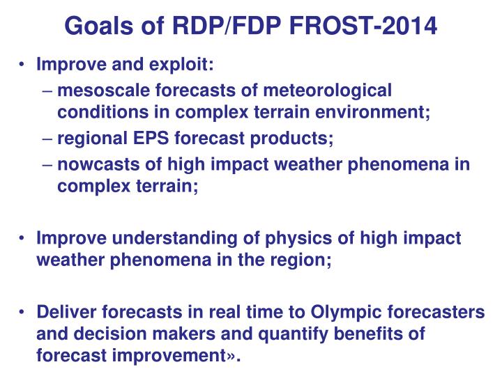
Goals of RDP/FDP FROST-2014. I mprove and exploit : mesoscale forecasts of meteorological conditions in complex terrain environment; regional EPS forecast products; nowcasts of high impact weather phenomena in complex terrain;

E N D
Goals of RDP/FDP FROST-2014 • Improve and exploit: • mesoscale forecasts of meteorological conditions in complex terrain environment; • regional EPS forecast products; • nowcasts of high impact weather phenomena in complex terrain; • Improve understanding of physics of high impact weather phenomena in the region; • Deliver forecasts in real time to Olympic forecasters and decision makers and quantify benefits of forecast improvement».
Suggested domains for FROST-2014 forecast data exchange and verification: outer – for Ensemble FDP, intermediate – for Ensemble RDP, inner – for Deterministic FDP.
CORSO project components FDP: • Snow analysis: - Adaptation of Meteo-Swiss analysis - Use of NOAA snow satellite analysis products • EPS system (7 km grid-size) • Post-processing/downscaling • Verification (pointwise and spatial) • Forecast delivery means (web-tools) – beyond the project RDP: • EPS system with 2 km grid resolution • High-resolution deterministic (1 km grid-step)
NOAA POTENTIAL CONTRIBUTION • Satellite-derived information on snow cover for model initialization and/or verification • - Daily at 1-2 km resolution by 2012 • - 10 km when cloudy (by 2013) • Higher temporal and spatial resolution snow cover data: • - Up to 15-30 min with SEVIRI • - Up to 250-350 m with MODIS or VIIRS • - Clear sky scenes only • Other satellite-based land surface products (e.g., LST, vegetation parameters, cloud cover)