Download

1 / 15
150 likes | 290 Vues
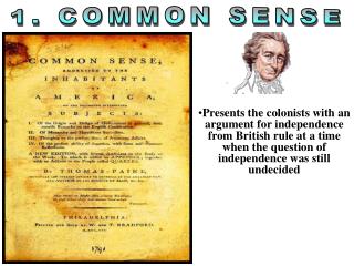
REGION: Making Sense of Diversity. Chapter 5. A World of Region. Canal Zone is an area of Panama under the control of the Unite States since 1903 Americans built the Panama Canal to connect the Atlantic and Pacific Oceans Largest engineering project in the world

E N D
REGION: Making Senseof Diversity Chapter 5
A World of Region • Canal Zone is an area of Panama under the control of the Unite States since 1903 • Americans built the Panama Canal to connect the Atlantic and Pacific Oceans • Largest engineering project in the world • American troops stationed there to protect their country’s investment • President Carter returned control of the Canal Zone to Panama at the end of 1999
What is a Region? • Region is an area of the Earth’s surface with its own unique characteristics • Canal Zone was a region • Combines all five themes of geography • Two places in Panama – Colon and Balboa joined by the canal • Movement of people and products occur daily
What is a Region? (cont.) • The canal increases interaction between countries as it reduces travel time • Physical environment changed to build canal – whole mountains removed • Region – with its own political boundries
Organizing The World into Regions • Geographers use regions to organize information about the Earth’s surface • Regions help geographers to understand the Earth (the way we organize our computers with files and folders) • World is a big place with great diversity
Large and Small Regions • Regions can be organized in different ways • Large or small • To examine a large region • Use small scale map • Map shows a small amount of detail • Eg. Figure 5-2 pg. 66 small scale map because it shows a large region (all of Italy) in very little detail
Large and Small Regions (cont.) • To understand detailed interaction in small region • Use large scale map • Shows a large amount of detail • E.g. Figure 5 – 3 pg. 67 a large scale map because it shows a very small region with Italy (Vatican City) in great detail
World’s Smallest Country • Vatican City • Can fit in our neighbourhood • Area of less than 0.5 square kilometers • Surrounded by Italian city of Rome • Own legal system and post office • Largest church St. Peter’s Basilica • Vatican’s museums and art galleries contain famous works by Renaissance artists • Michelangelo’s painting of Sistine Chapel is found there
Single Factor Regions • Regions that are based on only one factor are called single-factor regions • Use only one factor to identify a region • political boundaries • Outlines the area under the control of a government e.g. Canada • Larger countries with large population usually divide into smaller political regions (provinces, territories, and states)
Single Factor Regions (cont.) • Landforms • Identified by a common landform • E.g continuous mountain along the Pacific coast of North America (Western Cordillera) • Plains are flat low lying areas that also form patterns • Large region called the Interior Plains, extend across the length and width of North America – east of Cordillera
Multi-Factor Regions • An area that is identified by more than one characteristic is called a multi factor region • Two examples of multi factor regions • Urban regions • Ecozones
Urban Region • Urban – an area where at least 1000 people live close together • 80% Canadians live in urban regions • Very large population centres • Multi-factor region • Ottawa • Based on many factors (political boundaries, population, industry, and transportation) • People live in suburbs and work downtown
Urban Regions (cont.) • Problems caused by large urban regions due to • No single political government • Difficult to coordinate important public services • To solve • Extend Ottawa’s boundaries • Might help organize public services
Ecozone Regions • A region based on several environmental factors • Landform • Climate • Natural vegetation • Soil condition • Important because they help plan new national parks • Difficult to draw boundary lines for multi factor region • Boundaries on map are imaginary lines • Near the end of one and beginning of another they blend (mix together)
Ecozone Region (cont.) • Canadian ecozones • Northern Arctic • Boreal Shield • Both contain different communities of plants and animals