Download
1 / 17
170 likes | 285 Vues
Site Surveys at HartRAO. NERC Space Geodesy Facility, Herstmonceux ILRS Fall 2005 Workshop 3 October 2005 Ludwig Combrinck HartRAO Space Geodesy Programme. Footprints and Ties. Outer network Intermediate network Inner network 2000 micro network VLBI antenna offset

E N D
Site Surveys at HartRAO NERC Space Geodesy Facility, HerstmonceuxILRS Fall 2005 Workshop3 October 2005 Ludwig Combrinck HartRAO Space Geodesy Programme
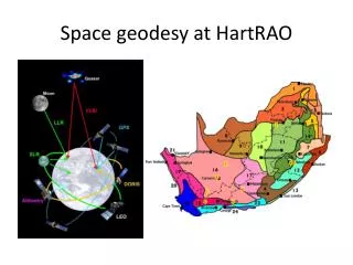
Footprints and Ties • Outer network • Intermediate network • Inner network • 2000 micro network • VLBI antenna offset • Ties between geodetic systems i.e. VLBI, SLR, GPS, DORIS
VLBI Antenna axis offset • VLBI reference point is intersection of axes, or the projection point of the secondary axis onto the primary axis • Axis offset determinations • 1960 JPL engineering 6707 mm • 1993Conventional surveying 6695 +- 3 mm (Mark Newling, CDSM) • 1995 VLBI 6693.6 +-2.5 mm (Chopo Ma) • 1995 VLBI 6692.5 +- 1.5 mm (Marshall Eubanks) • 1995 GPS 6695.6 +- 2.3 mm (Ludwig Combrinck) • 1996 VLBI 6688.8 +- 1.8 mm (Chopo Ma) • 2003 IGN 6695 +- 2.5 mm (IGN/JPL/CDSM)
Repeatability? • Different equipment (antennas etc) • HRAO-SLR X Y Z (mm) LC 1998 48554.3 65628.3 42835.7 LC 1998 48552.2 65628.8 42837.1 LC 1999 48556.2 65626.4 42834.7 ITRF 2000 48619 65574 42797 IGN 2003 48635.3 65591.8 42799.2 ~6.5cm ~4.5cm ~3.5cm ~1.5cm ~1.5cm ~0.2cm
Repeatability? • Tie between VLBI and SLR X Y Z (M) ITRF 1993 41.634 -66.597 -8.169 ITRF 1994 41.652 -66.620 -8.187 GPS 1995 41.680 -66.564 -8.131 ITRF 2000 41.672 -66.606 -8.135 IGN 2003 41.674 -66.596 -8.145 ~8mm ~40mm ~4mm ~2mm ~10mm ~10mm
Conclusions • Last survey closer to ITRF eccentricities • Last word has not been spoken……