Download
1 / 17
170 likes | 280 Vues
MDGs, and WSSD Plan of implementation Ashbindu Singh Regional Coordinator Division of Early Warning & Assessment – North America United Nations Environment Programme. Millennium Declaration Goals (MDGs) Agreed upon by All the Head of States at the UN Millennium Summit in 2000;

E N D
MDGs, and WSSD Plan of implementation Ashbindu Singh Regional Coordinator Division of Early Warning & Assessment – North America United Nations Environment Programme
Millennium Declaration Goals (MDGs) • Agreed upon by All the Head of States at the UN Millennium Summit in 2000; • High political visibility and all 191 member states have pledged to meet these goals
The Millennium Development Goals : 2015 • Halve extreme poverty and hunger • Achieve universal primary education • Promote gender equality and empower women • Reduce child mortality • Improve maternal health • Combat HIV/AIDS, malaria, and other diseases • Ensure environmental sustainability • Develop a global partnership for development
Millennium Declaration Goals (MDGs) A framework of 8 goals, 18 targets and 48 indicators
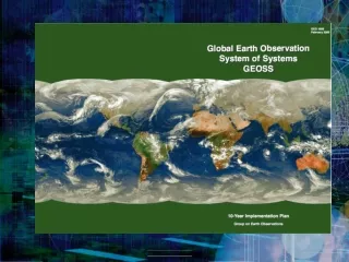
World Summit on Sustainable Development (WSSD) 2002: Plan of Implementation “Promote the development and wider use of earth observation technologies, including satellite remote sensing, global mapping and geographic information systems, to collect quality data on environmental impacts, land use and land use changes.”
World Summit on Sustainable Development 2002 Reverse the loss of biodiversity by 2010 What is needed:- - Baseline Information on geographical location of biodiversity; - Spatial configuration (relationship with population distribution, roads etc. ; - Changes in ecosystem (change matrices)
Indicators to follow-up the implementation of the Millennium Development Goals indicators • Goal 7: Ensure environmental sustainability • Target 9. Integrate the principles of sustainable development into countries policies and programmes and reverse the loss of environmental resources • Indicators • Proportion of land area covered by forest (FAO) • Land area protected to maintain biological diversity (UNEP) • GDP per unit of energy use (as proxy for energy efficiency) • Carbon dioxide emissions per capita
Millennium Development Goals Indicators CRITERION • Measure progress towards goals • Availability of Time series • Country –wise data available for a maximum number of countries • Some international agency responsible for data compilation on a regular basis
Irian Jaya (Indonesia) 10 Km Landsat 7 - 22 October, 2000 Path 100, Row 64 Deforested area near the Papua New Guinea – Irian Jaya (Indonesia) border. The area appears well planned and is near rectangular. A rough estimate of the area is nearly 10,0000 ha. (9,734.850)
Disappearing Wetlands Mesopotamian Wetlands, Iraq/Iran • 1973 - Dark green patches indicate marsh vegetation extending over 20,000 sq. km. • 2000 - Most of the wetlands have disappeared.
Recent trends towards policy relevant analysis • Trend over time is key focus of policy • Shift towards measuring performances than ‘understanding complex…..’ • Measuring what is supposed to be measured • Provide a comparative analysis of countries over time • Emphasis on improving the quality and timeliness of data
Challenge Operational programme to monitor terrestrial environment on an annual basis and generate policy relevant information Map data + Statistics