Download
1 / 35
350 likes | 446 Vues
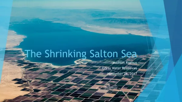
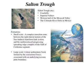
Natural History of the Salton Trough. Salton Trough. Gulf of California. Colorado River Delta. Peninsular Ranges. Cuyamaca Mountains. San Diego. T. U. M. S. T. U. M. S. Limestone. Great Barrier Reef, Australia. ARIZONA. SAN DIEGO. Stable Continental Crust (craton). Limestone.

E N D
Salton Trough Gulf of California
Cuyamaca Mountains San Diego
T U M S
T U M S
Limestone Great Barrier Reef, Australia
ARIZONA SAN DIEGO Stable Continental Crust (craton) Limestone Ocean Crust
Paleozoic Limestone Colorado River Delta
Algae removes CO2 - acidity decreases - lime precipitates Ancient Lake Cahuilla
Travertine Point (sort of) Paleozoic Lime (Marble) Holocene Lime (Travertine)
Pangaea Breakup Pangaea’s Breakup ends Paleozoic Stability
Plate B Plate A Plate C Fig. 3-16b, p. 75
Plate B Plate A Gap: divergent plate boundary Plate C Fig. 3-16b, p. 75
Plate B Plate A Overlap: convergent plate boundary Plate C Fig. 3-16b, p. 75
Sliding: transform plate boundary Plate B Plate A Plate C Fig. 3-16b, p. 75
T U M S
Volcanic Arc Craton Farallon Plate North American Plate
Backbone of Cuyamaca Mountains = Complex of 100’s of Plutons
Accretionary Wedge Forearc Basin (Point Loma / Cabrillo Fm.) Regional Metamorphism (Santiago Peak Volcanics, Julian Schist, Marble) Forearc thrusting and subduction erosion Peninsular Ranges Batholith Metamorphosed wedge sediments (Catalina - Orocopia schists)
Pangaea Breakup Paleocene (58–66 Ma) Pleistocene to Recent (0–1.6 Ma) Pliocene (1.6–5 Ma) Late Cretaceous (66–88 Ma) Middle Cretaceous (88–118 Ma) Miocene (5–24 Ma) Oligocene (24–37 Ma) Early Cretaceous (118–144 Ma) Late Jurassic (144–161 Ma) Eocene (37–58 Ma) Subduction Flattens
T U M S
U Un-roofed batholith Forearc Basin (La Jolla / Poway groups) Undulating peneplain Catalina Schist Uplift Orocopia Schist subduction erosion Underplating Unusually thick Farallon Plate Magma production shifts east