Download
1 / 12
140 likes | 357 Vues
http://pubs.usgs.gov/gip/deserts/types/index.html#mars.

E N D
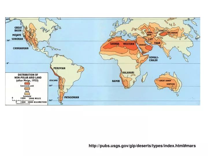
The Garlock fault, near the bottom of this Landsat image, is generally considered to be the geologic border between the Mojave Desert in the south and the Great Basin Desert in the north. The Great Basin contains more than 150 discrete desert basins separated by more than 160 mountain ranges Searles Lake, California. (Photograph courtesy of Kerr-McGee, Inc.) http://pubs.usgs.gov/gip/deserts/types/index.html#mars
Trade wind deserts The Sahara of Africa is the world's largest desert. It contains complex linear dunes that are separated by almost 6 kilometers. (Skylab photograph). http://pubs.usgs.gov/gip/deserts/types/
A rare rain in the Tengger, a midlatitude desert of China, exposes ripples and a small blowout on the left. Winds will shortly cover or remove these features. Midlatitude deserts occur between 30° and 50° N. and S., poleward of the subtropical highpressure zones. These deserts are in interior drainage basins far from oceans and have a wide range of annual temperatures. The Sonoran Desert of southwestern North America is a typical midlatitude desert.
Rain shadow Desert This Landsat image shows the Turpan Depression in the rain shadow desert of the Tian Shan of China. Rain shadow deserts are formed because tall mountain ranges prevent moisture-rich clouds from reaching areas on the lee, or protected side, of the range. As air rises over the mountain, water is precipitated and the air loses its moisture content. A desert is formed in the leeside "shadow" of the range. http://pubs.usgs.gov/gip/deserts/types/index.html#mars
Coastal Desert Coastal deserts generally are found on the western edges of continents near the Tropics of Cancer and Capricorn. They are affected by cold ocean currents that parallel the coast. Because local wind systems dominate the trade winds, these deserts are less stable than other deserts. Winter fogs, produced by upwelling cold currents, frequently blanket coastal deserts and block solar radiation. Coastal deserts are relatively complex because they are at the juncture of terrestrial, oceanic, and atmospheric systems. A coastal desert, the Atacama of South America, is the Earth's driest desert. In the Atacama, measurable rainfall--1 millimeter or more of rain--may occur as infrequently as once every 5-20 years. http://pubs.usgs.gov/gip/deserts/types/index.html#mars
Monsoon Desert "Monsoon," derived from an Arabic word for "season," refers to a wind system with pronounced seasonal reversal. Monsoons develop in response to temperature variations between continents and oceans. The southeast trade winds of the Indian Ocean, for example, provide heavy summer rains in India as they move onshore. As the monsoon crosses India, it loses moisture on the eastern slopes of the Aravalli Range. The Rajasthan Desert of India and the Thar Desert of Pakistan are parts of a monsoon desert region west of the ranqe. The Indus River floodplain, lower left, is the western border of the Thar Desert. This Landsat image of the monsoon desert shows small patches of sand sheets in the upper right, with three types of dunes; some dunes are almost 3 kilometers long. http://pubs.usgs.gov/gip/deserts/types/index.html#mars
Polar desert The Dry Valleys of Antarctica have been ice-free for thousands of years (courtesy of USGS Image Processing Facility. Flagstaff. Arizona). Polar deserts are areas with annual precipitation less than 250 millimeters and a mean temperature during the warmest month of less than 10° C. Polar deserts on the Earth cover nearly 5 million square kilometers and are mostly bedrock or gravel plains. Sand dunes are not prominent features in these deserts, but snow dunes occur commonly in areas where precipitation is locally more abundant. Temperature changes in polar deserts frequently cross the freezing point of water. This "freeze-thaw" alternation forms patterned textures on the ground, as much as 5 meters in diameter. http://pubs.usgs.gov/gip/deserts/types/index.html#mars
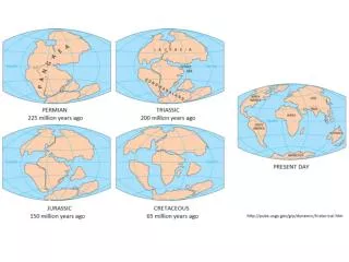
Paleo Deserts http://pubs.usgs.gov/gip/deserts/types/index.html#mars
Martian Desert One of the first images taken at the Viking 2 landing site on Mars shows the pink sky over Utopia and the desert pavement on the ground (courtesy of NASA). Some of the crescent-shaped dunes in this Viking image of Mars are more than a kilometer wide. The dark material that streaks from the horn-shaped features may be dust recently blown from the dunes (courtesy of NASA). This Viking spacecraft image of Mars shows alternating layers of ice and windblown dust near the north polar cap. Annual and other periodic climatic changes due to orbit fluctuations may occur on Mars (courtesy of USGS Image Processing Facility, Flagstaff, Arizona). http://pubs.usgs.gov/gip/deserts/types/index.html#mars