Download
1 / 30
320 likes | 526 Vues
GIS for Atmospheric Sciences and Hydrology. By David R. Maidment University of Texas at Austin. National Center for Atmospheric Research, 6 July 2005. GIS for Atmospheric Science and Hydrology. Space-time data models Hydrologic observations data Weather and climate data Common data model.

E N D
GIS for Atmospheric Sciences and Hydrology By David R. Maidment University of Texas at Austin National Center for Atmospheric Research, 6 July 2005
GIS for Atmospheric Science and Hydrology • Space-time data models • Hydrologic observations data • Weather and climate data • Common data model
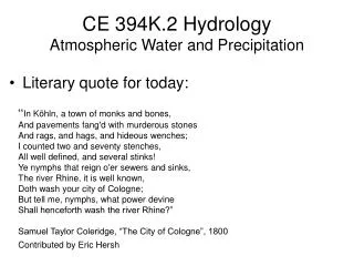
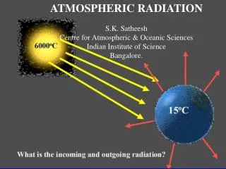
Atmospheric science – hydrology • Weather and climate fields are the drivers – continuous in space and time across the nation • Hydrologic flows in watersheds are the reactors – behaving according to watershed location and characteristics
Issues • Atmospheric science describes a fluid domain continuous in space and time, globally connected • The earth’s surface is a static, highly spatially varied domain whose water properties vary continuously in time, where water is concentrated in flow paths (streams and rivers)
Issues • Atmospheric science data are spatially extensive (e.g. North America), involve many variables, are “thin” in time (one day, one forecast period, one month), and use UTC time coordinates • Hydrologic data are spatially localized (e.g. my watershed), involve few variables (precipitation, evaporation, runoff), are “deep” in time (many decades), and use local time coordinates This space-time recompositing problem Is not trivial!
Issues • Atmospheric science data are stored in vary large binary files with specialized formats (Grib, netCDF, XMRG, ….) whose georeferencing may not be strong • Hydrologic data are stored in tables in GIS and relational databases, and accessed using GISspatial and SQL queries How do we connect these very different data worlds?
Time, T D Space, L Variables, V Data Cube
Continuous Space-Time Data Model -- NetCDF Time, T Coordinate dimensions {X} D Space, L Variable dimensions {Y} Variables, V
Discrete Space-Time Data Model-- Arc Hydro Time, TSDateTime TSValue Space, FeatureID Variables, TSTypeID
Value Time Geospatial Time Series Time Series Properties (Type) A Value-Time array A time series that knows what geographic feature it describes and what type of time series it is Shape
GIS for Atmospheric Science and Hydrology • Space-time data models • Hydrologic observations data • Weather and climate data • Common data model
Data Model for Hydrologic Observations Relationships
USGS National Water Information System Access is rapid enough that it is as if NWIS is a local disk on your computer
Plot from the Hydrology Data Portal Produced using a CUAHSI Hydrology Web Service: getDailyStreamflowChart
Applications and Services Web application: Data Portal • Your application • Excel, ArcGIS, Matlab • Fortran, C/C++, Visual Basic • Hydrologic model • ……………. • Your operating system • Windows, Unix, Linux, Mac Internet Web Services Library
GIS for Atmospheric Science and Hydrology • Space-time data models • Hydrologic observations data • Weather and climate data • Common data model
A retrospective study of weather and climate made by the National Centers for Environmental Prediction’s (NCEP) numerical weather prediction model and observations from 1979 to 2003 to make 3 hour forecasts. 3 hour, daily and monthly data are available on a 32 km grid over North America. http://wwwt.emc.ncep.noaa.gov/mmb/rreanl/
Using IDV and THREDDS to access NARR NARR at Asheville, NC IDV in Austin, TX NARR.xml Get NARR.xml from NARR home page
Precipitable Water and Specific Humidity over Gulf Altitude 0.005 0.020 Specific humidity (kg/kg)
Precipitable Water and Specific Humidity over Texas Altitude 0.005 0.020 Specific humidity (kg/kg)
Precipitation July 2003, 1800Z
Surface evaporation July 2003, 1800Z
GIS for Atmospheric Science and Hydrology • Space-time data models • Hydrologic observations data • Weather and climate data • Common data model
NetCDF-Java version 2.2 Common Data Model John Caron Unidata/UCAR Dec 10, 2004
Scientific Datatypes Grid Station Image THREDDS Catalog.xml Application NetCDF-Java version 2.2 architecture NetcdfDataset NetcdfFile OpenDAP ADDE HDF5 I/O service provider NetCDF-3 NetCDF-4 GRIB NIDS GINI Nexrad … DMSP
CDM Goal: N + M instead of N * M things on your TODO List File Format #1 Visualization &Analysis NetCDF file File Format #2 Data Server File Format #N Web Service
ArcGIS ModelBuilder Application for Automated Water Balancing
Conclusions • Data access through web services can mask the variations in data structure between relational databases and data file systems • We need a “Common, common” data model to better integrate GIS and weather and climate information • We need tools for space-time recompositing of weather and climate information to make it suitable for hydrology