Download
1 / 22
220 likes | 323 Vues
Rocky Mount Pedestrian Master Plan. Scott Lane, AICP, GISP, Stantec Consulting Services Betsy Watson, PE, Stantec Consulting Services Michelle Matera, Stantec Consulting Services Don Kostelec, AICP, Transpo Group. About Stantec. Over 50 Years of Service 50,000 Projects 5,000 Clients

E N D
Rocky MountPedestrian Master Plan Scott Lane, AICP, GISP, Stantec Consulting Services Betsy Watson, PE, Stantec Consulting Services Michelle Matera, Stantec Consulting Services Don Kostelec, AICP, Transpo Group
About Stantec • Over 50 Years of Service • 50,000 Projects • 5,000 Clients • 150 Locations • Over 10,000 staff
Sustainable Solutions • Three Parts: Community, Economics, Environment • Integrate transit, bicycle, and pedestrian modes • Multidisciplinary approach • Public Outreach • Visualization • Landscape Architecture • Recreation • Signage / Markings • Traffic Engineering • Environmental Sciences
About Pedestrian Planning • Walking Happens at a Different Scale And Pace • In Rocky Mount… • Sincere interest in accomplishing multiple goals • Develop programs and policies, in addition to projects • Successful engagement doesn’t just mean public meetings
Connecting to the “Trunk” pedestrian system and expanding it Tar River Trail
Identifying opportunities for locations, design of transit facilities Tar River Transit
Identifying short-term projects that can have a disproportionate “bang-for-the-buck” Connectivity Counts
Better site design standards and guidance Connecting Businesses
Rail crossing design guidance We’ve developed our own guidance based on FRA 2008 guidance and vetted with NCDOT’s Rail Division
Measuring the Value of Non-Motorized System Connectivity • Beyond “good” sidewalks • Safe Routes to Schools • Access to Transit • Neighborhood Walkability • Active Living
A B …a better way to measure and monitor the quality of the pedestrian transportation system… • What is it: Connectivity measured via Route Directness Index (RDI) straight-line distance “A” actual route distance “B” RDI = A / B
Williford Elementary School Located on edge of traditional grid network. Walkable areas north and east Isolated parcels southeast of the school RDI for School: 0.76 Rocky Mount School Connectivity Analysis Williford Elementary School
Baskerville Elementary School Located in area with disconnected street and sidewalk system. Near Middle School Walkable areas west of school near downtown Several large isolated areas RDI for School: 0.64 Rocky Mount School Connectivity Analysis Baskerville Elementary School
ViaCity Analysis for Rocky Mount • Priority areas / major generators • Incorporate demographic and equity measures in refined analysis • Gap analysis • Testing alternatives • Project prioritization
Work Samples Graphics
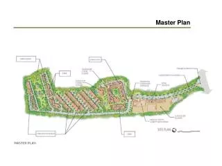
Work Samples Subarea and Corridor Assessments
Work Samples Durham Pedestrian Plan
Our Process and Deliverables • Coordination meeting with staff and steering committee • Visioning exercise • Accident / Facility inventory • Review of Existing Policies and Plans • Public Engagement #1 • Refinements to Projects, Programs, and Policies • Small-Area Plan • Reviews of Draft and Adoption of Final Plans • Better understanding of needs and deliverables • Informed leaders • Establishing study framework • Mapping and issue analysis • Survey, Facebook site, Focus Group Meetings, Fact Sheets • Recommendations for projects, policy/ordinance changes • Rendering and text capturing key design recommendations for a walkable neighborhood
Small-Area Planning Exercise …The streetscape development has helped revitalize North Charleston's Montague Avenue and Park Circle area, which was just named one of the nation’s “coolest neighbor-hoods” in the June 2009 issue of Men’s Journal.
Strong Engineering Credibility • International, National, State, and Local Experience • Innovative Technical Approach that Can Further Multiple Goals • Public Engagement and Plan Elements that Respect the Diversity of the City Thank You! http://walkrockymount.wikispaces.com