Download
1 / 102
1.03k likes | 1.16k Vues
CASARA NATIONAL NAVIGATOR COURSE Search and Rescue Procedures. CASARA Navigator Course. Table of Contents: SEARCH and RESCUE PROCEDURES The Search Plan Area Coverage Search patterns – Visual Search patterns – Electronic Reports and Returns. The Search Plan.

E N D
CASARA NATIONAL NAVIGATOR COURSE Search and Rescue Procedures
CASARA Navigator Course Table of Contents: SEARCH and RESCUE PROCEDURES • The Search Plan • Area Coverage • Search patterns – Visual • Search patterns – Electronic • Reports and Returns
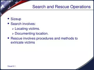
The Search Plan • Once an Aircraft or vessel has been reported missing, the search planning process begins. • To give you an idea of where your search tasking originates, we will review the factors the Searchmaster must consider in his/her search planning.
The Search Plan • When the Searchmaster draws up a SEARCH PLAN he/she considers the following; • Estimate the datum; • Determine the size of the search area; • Select the appropriate search patterns; • Determine the desired area coverage; and, • Develop an optimum and attainable search plan
Developing the Search Plan • Estimate the DATUM; • Determine the position of the emergency • For marine cases, calculate the effect of tide and current on the survivors.
Developing the Search Plan • Determine the size of the search area; • Allow for errors in position estimates,; • Allow for navigation errors of the search units; and, • Drift variables of wind and tide.
Developing the Search Plan • Select the appropriate search plan; • Consider the size of the area; • The type of terrain; and, • The capabilities of the search units.
Developing the Search Plan • Determine the desired area coverage; • Factors affecting probability of detection; • Tree coverage, snow, water conditions • Track spacing; • Visibility from the search unit • Visibility and size of the object. • The smaller the Track Spacing, the more units required • The number of sweeps. • A factor of the # of units, weather, daylight, etc
Developing the Search Plan • Develop an optimum and attainable search plan • Consider the number of search units available and other factors and circumstances.
Search Planning Methods • Based on least and greatest values of all unknown or uncertain factors: • Such as earliest and latest time of the incident, winds, tides, navigation errors, etc.. • Plots minimum vectors and maximum vectors that the search object may have drifted. • The search area then incorporates the whole of this area.
Search Planning Methods • The two systems that will most likely be used to task a CASARA resource for aviation incidents over land are: • The Canadian Search Area Definition Method (CSAD) or • The Mountain VFR (MVFR) Method
Search Planning Methods The Mountain Visual Flight Rules (VFR) Method acknowledges that: • Crashes are likely to occur along the whole of the intended track. • Very few occur before the Last Known Position (LKP). • Sites cluster close to the intended track.
Search Planning Methods • Probability of Containment (POC) area stretches along the entire length of the track. • If the intended route is not known with any certainty, all likely routes must be covered. • From 5 miles before LKP to 5 miles beyond the intended destination,
Mountain Visual Flight Rules (VFR) Method • AREA A • Entire length of the intended track, 5 miles on either side, • The same coverage on any alternate routes than may have been used.
Mountain Visual Flight Rules (VFR) Method • AREA B • Entire length of the intended track, 10 miles on either side, • From 10 miles before LKP to 10 miles beyond the intended destination,. • The same coverage on any alternate routes than may have been used.
Mountain Visual Flight Rules (VFR) Method (alt routes) Alternate Routes
Canadian Search Area Definition (CSAD) Method • Two probability areas are computed as follows: • AREA 1- a rectangle 10 nautical miles (NM) each side of the track, beginning 10 NM before LKP and extending 10 NM beyond the destination. • AREA 2- a rectangle 15 NM each side of the track, beginning at LKP and extending 15 NM beyond destination. Area 2 includes the overlapping portion of Area 1.
Canadian Search Area Definition 10 20 0 -10
Search Plan Once the Search Plan has been established and resources assigned, the Searchmaster must decide on the search sequence and search patterns to be used throughout the search process.
Search Plan-Sequence • PHASE I • For searches where the CSAD or MVFR method is used. • PHASE I is a preliminary electronic and visual search effort performed before all the necessary assets arrive in the search area. • The intent is to provide a platform to spot a visual or electronic signal from the survivor or short term evidence of the crash site. • Carry out track crawls of the missing aircraft’s intended route checking the LKP and destination for take-off and landing incidents.
Search Plan-Sequence • PHASE I cont’d • Carry out an electronic search to detect any distress beacon signals. • Carry out a cooperative target/survivor search over the high probability area . Covering 15 miles either side of tract(s), including 15 miles before LKP and beyond Destination (use10 miles for MVFR).
Search Plan-Sequence PHASE II (for all CSAD track lengths) • Search AREA ONE in the following sequence: • The last quarter of track from the intended track outwards. • The third quarter of the intended track. • The first quarter of the intended track. • The second quarter. • The overfly area commencing at Destination. • The underfly area commencing at LKP.
CSAD Search Sequence 4th 2nd 3rd 1st 6th 5th
Search Patterns-Plan • PHASE II (for all MVFR track lengths) • Search AREA ONE in the following sequence: • The third quarter of track from the intended track outwards. • The last quarter of the intended track. • The second quarter of the intended track. • The third quarter. • The overfly area commencing at Destination. • The underfly area commencing at LKP.
Search Plan-Sequence • PHASE III • Expand the search to AREA TWO and use the same sequence as in Phase II for the appropriate type of search area. • For MVFR, any valleys, dead-end canyons, passes than may have been accidentally taken by the missing aircraft should also be covered.
Search Patterns-General • Once the search area has been defined and the search sequence established, the search assets are given their specific taskings. • They will be assigned a specific portion of the search area using one of three possible methods • GEOREF, • The Track Line Method, or • The Corner method by giving the Latitude and Longitude positions of each corner.
Search Patterns-General • GEOREF has been discussed earlier and the Corner Method is self evident but the Track Line method requires clarification. • Once the likely track of the aircraft has been determined and AREAs ONE and TWO or AREAs “A” and “B” (MVFR), the track is divided into 10 mile segments starting at the LKP ( the track line before the LKP is a MINUS value -15, -10 etc).
Search Patterns-General • A specific portion of the search area will be assigned by giving: • The AREA (ONE and/or TWO), “A” and/or”B” for MVFR. • Whether the AREA to be covered is North or South (East or West) of the track Line • “miles along the track line”.. • Example; • Search AREA ONE and TWO NORTH from 10 miles to 20 miles.
Canadian Search Area Definition Assigned Area 10 20 0 -10
Search Patterns • As part of your tasking you will also be told the type of search assigned and the search parameters. • Different search patterns are used for different purposes but you will be assigned one of the following: • Electronic Search • Track Crawl; • Creeping-Line-Ahead (CLA); • Parallel Track; • Expanding Square; • Sector Searches; • Contour Search, or; • Coast Crawl.
Electronic Search • ELTS can be heard by satellites some 25,000 miles overhead but at our searching level there are some limitations. • Because of the limited life of most ELTs it is essential to saturate the high probability areas as soon as possible. • Assuming a heavily treed area and level terrain, we should only expect to receive an ELT at approximately 3 nm if we flew at 1000 feet AGL. At 5000 feet the range would be approximately 15 nm. Essentially, the higher you fly the better the range.
Electronic Search • Any Normal visual search pattern which allows you to cover a great deal of area in a short time is fine for an electronic search but the flying altitude is normally not appropriate for visual searching. • Normal cruising airspeed will not reduce the effectiveness of an electronic search and will improve the rate at which you cover the area. • False “On Top” indications should be confirmed with a second “On Top” from a different direction.
Electronic Search • The most effective searches are Parallel Track or a creeping Line. • Search Width and Track spacing should anticipate nominal beacon reception for the altitude, area and terrain. • Prior to take-off, the effectiveness of the electronic homer should be confirmed using a hand held radio on an appropriate frequency.
ELT Homer Operation • The following hints are not meant to replace reading the pamphlets on the homer, watching the training video and flying training flights. • Once the search aircraft is airborne, the homer may be operated by the navigator or one of the spotters . • It is important for the operator to be able to hear any signal on the homer and still be in instant communication with the pilot. Some zones use a small homer earphone under the aircraft headset.
ELT Homer Operation • When you are searching for a signal. The homer should be set to “receive” with the VOLUME and SENSITIVITY towards the “Maximum” range. • Once a signal is received. The Homer is selected to “Direction Finding” and the VOLUME and SENSITIVITY reduced to keep the “needle” from deflecting to maximum (see diagram). • Banking of the aircraft will cause the needle to swing so bearings should be taken with the aircraft level and steady.
ELT Homer METER MODE FREQUENCY SENSITIVITY VOLUMN
ELT Homer Operation • Changing VOLUME and SENSITIVITY will also affect the “swing” of the needle so changes should be made in stages and not constantly. The aim is to keep the needle as sensitive as possible without letting it swing to either end of the meter. • As you get close to the “On-Top” put the VOLUME/SENSITIVITY at a suitable level and leave it there • Minimize your heading changes as well. • Try to identify the “On Top” by the change in volume and any unusual movement of the needle.
ELT Homer Operation • Once you assess an “On Top”, call it out and mark the position on the map or with the GPS. • Continue on the track just to confirm that this was the “On Top”. • To confirm and refine the position, conduct a second homing from a 90 degree position. Regardless of the “On Top”, the ELT should be close to where the two tracks cross. • To prepare for those times when you do not have a homer or it is not working, review and practice the “Aural Null” procedures in the CASARA Training Manual.
Search Patterns • VISUAL SEARCH PATTERNS • A Tasking for a visual search pattern will include: • The area to be searched • The type of pattern • Commence search point • The search elevation • Search visibility and/or track spacing
Search Briefing • As part of your SEARCH TASKING, you would normally receive a SEARCH BRIEFING. This should include • A comprehensive description of the weather conditions and forecast. • A description of the search object and all pertinent details (see the SAR Briefing / Tasking in the NSM). • Information on any other SAR assets in the area.
Search Briefing • Communication requirements (times, agencies and frequencies). • Your specific search tasking. • A CASARA crew shall only accept the proposed tasking if their equipment and crew capability will permit completion of the task with safety. • Often CASARA crews receive their taskings by phone and it is the responsibility of the crew to ensure that they have all the necessary information.
Search Tasking • AREA TO BE SEARCHED • The area to be searched will normally be given in GEOREF, in reference to the Track Line or by designating the corners of the area. • THE TYPE OF PATTERN • Visual search patterns will be discussed later. • COMMENCE SEARCH POINT • Normally specified as a corner, i.e.. North East corner. Some searches specify the direction of movement as well
Search Tasking THE SEARCH ELEVATION • This is the height above the ground and any obstacles that you are expected to fly over. • As the ground elevation will change throughout the area, it is your responsibility to inform the pilot so that he can adjust his flight level. • In the case of obstacles, it would not be effective to fly a 500 ft search at 500 feet above a 1200 foot tower so you must be aware of prominent obstacles and coordinate with the pilot to fly the most effective (but safe) altitude.
Search Tasking THE SEARCH ELEVATION • The elevation of the search aircraft is a trade-off. • The lower you go the less you can see to the side and the slower you must fly to avoid making the ground below a blur for the spotters. • 1500 ft & 11/2 nm visibility: During the initial part of the search, assets are tasked to fly at 1500 feet with a track spacing of 3 nm • At this elevation and width you are searching for obvious signs of a crash or signals from a survivor
Search Tasking • 1000 ft & 1nm visibility: As the search proceeds you are now flying at 1000 feet above ground with 2 nm between tracks You are primarily looking for signs of a crash or signals from a survivor. • 500 ft & 1/2nm visibility: In the most intense part of the search you are flying at 500 feet AGL with 1 mile between tracks. You are hoping to spot pieces of the wreckage, manmade signals or persons on the ground.
Search Tasking SEARCH VISIBILITY – TRACK SPACING • Search visibility is the distance you can expect to see on EITHER side of the aircraft. • Track spacing is twice the search visibility since you would see ½ mile to the side on leg one and ½ mile into the same space on the next leg (see the next slide). • It is a fact of searching that fewer targets will be spotted at the extreme visibility distances and directly below the aircraft.
Search Tasking • The visibilities corresponding to 1500, 1000 and 500 feet, 1 1/2, 1, and ½ approximate an angle of 28 degrees from the horizontal (72 degrees from the vertical). • There is always some confusion between “Visibility” and “Track Spacing”. • “Visibility” is the distance a spotter is expected to search on his side of the aircraft. • “Track Spacing” take account of the fact that the spotters scan one “visibility on each side of the aircraft so the next track is two times visibility abeam.
Search Visibility And/or Track Spacing Visibility Track Spacing