Download
1 / 24
240 likes | 341 Vues
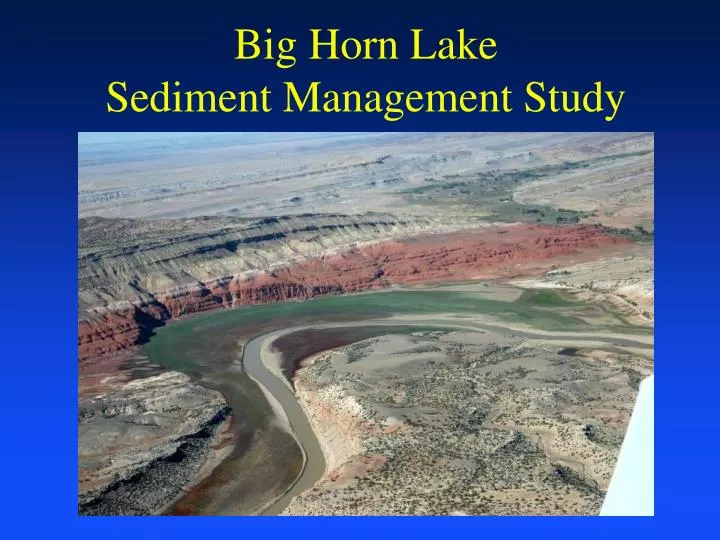
Big Horn Lake Sediment Management Study. Study Background. Bureau of Reclamation and Omaha District Interagency Agreement Compare sediment management alternatives and provide future recommendations PM/Technical Lead Reclamation – Stephanie Hellekson COE – Dan Pridal. Scope.

E N D
Study Background • Bureau of Reclamation and Omaha District Interagency Agreement • Compare sediment management alternatives and provide future recommendations • PM/Technical Lead • Reclamation – Stephanie Hellekson • COE – Dan Pridal
Scope • Initial appraisal level of detail • Focus on screening and alternative comparison • Highlight constraints/issues/impacts of the sediment management challenge • Technical focus – define what is technically feasible
Alternatives • A) Higher pool level during recreation season • B) Trap sediments upstream of Horseshoe Bend • C) Flush sediment through Horseshoe Bend • D) Manage sediment within Horseshoe Bend • E) Manage sediments within the watershed (not part of this study) • F) Dredging/Removal (evaluate previous)
Progress Update • Completed items include background report review, site visit, alternative development, meetings/coordination • Ongoing efforts on HEC-RAS model development for base and alternative conditions • Some study delay, about 4 weeks
Schedule • Kickoff Meeting – Jan 2008 • Site Visit and Data Collection – May 2008 • Initial model assembly – June 2008 • 60% Alternatives Analysis – August 2008 (revised to September) • 90% Draft Report – October 2008 • Study Complete – November 2008
Alternative A A) Higher pool levels during recreation season Change Yellowtail operation to alter pool level – examine past records with respect to pool level vs. sediment inflow Modifies deposition location, probably increase in southern end of reservoir, eventually worsen conditions at Horseshoe Bend Does not solve problem but may buy some time for Horseshoe Bend
Alternative B B) Trap sediments upstream of Horseshoe Bend Alter causeway east of Lovell to serve as impoundment Area is wide and shallow, more effective for coarse material than fine Trapped sediment could be removed if funds available Identify construction issues, policy issues, O&M
Alternative C C) Flush sediment through Horseshoe Bend Maintain lower pool level during high sediment runoff period to flush sediment past Horseshoe Bend Likely some deposition still occurs within Horseshoe Bend Does not solve sediment problem but spreads to entire project to buy time, long term impact may be detrimental and worse than without change Risk that pool may be impacted during lower runoff years, other similar impacts
Alternative D D) Manage sediment within Horseshoe Bend Implement local features to control and alter sediment deposition and transport through Horseshoe Bend May require berm construction to separate flowing river from recreation area Sediments move past Horseshoe Bend with minimal impact to recreation area Alternative is most independent of other actives, least impacted by hydrology Other alternatives may also require some implementation of local sediment management activities
Evaluation Method • Collect available data • Construct hydraulic model • Verify model with existing conditions • Modify model for alternative • Evaluate and compare • Basis for recommendations
Modeling Options • Simple sediment transport for a cross section • HEC-RAS / HEC-6 / GSTARS Hydraulic Models • More complex models (2d and 3d) • Model complexity and analysis limited • Will select model consistent with alternatives and available data
Model Input • Hydraulic Model Data Requirements • River/Reservoir Geometry Data • Roughness and Loss Coefficients • Bed Gradation Data for River and Reservoir Reaches • Upstream Inflow • Sediment Inflow and Gradation • Pool Level
Data Sources • Reservoir rangeline surveys (numerous years) • Sediment sampling • USGS gage stations • Other Agencies • Sediment data? • Historical topo data? • Aerial photos? • Previous Studies
16 15 14 Reclamation Range Line Location Horseshoe Bend Vicinity
D/S Horseshoe Bend 2000 Bighorn Lake Sed. Survey – Reclamation Sed. Group Summer – Top of Joint Use Safe Launch Elev at Horseshoe Bend
Lower Horseshoe Bend 2000 Bighorn Lake Sed. Survey – Reclamation Sed. Group Summer – Top of Joint Use Safe Launch Elev at Horseshoe Bend
Upper Horseshoe Bend 2000 Bighorn Lake Sed. Survey – Reclamation Sed. Group Summer – Top of Joint Use Safe Launch Elev at Horseshoe Bend
Schedule • Kickoff Meeting – Jan 2008 • Site Visit and Data Collection – Spring 2008 • Initial model assembly – June 2008 • 60% Alternatives Analysis – August 2008 • 90% Draft Report – October 2008 • Study Complete – November 2008
Summary • Compare Sediment Management Alternatives • Initial assessment level of detail to screen and compare alternatives • Provide technical report and recommendations