Download
1 / 6
60 likes | 91 Vues
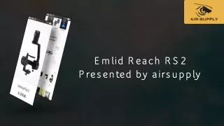
Emlid Reach RS2u00a0is highly efficient and helpful for people working in survey and navigation fields. With Reach RS2, you can create survey projects to manage the data collection. When it works in the area, each point is assigned an offset and a custom name.u00a0<br>Please visit: https://bit.ly/3b7QJji<br>

E N D
Emlid Reach RS2 Enables Accurate Positioning for Mapping and Surveying Emlid Reach RS2 is a rugged and versatile multi-GNSS RTK receiver with in-built IMU. This type of RTK is widely used for survey and navigation. It gives centimeter accuracy. RTK is nothing but a technique that is used to improve the efficiency of a standalone GNSS receiver. Generally, traditional GNSS receivers could only be able to determine the position with 2-4 meter accuracy, but RTK receiver can give you centimeter accuracy.
Emlid Reach RS2 Enables Accurate Positioning for Mapping and Surveying A GNSS receiver is used to measure how long for a signal to travel from a satellite to a receiver. The signals that are transmitted travel by way of the ionosphere and slowed down as well as perturbed on the way. For instance, the transmitted signals travel differently on a cloudy day and in clear sky conditions. Due to this reason, it is not very easy for a standalone receiver to determine its position correctly. But RTK technology can solve this issue quickly.
Used for Real-time High Precision Commonly two receivers are used in RTK, where one of the receivers is stationary, and another receiver moves freely. They are called the rover as well as the base station. The mission of a base station is to stay in one fixed place and send corrections to the moving receiver. On the other hand, the rover uses data to attain centimeter accuracy or precise position. Though, any number of rovers can connect to the base whether their input settings match the output of a base. Emlid Reach RS2 is highly efficient and helpful for people working in survey and navigation fields.
Why Is It Great for Survey & Navigation? The Emlid Reach RS2 helps to take accurate positioning for mapping, agriculture, surveying, and drones. Reach RS2 is particularly designed to provide an economical solution. The built-in field-ready receiver can track SBAS i.e., Space-Based Augmentation Systems satellites, QZSS, BeiDou, GPS, and more. It is built with an integrated high–performance dual-feed antenna that is mounted on a ground-plane. Generally, the ground-planes are large.
CONTACT US: Air SupplyCity: Corvallis State: Oregon Country: USA Zip: 97333 PH: (605) 695-2228 Web: airsupply.com