Download
1 / 56
560 likes | 861 Vues
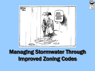
Managing Stormwater Through Improved Zoning Codes. Our Goal for Today. Increase Awareness: Local flooding can be reduced, and you can help Introduce New Concepts: Zoning code changes that include Best Management Practices can help reduce runoff Give You a Head Start:

E N D
Our Goal for Today Increase Awareness: Local flooding can be reduced, and you can help Introduce New Concepts: Zoning code changes that include Best Management Practices can help reduce runoff Give You a Head Start: Assist communities to comply with NPDES Phase II Permit. Provide specific examples of how to retrofit your local zoning code
Floods Are Not a New Problem 15 WORST FLOODS IN CINCINNATI • January 26, 1937 80.0 • February 14, 1884 71.1 • April 1, 1913 69.9 • March 7, 1945 69.2 • February 15, 1883 66.3 • March 11, 1964 66.2 • January 21, 1907 65.2 • April 18, 1948 64.8 • March 6, 1997 64.7 • March 21, 1933 63.6 • February 12, 1918 61.8 • March 29, 1898 61.4 • March 3, 1962 61.3 • February 26, 1897 61.2 • March 10, 1955 61.0 Spring Grove Cemetery -1937
Floods Are Expensive TAFT ASKS PRESIDENT BUSH FOR DISASTER DECLARATION FOR MID-JULY FLOODING IN BROWN, BUTLER, CLERMONT AND HAMILTON COUNTIESCOLUMBUS (August 16, 2001) – Gov. Bob Taft today asked the president to declare four southwest Ohio counties disaster areas because of an estimated $7.7 million in damages and costs to local and state government agencies due to flooding in mid-July. “I have determined this incident, in concert with previous 12 month state disaster expenditures, now exceeds $12 million and is of such severity and magnitude that it exceeds the capabilities of the voluntary agencies, local and state government to recover,” wrote Taft in his letter to the president. If granted, local governments in Brown, Butler, Clermont and Hamilton counties as well as the state departments of Natural Resources and Transportation, would be eligible for partial federal reimbursement for their costs and expenditures during their response to and recovery from the mid-July floods. Taft also pledged in his letter that the state will assist local governments by paying up to one-half their share of any federal assistance. Generally, presidential declarations of a major disaster pledge the federal government to reimburse up to 75 percent of local expenditures. Estimates of flood damage were prepared by state, federal and local emergency management agency personnel last week: Brown County, $586,000; Butler County, $1.5 million; Clermont County, $1.8 million, and Hamilton County, $3.7 million. State government’s estimated costs from the southwest Ohio flooding included $37,000 for use of Civilian Conservation Corps personnel clearing debris at 25 separate sites in Clermont County and an additional $245,000 in ODOT personnel costs for the work of six separate work crews …. Estimates of flood damage were prepared by state, federal and local emergency management agency personnel last week: Brown County $586,000 Butler County $1.5 million Clermont County $1.8 million Hamilton County $3.7 million Source is a News Release from the Ohio Governors office on August 16, 2001 http://www.governor.ohio.gov/releases/Archive2001/81620018002.htm
Basic Definitions Impervious Surface Source Control Best Management Practices A design solution that allows stormwater to seep into the ground before it can run off Any hard surfaced, man-made area that does not readily absorb water
Runoff and Urbanization Source: Federal Interagency Stream Restoration Working Group, 1998
Zoning Can Make a Difference Some communities do not require site plan review… But, they can. Brentwood Plaza July 2003, prior to redevelopment Brentwood Plaza September 2005, after redevelopment
Zoning ordinances should not prohibit the use of BMPs • Familiarize yourself with stormwater BMPs (in particular, source control BMPs) • Read through your code carefully • Look for language that is limiting • Encourage the use of BMPs when reviewing development applications
Residential Development Changes to Consider: • Permitting the use of shared driveways • Setting maximum lot coverage requirements • Modify street design • Increase setbacks from sensitive areas • Considering the use of Planned Unit Developments (PUD’s)
Allow Shared Driveways • Reduces amount of pavement • Reduces stormwater runoff • Reduces curb-cuts onto roadway system http://www.gjcity.org/CityDeptWebPages/PublicWorksAndUtilities/TransportationEngineering/TEFilesThatLINKintoDWStoreHere/TEDS/FireReq.pdf
Establish Maximum Lot Coverage Requirements • 3-5.16 Pavement in Required Front Yards of Residential Uses • The impervious surface of the required front yard shall not exceed thirty percent (30%), except for lots having a width of fifty (50)feet or less, which shall not exceed thirty-five percent (35%). Hamilton County Zoning Code, 2005
Modify Street Designs • Allow streets without curbs • Reconsider the use of typical piped storm system within streets • Encourage medians with swales to channel and absorb stormwater • Encourage Alternative Cul-de-Sacs
Modify Street Design: Streets without curbs Courtesy of HCRPC 2005
Modify Street Designs: Alternative Cul-de-Sacs Center for Watershed Protection, 2002
Increase Setbacks from Sensitive Areas 937.05 C. Widths of Setbacks Center for Watershed Protection, 2002 Summit County, OH Zoning Code, 2002
Planned Unit Development (PUD) • An alternative to conventional subdivision design • Encourages clustering to protect environmentally sensitive areas • Allows for innovative infill projects • Allows development standards to be relaxed for better site design, land use relationships, and conservation of natural resources. Cluster Example – Ham. Co. Zoning Resolution, Chapter 4
Non- Residential Development Changes to Consider: • Require landscaping for commercial development • Require additional landscaping when minimum parking requirements exceeded • Allow for reduced depth of parking stalls • Establish Maximum parking space limits Continued
Non- Residential Development Changes to Consider:(continued) • Create more flexible parking requirements • Allow shadow parking • Allow shared parking • Allow alternative pavement products
Require Landscaping for Commercial Developments • Increase required % of landscaping in interior of parking lots • Increase setbacks and open space requirements • Require landscaping on road frontage http://www.forbeslibrary.org/about/images/site_plan.jpg
Require Additional Landscaping when parking space requirements exceeded The minimum number of trees and shrubs for interior landscaping areas shall be calculated as follows: Required parking: 1 tree & 3 shrubs per 15 parking spaces or fraction thereof. Parking in excess of code requirement: 2 trees & 6 shrubs per 15 parking spaces or fraction thereof. Zoning Resolution, Colerain Township
Reduce Dimension of Parking Spaces “…when a parking space or spaces abut a landscaped area, grassy strip, or yard, a maximum of two feet of the overall length (20 SF) of any such space or spaces may extend into the landscaped area, grassy strip or yard.” City of Wyoming Zoning Code
Establish Maximum Parking Limits “…minimum 4 spaces, maximum 6.5 spaces for each 1,000 SF of retail building.” City of Montgomery Zoning Code Ridgewater Plaza on Highland Ave. Photo courtesy of CAGIS
Create Flexible Parking Standards Source: Anderson Township Zoning Resolution, 2004; Fig. 145-B
Permit Shadow Parking Shadow Parking: A portion of the required spaces may remain landscaped and unpaved or paved with pervious pavers provided that the parking and unpaved areas currently is deemed unrequired. Anderson Township Zoning Resolution, 2004; Sec. 145 Source: Anderson Township Zoning Resolution, 2004; Fig. 145-C
Shared Parking Parking Peaks Source: http://www.vtpi.org/tdm/tdm89.htm “Shared parking is encouraged and permitted if the multiple uses that the shared parking will benefit can cooperatively establish and operate the facilities.” Anderson Township Zoning Resolution, 2004; Sec. 145 (D)(2)(a)
Alternative pavement products Rhode Island Urban Environmental Design Manual, 2005 http://www.jmendell.com/images/warrenhouse.jpg http://www.jmendell.com/images/warrenhouse.jpg
Best Management Practices (BMPs) result from policy changes • Incentives • Property Tax Reduction • Reduced Permit Processing Time • Floor Area Ratio Bonus • Zero Discharge
Incentives: Tax Reduction • Reduction of Stormwater in some communities is assessed as a Value Tax on the property. If the builder designs systems to reduce stormwater runoff, the property tax is reduced. • Examples: Newport- News, VA. and the Portland, OR, Clean Rivers Act.
Incentives: Permit Processing Time In other communities, the incentive is reduced time to get a permit. Chicago will cut the time in half to get a building permit if the building design has a greenroof.
Incentives: Floor Area Ratio Bonus Floor Area Ratio Bonus refers to a formula that allows builders to increase their floor area ratio in exchange for either a greenroof or porous pavement. The square footage permitted for the exchange depends on the particular zoning code. Examples are found in Portland, OR, and Minneapolis, MN, zoning codes.
Zero Discharge • Zero stormwater discharge from a 14-acre site: • Dramatic decrease in the amount of impervious surfaces • Various native landscaping strategies • Water features, including two ponds and a rooftop rainwater collection system • Rainwater channeled into a 38,000-gallon underground cistern, where it is filtered, chlorinated and then used in the building's urinals and water closets • Savings of close to 300,000 gallons of water each year Alberici's headquarters, St. Louis, MO
Source Control BMPs http://cfpub.epa.gov/npdes/stormwater/menuofbmps/menu.cfm
Source Control BMP Methods(may be included in zoning codes) • Porous Pavement/Pavers • Bio-Retention Swales • Rainscapes and Rain Gardens • Rain Barrels and Cisterns • Greenroofs • Riparian Corridors and Open Space Protection
Porous Pavement Allows Water to Pass Through into the Soil Below • Reduce Run-off • Filter Pollutants • Increase Groundwater recharge Types: • Aggregate • Paver-Blocks • Porous Concrete • Porous Asphalt
Porous Pavement Installation Heritage Park - Colerain Township, OH
Porous Pavement - Typical Maintenance Activities • Monthly- Remove debris sediments from the pavement area • Quarterly- Vacuum sweep to keep the surface free of sediment • Annually- Inspect the surface for deterioration • As Needed- Incorporate erosion control measures in surrounding areas Source: Watershed Management Institute (WMI). 1997. Operation, Maintenance, and Management of Stormwater Management Systems. Prepared for: US EPA Office of Water. Washington, DC.
Bio-Retention Swale • A shallow depression that collects water and permits its gradual absorption into the ground Northern Kentucky Sanitation District No. 1 www.sd1.org http://www.jmendell.com/images/warrenhouse.jpg
Bio-Retention Swales – Typical Maintenance Activities • At Project Completion- Water the plants daily for two weeks • Monthly- Remove debris and litter and inspect for erosion • Bi-annually- Treat or replace dead and diseased vegetation • Annually- Add mulch and replace tree stakes and wire Source: The Stormwater Manager’s Resource Center - http://www.stormwatercenter.net/
Rainscapes and Rain Gardens • Recreate natural ecosystems • Help soil capture and filter rain water • Prevent pollution runoff • Prevent erosion • Recharge the groundwater Photos taken by Christine Baeumler http://www.main.nc.us/riverlink/content/12chap/chap12.htm
Rain Barrels and Cisterns http://www.lid-stormwater.net/raincist/ raincist_specs.htm http://dnr.metrokc.gov/wlr/PI/rainbarrels.htm
Greenroofs Provide Excellent Opportunity to Control Runoff Greenroofs : Layers of growing medium and plants on top of traditional roofing system Michigan State University http://www.greenroofs.com/test.htm Chicago City Hall http://www.asla.org/meetings/awards/awds02/chicagocityhall.html Atlanta City Hall http://www.greenroofs.com/north_american.htm
Greenroof Capable of Retaining 25 – 75% of Stormwater Runoff • Types: • Intensive • at least 12” of soil • Extensive • at least 1– 5” of soil Minnesota Urban Small Sites BMP Manual
Examples in the U.S. Fencing Academy of Philadelphia http://www.greenroofs.com/projects/pview.php?id=25 Seattle Justice Center http://www.ci.seattle.wa.us/mayor/gallery_2002/pg100902_1.htm
Examples in the U.S. Ford Motor Company’s Rouge Plant in Dearborn, MI is the second largest greenroof, at 10 acres Carrabba’s in Greensboro, NC http://www.greenroofs.com/exclusives.htm http://www.greenroofs.com/projects/pview.php?id=12
Riparian Corridor and Open Space Protection Why the Need for Protection? Great Miami River floodplain in Miamitown – January 2005 Would you park over here?????
Riparian Corridor and Open Space Protection: Why? • Streams will meander across a valley over time • Homes and structures placed within this valley are subject to increased flooding, erosion, and property loss Source of stream meander photo: http://www.paleocurrents.com/castle_rock/docs/meandering_river.html.