Integrated Surface Observing System Commerce and Transportation Goal Team Richard F. Edwing July 20, 2004
Integrated Surface Observing System Commerce and Transportation Goal Team Richard F. Edwing July 20, 2004 Commerce and Transportation Outcomes: Safe, secure and seamless movement of goods and people in the U.S. transportation system.

Integrated Surface Observing System Commerce and Transportation Goal Team Richard F. Edwing July 20, 2004
E N D
Presentation Transcript
Integrated Surface Observing System Commerce and Transportation Goal Team Richard F. Edwing July 20, 2004
Commerce and Transportation • Outcomes: • Safe, secure and seamless movement of goods and people in the U.S. transportation system. • Environmentally sound development and use of the U.S. transportation system • 7 Programs: • Marine Transportation Systems • Geodesy • Emergency Response • Commercial Remote Sensing Licensing • Aviation Weather • Marine Weather • Surface Weather
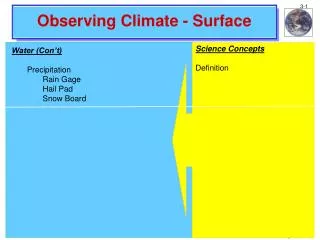
Shoreline Mapping NOS supports Marine Transportation and Coastal Resource Management Commerce and Transportation Marine Transportation Systems • Tides (NWLON) • Currents (NCOP) • PORTS • Shoreline • Hydrography
Commerce and Transportation Geodesy Continuously Operating Reference System (CORS)
Commerce and Transportation Emergency Response
Commerce and Transportation Commercial Remote Sensing Licensing
Commerce and Transportation Aviation Weather • ASOS • GRIDS ASOS Present Weather Sensor
Commerce and Transportation Marine Weather • Fixed Buoys • Drifting Buoys • VOS
Commerce and Transportation Surface Weather Fog limits visibility
Commerce and Transportation • Needs • Partnerships/Collaboration/Cooperative Observing Programs • Funding • Socio-economic benefits • How to prioritize common observation systems across GT/LOs • Standards and Specifications • FGDC • Flexible format • GAPS • Communication • Exploration of all NOAA Observation Platforms possibilities (planes, ships, et al.)
Commerce and Transportation • Core Questions • Is NOAA including data from outside sources? • Will NOAA start with a broader view of what observations should be pursued, and develop the tools and products necessary for the public to understand and utilize the observations