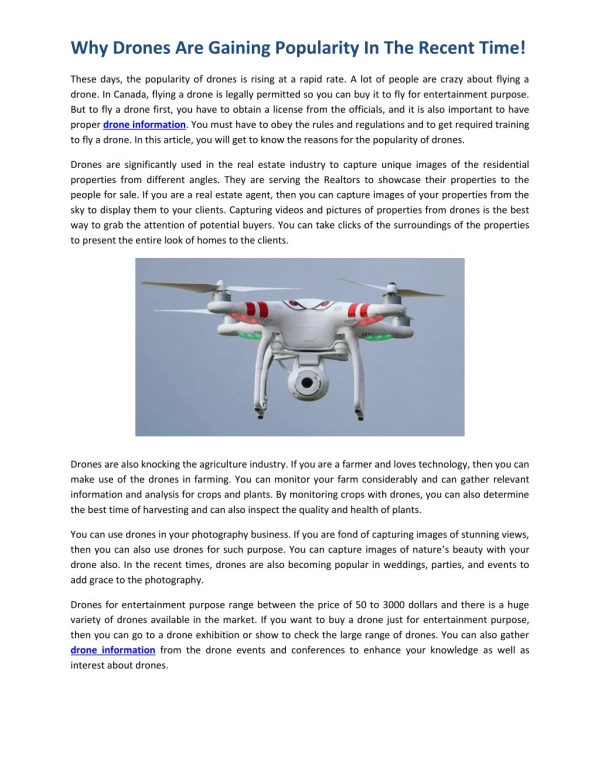
Download

1 / 7
0 likes | 2 Vues
Modern methods for improving asset management and infrastructure monitoring are offered by advanced aerial technology. Compared to conventional ground methods, utility drone services in California offer greater safety, quicker results, and more precision. Organizations can lower risks and streamline processes by implementing state-of-the-art tools. Check out the full blog to know more.

E N D
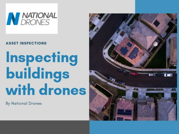
Why Utility Companies Are Replacing Manual Inspections with Drones? Before the Drone Utility inspections used to mean boots on the ground, risky climbs, and hours (if not days) of manual documentation. It wasn’t fast. It wasn’t always safe. And it often left decision-makers waiting too long for incomplete data. Today, the game has changed—and it’s flying. The Rise of Utility Drone Services Unmanned aerial inspection services are changing how utility companies work. From transmission towers to substations and underground vaults, drones are replacing traditional inspections with something better:
•Faster data collection •Real-time visibility •Reduced human exposure to hazardous environments And the impact? •60% faster inspection turnaround •Up to 30% cost savings •70% reduction in field risk exposure These aren’t just stats—they’re transformations. Also Read:The View That Changed Everything: How UAS Imagery Is Revolutionizing Utility Inspections
Built for the Tough Stuff At Birds Eye Aerial Drones, we specialize inUtility Drone Services in California,teams that are trained to operate safely in wildfire zones, over energized lines, and in remote, hard-to-access regions. Our drone crews are: •FAA Part 107 Certified •OSHPD/Cal-OSHA compliant •Backed by $10M aviation insurance •Trained in utility-specific protocols like GO 95, GO 165, and DIMP/TIMP We’ve flown over350,000 utility assets—from PG&E and SCE to local municipalities and cooperatives.
What You Get With Professional Drone Utility Inspection Solutions? •High-resolution aerial imageryfor documentation and defect detection •Thermal imagingto pinpoint hotspots and failing components •3D models and LiDARfor accurate structure mapping •Automated shot sheets and metadata for QA/QC •Live flight tracking and reporting dashboards It’s not just a photo op—it’s a full-blown data strategy. Digging Deeper: Data Integrity, Accuracy & Compliance AtBirds Eye Aerial Drones, every unmanned aerial inspection is powered by RTK/PPK-enabled drones, ensuring sub-centimeter accuracy and full geospatial integrity. This precision supports critical asset management systems, allowing utilities to layer high-resolution orthomosaics, thermal data, and 3D point clouds into GIS workflows with confidence. Our outputs are fully compatible with ESRI ArcGIS, Autodesk, and enterprise asset systems—meeting the rigorous data submission standards required by agencies like SCE, PG&E, and SDG&E. For compliance-focused stakeholders, we provide full metadata, time-stamped flight logs, and environmental overlays to satisfy inspection mandates under GO 95, GO 165, and NERC FAC-003. Simply put, we don’t just fly drones—we deliver precision data that utilities can trust.
Real Work. Real Clients. Real Results. “The insights we gained from BEAD’s drone inspections helped us prioritize critical repairs while cutting our survey time in half. Their crews understood our safety standards—and exceeded them.” –Client, California Utility Infrastructure Manager Beyond the Pole: Strategic Insights Our inspection approach doesn’t stop at the structure. Our team provides: GIS-integrated outputsto merge seamlessly with utility asset systems Change detection over timefor proactive maintenance Regulatory-ready documentationthat supports audit, compliance, and litigation protection This is more than imagery—this is aerial intelligence, built for the future of utilities.
Desk Inspector Program: Real-Time Eyes on Every Asset Our Desk Inspector Program brings the field to your fingertips. By pairing our drone-collected imagery with a secure, cloud-based review platform, BEAD enables utility clients to perform remote asset evaluations with precision and speed. Each image is geo-tagged and organized by structure ID, allowing trained inspectors—either in-house or outsourced—to flag anomalies, verify condition, and recommend next steps without ever setting foot on-site. Whether it’s corrosion on a pole top, vegetation encroachment, or a missing ground wire, our desk inspectors catch it early. The result? Reduced truck rolls, lower labor costs, and faster decision-making—backed by high-resolution visual evidence and AI-assisted anomaly detection tools. With BEAD, inspections no longer end in the field— they evolve at the desk. Why Settle for Less? Manual inspections will always have their place, but not when drone services offer greater clarity, safety, and efficiency. Birds Eye Aerial Drones is not just a drone company-we are your mission-critical partner in important infrastructure. Whether you’re preparing for PSPS events, tracking wildfire damage, or inspecting transmission corridors, ourUtility Drone Servicesdeliver real results that elevate your operations. Ready to leave the manual behind? Let’s fly smarter, safer, and more efficiently—together. info@birdseyeaerialdrones.com|birdseyeaerialdrones.com