Download

1 / 5
50 likes | 89 Vues
Florida Aerial Survey Technologies is a fully licensed surveying and mapping company serving South West Florida, Miami, Orlando and Tampa. Call us 239-330-1015.<br><br>Website: https://www.floridaaerialsurvey.com/<br>

E N D
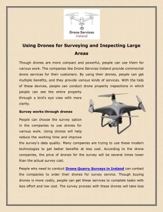
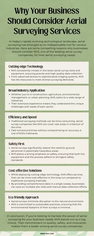
Why Use Drones for Aerial Surveying Drones are one of the best technological advancements of the past few years. Its usage is on the rise because of the high quality pictures and accurate data it generates with the HD cameras. The potential of aerial surveying with drones is rising in several sectors such as land development, mining, infrastructure development, maintenance and more.
The Best Drone Service for Safety and Economic Benefits Florida quick survey can be carried on by hiring an experienced and trained drone surveying and mapping company. When looking online, you will come across several companies offering drone services, but it is crucial to select the best suited company according to your needs. For successful aerial surveying, the pilot should be skilled and trained for surveying. An improper aerial survey will provide inaccurate data which can cause losses and accidents.
Benefit from Using Drones to Inspect and Survey Drone surveys are a cost-efficient way to conduct surveys from a height. Drones are becoming a popular choice for engineers, construction supervisors, asset managers and more, because they are fast and safe. The high definition pictures and videos they provide eliminate the need of hiring a plane or helicopter, saving money and time. As drones are easy and quick to deploy,
Florida Aerial Survey Technologies Florida Aerial Survey Technologies is one of the best companies for aerial surveying and mapping data. They provide a huge range of data collection processes which encompasses surveying as well as mapping, site work, road works, topographical maps, volume calculations, environmental maps, elevation maps, engineering deliverables, and much more.
Contact us: Florida Aerial Survey Technologies is a fully licensed surveying and mapping company serving South West Florida, Miami, Orlando and Tampa. Call us 239-330-1015. Florida Aerial Survey Technologies Miami, Florida 33101 USA 239-249-5228 https://www.floridaaerialsurvey.com/