Download
1 / 55
550 likes | 802 Vues
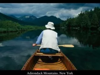
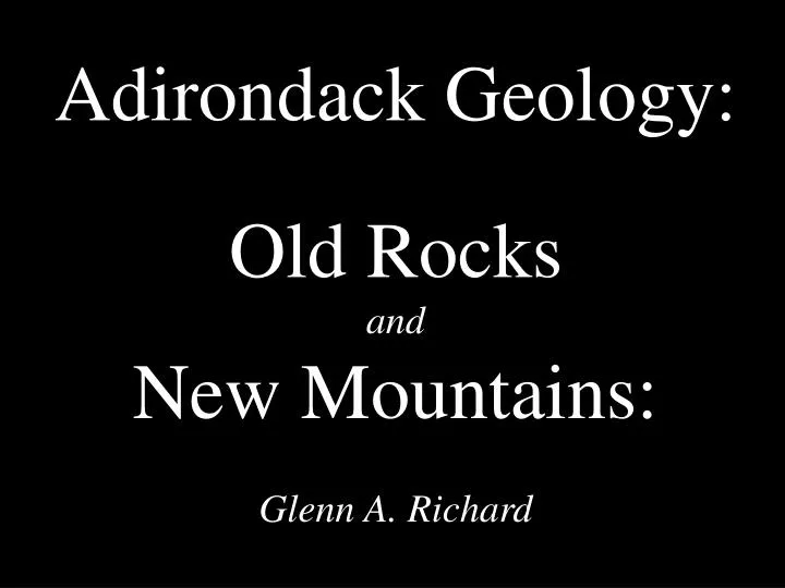
Adirondack Geology: Old Rocks and New Mountains: Glenn A. Richard. The Adirondacks are a dome of old rock (1.1 billion years), surrounded by much younger rock (less than 600 million years). Relief Map of Adirondacks. Map of Streams and Lakes.

E N D
Adirondack Geology: Old Rocks and New Mountains: Glenn A. Richard
The Adirondacks are a dome of old rock (1.1 billion years), surrounded by much younger rock (less than 600 million years) Relief Map of Adirondacks
Map of Streams and Lakes Surface water elevations are primarily controlled by underlying bedrock elevations, rather than the type of bedrock. Radial drainage pattern: Streams flow primarily outward from the center toward the edge. However, drainage in the Adirondacks is also controlled by faults.
Roadless areas are undeveloped. ~43% of 6 million acre Adirondack Park (created in 1892) is owned by the state and belongs to the Forest Preserve (created in 1885). Roads
Mount Marcy, highest point in New York (5344’), from Haystack. Predominant rock type is metanorthosite (Mineralogy: mostly blue labradorite feldpar (high in Ca, some Na, low in K), with some pyroxene).
Shore of Lake Champlain (elevation 95 feet) from eastern Adirondacks. Lowest elevation in Adirondacks.
Haystack from Marcy – July 2, 2001. Rugged topography caused by faulting, uplifting, erosion by water and glacial ice.
Picea rubens and Abies balsamea just below tree line on Haystack, third highest peak in the state at 4960’.
Cross section of Earth • Layers of the Earth: • Inner Core • Outer Core • Mantle • Crust Diagram by Keelin Murphy Crust and very upper mantle are hard rock, called lithosphere. Lithosphere divided into tectonic plates. Plates are in motion – several centimeters per year – PLATE TECTONICS Orogeny: Collision of plates can build mountains (Example: Himalayas now rising due to current collision of Indian and Asian plates).
Diagram by Keelin Murphy Plate Boundaries Transform: San Andreas Fault Divergent: East Pacific Rise Convergent: West Coast of South America -Andes forming here
1.3 Billion Years Ago: Pre-Grenville Ocean Fossil stromatolite (blue-green alga, 1.3 bya) near Balmat in western Adirondacks. From Pre-Grenville Ocean prior to Grenville Orogeny .
1.1 Billion Years Ago: Grenville Orogeny Metanorthosite (intruded about 1.15 bya) with labradorite crystal on Noonmark. Smaller amounts of pyroxene are present. Grenville Orogeny metamorphosed the rock about 1.1 bya while it formed the Grenville Supercontinent and the Grenville Mountains.
Boudinage in migmatite, northwestern Adirondacks formed during Grenville Orogeny 1.1 bya
650 Million Years Ago: Grenville Supercontinent Breaks Up Lake Placid from Whiteface. Shape is controlled by a group of faults that formed about 650 million years ago, when Grenville Supercontinent split up.
Colden, Avalanche Pass, Algonquin, Indian Pass, Wallface. Passes are valleys formed along faults.
Faulting helps to create valleys and basins for streams and lakes. Lake Placid from Whiteface. Shape is controlled by some of the faults that formed about 650 million years ago.
Diabase dike (650 mya) in western Adirondacks intruded during breakup of Grenville supercontinent.
500 Million Years Ago: A Warm Shallow Sea Ripple marks on Potsdam Sandstone (500 mya), Ausable Chasm display. Formed in warm shallow sea. Potsdam sandstone probably covered Adirondacks and was eroded from central portions after later uplift.
Beginning 60 to 15 Million Years Ago: Adirondack Mountains Form Great Range from Noonmark – Adirondacks rising since 60 to 15 million years ago for uncertain reasons. Some have attributed uplift to a hot spot, but there is not much evidence for that.
Beginning 1.6 Million Years Ago: Continental and Alpine Glaciation Glacial erratic near Debar Mountain in northern Adirondacks
Au Sable Chasm with Potsdam Sandstone. Au Sable River has cut into the sandstone as uplift occurs.
Heart Lake from Mount Jo. Some consider it to be a glacial kettle.
Snow on Saint Regis Mountain with fall color at lower elevations, shows climate variation with elevation.
Vegetation reflects geology Red oak at Lake Champlain shore. Soil in Adirondacks is mostly acid.
Walking fern near Lake Champlain shoreline favors habitats where calcite is present.
Cystopteris bulbifera at Cascade Lakes favors habitats where calcite is present.
Cotton grass on floating bog mat at Sunday Pond. Peat is acidic and water is low in oxygen and dissolved nutrients
Insectivorous pitcher plant on Sunday Pond bog mat. Bog water is low in nitrates.
Labrador tea on Sunday Pond bog mat favors wet acid conditions.
Altona Flat Rock with Potsdam Sandstone – Pine barrens on very thin soil. Soil washed away by catastrophic flood during glacial times.
Pteridium aquilinum in Clintonville Pine Barrens grows well in dry, sandy, acidic soil.
Bearberry in Clintonville Pine Barrens gows well in dry, sandy, acidic soil.
Balsam fir in boreal forest on Crane Mountain. Cones point upward.
Red spruce in boreal forest Nun-Da-Gao Ridge. Cones point downward.
Haystack Summit (4960’) – Very thin soil and cool conditions above treeline support alpine plant community.