Download
1 / 55
550 likes | 761 Vues
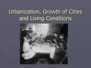
The Growth of Cities . How the World Works?. How Stuff Works Wikipedia Llrx.com. “The nature of urban sprawl: the process of suburbanization” Annual Meeting Association of American Geographers. Denver, 2005

E N D
How the World Works? • How Stuff Works • Wikipedia • Llrx.com
“The nature of urban sprawl: the process of suburbanization” Annual Meeting Association of American Geographers. Denver, 2005 • “Protecting open space in and around the Twin Cities Metropolitan Area” in Bengston, David N. (tech. ed.). Policies for Managing Urban Growth and Landscape Change: A Key to Conservation in the 21st Century. General Technical Report NC-265. St. Paul, MN: USDA Forest Service, North Central Research Station. 14-20
Urban Sprawl: the Big Picture (NASA) • Urban Growth in American Cities (USGS) – Twin Cities • Urban Sprawl (Wikipedia) • Urban Sprawl (National Geographic Magazine) • Stopping Sprawl (Sierra Club) • Land Use and Urban Sprawl (Clean Water Action Council) • Sprawl City (www.sprawlcity.org) • Austin TX Smart Growth
On Wednesday, May 23, 2007 a majority of the earth’s population lives in urban areas • Urban Population to Become the New Majority Worldwide • Countries ranked (United Nations Development Programme)
The Nature of Urban Sprawl – The Process of Suburbanization • Increased in-migration into urban areas • Increased density - congestion • Horizontally • Vertically • Horizontal Spread - sprawl
Fragmentation – the division of a spatial unit into smaller spatial units • Private space • Jurisdictional space • The dominant process throughout the history of the United States • There has obviously been agglomeration of spatial units • Annexation – a particular type of agglomeration • theextension of jurisdictional space – applied to municipalities – urban areas
A mosaic of spatial units • A. Jurisdictions (governments) • B. Real property - land, subsurface, water, air, wildlife • Organized spatially, horizontally & vertically, and temporally • Historically • Increasing number of spaces • Decreasing size of spaces • Fragmentation of the land surface
Federal Policy • In the eighteenth & nineteenth centuries individuals migrated into a largely uninhabited continental interior in response to federal policy aimed at creating and promoting private landownership
Fragmentation 1847-1853 Current
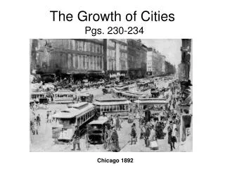
Annexation • Growth of Chicago
Fragmentation Annexation
How Municipalities Grow • At the margins of the “urban” area - extending urban structures and infrastructure into the “rural” fringe - sprawl • Rural area annexed by municipality • Rural area subdivided by landowners • Lands dedicated to public use • Within the urban areas – existing urban structures and infrastructures are reformatted – redeveloped – replatted
Horizontal Urban Sprawl - Suburbanization • Two processes • 1. Agglomeration • Municipality annexes non-urban land adjacent to urban land • Urban services, especially sewers and transportation arteries, extended into non-urban areas • 2. Fragmentation – landowner subdivides non-urban land on the margins of an urban area into private and public spaces
A Paradigm for Landscape • A mosaic of spatial units - each comprising layers of powers to do something in the unit • Evolved over time and are continuing to evolve - fragmentation of space • Powers have also evolved over time and are continuing to evolve – proliferation of powers • Most units and most powers can only be appreciated with reference to an appropriate geographical and historical setting
A Tangent • The Challenge to the Sprawl Campaign works to fight poorly planned runaway development and promotes smart growth communities that increase transportation choices, reduce air and water pollution, and protect our natural places (Sierra Club) • The American Dream. Urban Sprawl (National Geographic, 2001) • Urban Sprawl: the Big Picture (NASA) • Sprawl City (Census Bureau) • About Sprawl (About Geography) • “Urban competition for farmland will become more intense. Agriculture will have a harder time competing against it. Sprawl will get worse. Fewer Americans will be able to enjoy the countryside. Their quality of life will decline, and the nation's agricultural security will continue to diminish.” (American Farmland Trust, 2001)
Sierra Club Natural Resources Defense Council American Farmland Trust Metropolitan Council Embrace Open Space (McKnight Foundation) Fresh Energy Last summer the Minnesota Supreme Courtupheld a ruling that Lake Elmo must change subdivisions ordinances to allow increased urban development Appeals Court Last Fall Oregon Ballot Measure 37 - requiring governments to compensate landowners if regulations damage property values Last month Virginia Supreme Court ruled that Loundon County, the nation's fastest growing county, must change public policy to increase urban development Another Tangent
Twin Cities Metropolitan Area • Metropolitan Council • Local governments • 7 Counties • 138 Cities • 50 Townships • (49 School Districts) • (22 Special Purpose Districts)
Planning for Urban Growth in the Twin Cities Metropolitan Area • A 20-year study of two jurisdictions at the urban fringe of the Twin Cities metropolitan area • Concluded that current policies aimed at preserving permanent agricultural and rural areas cannot guarantee their preservation • Recommended that more vigorous policies and tools be explored to assure that designated permanent rural areas remain rural
Annexation • Minnesota Statutes Chapter 414 • Minnesota Rules Chapter 6000 • Municipal Boundary Adjustments • Adjustment Status Reports • City limits: a report to the Minnesota Legislature on municipal boundary adjustments, February 2002
Brief History • Municipal boundary chaos • In just one decade in five metropolitan counties • 45 new villages were organized • Almost half contained under 1,000 people • 7 contained under 200 • 1 contained only 43 • End of the 1950s, 130 separate municipalities existed in the seven-county Twin Cities area • Most of the villages lacked means to furnish their own police and fire protection or adequate sewage disposal facilities
Minnesota Municipal Board • Established in 1959 to decide incorporation and boundary adjustment questions and to guide urban growth • At the time public policy addressing incorporation and boundary changes were either nonexistent or haphazard • 1999 Minnesota Municipal Board duties and responsibilities transferred to the Office of Strategic and Long-Range Planning - Minnesota Planning • Municipal Boundary Adjustments • Metropolitan Council
Minnesota Statutes c. 414 (Laws, 1959 c 686 s 1 as amended) • sound urban development and preservation of agricultural land and open spaces through land use planning is essential to the continued economic growth of this state • municipal government most efficiently provides governmental services in areas intensively developed for residential, commercial, industrial, and governmental purposes • township government most efficiently provides governmental services in areas used or developed for agricultural, open space, and rural residential purposes
Minnesota Statutes c. 414 (Laws, 1959 c 686 s 1 as amended) • the public interest requires that municipalities be formed when there exists, or will likely exist, the necessary resources to provide for their economical and efficient operation • annexation to existing municipalities of unincorporated areas unable to supply municipal services should be facilitated • the consolidation of municipalities should be encouraged
Minnesota Statutes 414.031. Annexation by board order • A proceeding for annexing unincorporated land abutting a municipality may be initiated by • a resolution of the annexing municipality • a resolution of the township containing the area proposed for annexation • a petition of 20 percent of the property owners or 100 property owners, whichever is less, in the area to be annexed • a resolution of the municipal council together with a resolution of the township board stating their desire to have the entire township annexed to the municipality
Minnesota Planning hold hearings - decision based upon • (1) present population and projected growth • (2) acreage and type of land involved • (3) degree of contiguity of the boundaries • (4) present pattern of physical development and future land uses • (5) present and future transportation network • (6) present land use controls • (7) existing and future levels of governmental services
Minnesota Planning hold hearings - decision based upon • (8) existing and future environmental problems • (10) fiscal impacts • (11) effect of the proposed action on school districts and communities • (12) adequacy of town government to deliver services to the subject area; • (13) analysis of whether necessary governmental services can best be provided through the proposed action or another type of boundary adjustment; and • (14) effect on area not annexed
Annexation by Ordinance • Used in limited circumstances where specific statutory criteria are met • the land to be annexed abuts the city • the land does not exceed 60 acres • the land is not presently served by public sewer facilities • the city receives a petition for annexation from all property owners of the land • Minnesota Planning reviews the annexation to determine whether the statutory criteria are met
Staff review 375 to 400 petitions for municipal boundary adjustments annually • Majority of petitions from property owners • Remainder from cities and townships • Most adjustments take place with the support of all affected parties • Approximately five to ten petitions a year are contested - only three to five actually require an administrative hearing to decide the petition
FY 2002 (July 1, 2001 – June 30, 2002) • 176 Annexation ordinances were approved • 151 Orders were issued • 8 were orders on contested annexations • 140 were orderly annexations • 3 were detachments • No incorporations or consolidations • 24,041.3 acres were affected
Subdivision • Minnesota Statutes Chapter 505.90 • The county board of any county shall have power to control and regulate the subdivision of land and the laying out of streets and other public ways beyond the boundaries of municipalities • Minnesota Statutes Chapter 515B • Condominium • Cooperative • Planned Community
Types of Plats • Subdivision plats show the division of land into lots and blocks and dedicates lands for public use • CIC plats shows the division of land into Common Interest Communities - Condos, Townhouse, Planned Communities, Coops • Highway right-of-way plats show the right of way that may be acquired for state, city, county, or township roads • Registered land surveys identify the boundaries of registered lands